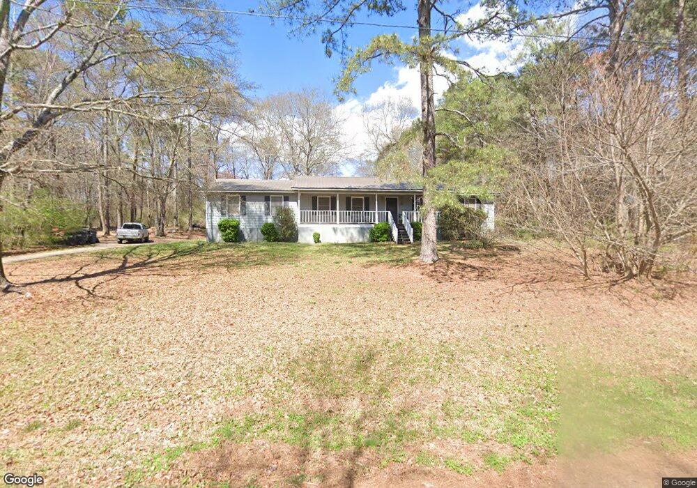
66 Michael Blvd Cedartown, GA 30125
Estimated Value: $272,000 - $313,000
3
Beds
2
Baths
1,693
Sq Ft
$174/Sq Ft
Est. Value
About This Home
This home is located at 66 Michael Blvd, Cedartown, GA 30125 and is currently estimated at $293,869, approximately $173 per square foot. 66 Michael Blvd is a home located in Polk County.
Ownership History
Date
Name
Owned For
Owner Type
Purchase Details
Closed on
Jul 2, 2003
Sold by
Fricks Elizabeth Joann
Bought by
Fricks Charles L
Current Estimated Value
Purchase Details
Closed on
Aug 16, 1989
Sold by
Peek Paige H
Bought by
Fricks Charles L
Purchase Details
Closed on
Aug 4, 1989
Sold by
Blakenship Earl
Bought by
Peek Paige H
Purchase Details
Closed on
Oct 19, 1987
Sold by
Liverant Jacob
Bought by
Blankenship Earl
Purchase Details
Closed on
Oct 30, 1973
Bought by
Igel Stanley
Create a Home Valuation Report for This Property
The Home Valuation Report is an in-depth analysis detailing your home's value as well as a comparison with similar homes in the area
Home Values in the Area
Average Home Value in this Area
Purchase History
| Date | Buyer | Sale Price | Title Company |
|---|---|---|---|
| Fricks Charles L | -- | -- | |
| Fricks Charles L | $4,500 | -- | |
| Peek Paige H | -- | -- | |
| Blankenship Earl | $4,500 | -- | |
| Igel Stanley | -- | -- |
Source: Public Records
Tax History Compared to Growth
Tax History
| Year | Tax Paid | Tax Assessment Tax Assessment Total Assessment is a certain percentage of the fair market value that is determined by local assessors to be the total taxable value of land and additions on the property. | Land | Improvement |
|---|---|---|---|---|
| 2024 | $2,114 | $103,143 | $16,000 | $87,143 |
| 2023 | $1,695 | $73,437 | $16,000 | $57,437 |
| 2022 | $1,236 | $54,084 | $4,060 | $50,024 |
| 2021 | $1,252 | $54,084 | $4,060 | $50,024 |
| 2020 | $1,255 | $54,084 | $4,060 | $50,024 |
| 2019 | $1,491 | $57,530 | $4,000 | $53,530 |
| 2018 | $1,448 | $54,542 | $4,000 | $50,542 |
| 2017 | $1,430 | $54,542 | $4,000 | $50,542 |
| 2016 | $1,430 | $54,542 | $4,000 | $50,542 |
| 2015 | $1,447 | $55,006 | $4,000 | $51,006 |
| 2014 | $1,284 | $48,708 | $3,078 | $45,630 |
Source: Public Records
Map
Nearby Homes
- 100 Lee Ave
- 383 Valley Grove Rd
- 424 Michael Blvd
- 600 Miller Rd
- 0 Cave Spring Rd Unit 10631588
- 0 Cave Spring Rd Unit 7671027
- 374 Seab Green Rd
- 1200 N Cave Spring St
- 727 Cherokee Rd
- 88 Sequoyah Ct
- 217 Cherokee Cir
- 113 Cherokee Estates Dr
- 828 N College Dr
- LOT 21 Cherokee Cir
- 208 Silverthorn Way
- 39 Summerwind Dr
- 621 N College Dr
- 00 Oak Crest Dr
- 0 Collins Rd Unit 10627302
- 232 Stephens Rd
- 62 Michael Blvd Unit 21
- 46 Michael Blvd
- 62 Michael Blvd
- 37 Michael Blvd
- 92 Michael Blvd
- 13 Michael Blvd
- 509 Chubbtown Rd
- 449 Chubb Town Rd
- 40 Michael Blvd
- 12 Michael Blvd
- 116 Michael Blvd
- 0 Chubbtown Rd Unit 7161485
- 0 Chubbtown Rd Unit 7567656
- 0 Chubbtown Rd Unit 7123163
- 0 Chubbtown Rd Unit 3151396
- 0 Chubbtown Rd Unit 8303602
- 0 Chubbtown Rd Unit 8502253
- 0 Chubbtown Rd Unit 8906936
- 80 Lee Ave
- 529 Chubbtown Rd