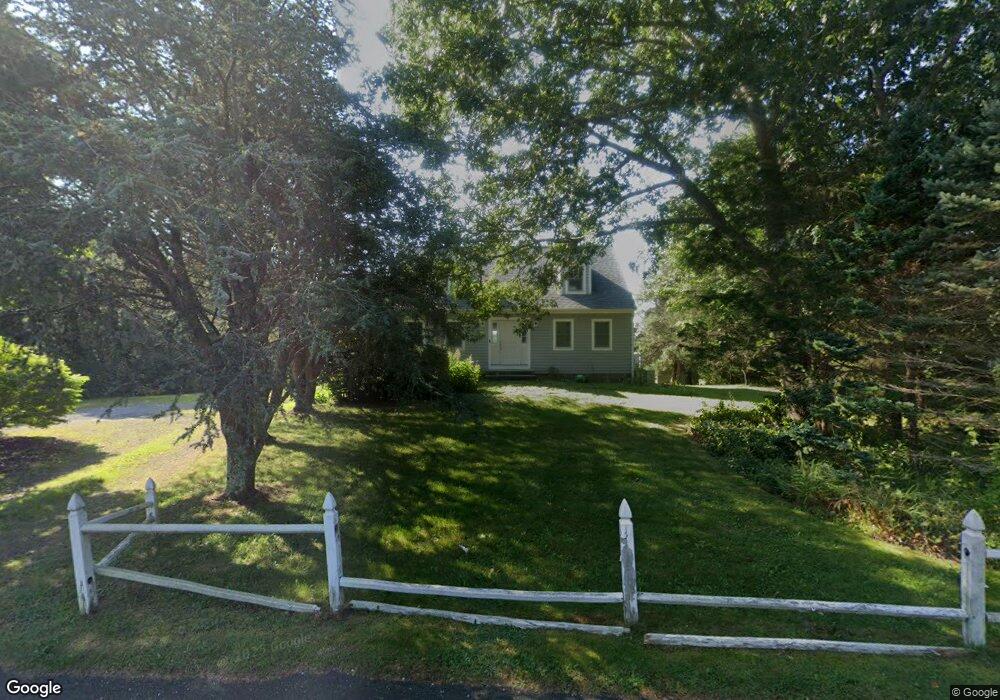
66 Old Dam Rd Bourne, MA 2532
Estimated Value: $905,606 - $1,327,000
4
Beds
2
Baths
1,764
Sq Ft
$587/Sq Ft
Est. Value
About This Home
This home is located at 66 Old Dam Rd, Bourne, MA 2532 and is currently estimated at $1,035,402, approximately $586 per square foot. 66 Old Dam Rd is a home located in Barnstable County with nearby schools including Bourne High School, St Margaret Regional School, and Cadence Academy Preschool - Bourne.
Ownership History
Date
Name
Owned For
Owner Type
Purchase Details
Closed on
Jan 13, 2026
Sold by
Cryan Michael S and Julian Carole R
Bought by
Cryan Michael S
Current Estimated Value
Home Financials for this Owner
Home Financials are based on the most recent Mortgage that was taken out on this home.
Original Mortgage
$600,000
Outstanding Balance
$600,000
Interest Rate
6.19%
Mortgage Type
New Conventional
Estimated Equity
$435,402
Purchase Details
Closed on
Nov 14, 2017
Sold by
Johansen Norman
Bought by
Cryan Michael and Julian Carole
Home Financials for this Owner
Home Financials are based on the most recent Mortgage that was taken out on this home.
Original Mortgage
$488,000
Interest Rate
3.83%
Mortgage Type
Purchase Money Mortgage
Purchase Details
Closed on
Nov 3, 2017
Sold by
Johansen Norman
Bought by
Cryan Michael S and Julian Carole
Home Financials for this Owner
Home Financials are based on the most recent Mortgage that was taken out on this home.
Original Mortgage
$488,000
Interest Rate
3.83%
Mortgage Type
Purchase Money Mortgage
Create a Home Valuation Report for This Property
The Home Valuation Report is an in-depth analysis detailing your home's value as well as a comparison with similar homes in the area
Purchase History
| Date | Buyer | Sale Price | Title Company |
|---|---|---|---|
| Cryan Michael S | -- | -- | |
| Cryan Michael | $620,000 | -- | |
| Cryan Michael | $620,000 | -- | |
| Cryan Michael S | $620,000 | -- | |
| Cryan Michael S | $620,000 | -- |
Source: Public Records
Mortgage History
| Date | Status | Borrower | Loan Amount |
|---|---|---|---|
| Open | Cryan Michael S | $600,000 | |
| Previous Owner | Cryan Michael S | $488,000 |
Source: Public Records
Tax History
| Year | Tax Paid | Tax Assessment Tax Assessment Total Assessment is a certain percentage of the fair market value that is determined by local assessors to be the total taxable value of land and additions on the property. | Land | Improvement |
|---|---|---|---|---|
| 2025 | $7,229 | $925,600 | $623,300 | $302,300 |
| 2024 | $7,070 | $881,500 | $593,600 | $287,900 |
| 2023 | $6,902 | $783,400 | $525,300 | $258,100 |
| 2022 | $6,761 | $670,100 | $464,900 | $205,200 |
| 2021 | $6,526 | $605,900 | $423,100 | $182,800 |
| 2020 | $6,273 | $584,100 | $419,100 | $165,000 |
| 2019 | $6,050 | $575,600 | $419,100 | $156,500 |
| 2018 | $5,700 | $540,800 | $399,200 | $141,600 |
| 2017 | $5,282 | $512,800 | $388,300 | $124,500 |
| 2016 | $5,186 | $510,400 | $388,300 | $122,100 |
| 2015 | $5,117 | $508,100 | $388,300 | $119,800 |
Source: Public Records
Map
Nearby Homes
- 5 Zoli Ln
- 203 County Rd
- 13 Laurel Hill Ct
- 35 Benedict Rd
- 5 Sea Knoll Ct
- 44 Cotuit Rd
- 60 Bourne Neck Dr
- 12 Turnberry Rd Unit 12
- 46 Holt Rd Unit B
- 46 Holt Rd
- 1 Hollyhock Knoll Ct Unit 1
- 4 Hollyhock Knoll Ct Unit 4
- 4 Hollyhock Knoll Ct Unit 4
- 60 Sandwich Rd
- 16 Amberwood Ct
- 10 Sandy Ln
- 38 Old Bridge Rd
- 40-A Lafayette Ave
- 3 Honora Ln Unit 3
- 6 Honora Ct
Your Personal Tour Guide
Ask me questions while you tour the home.