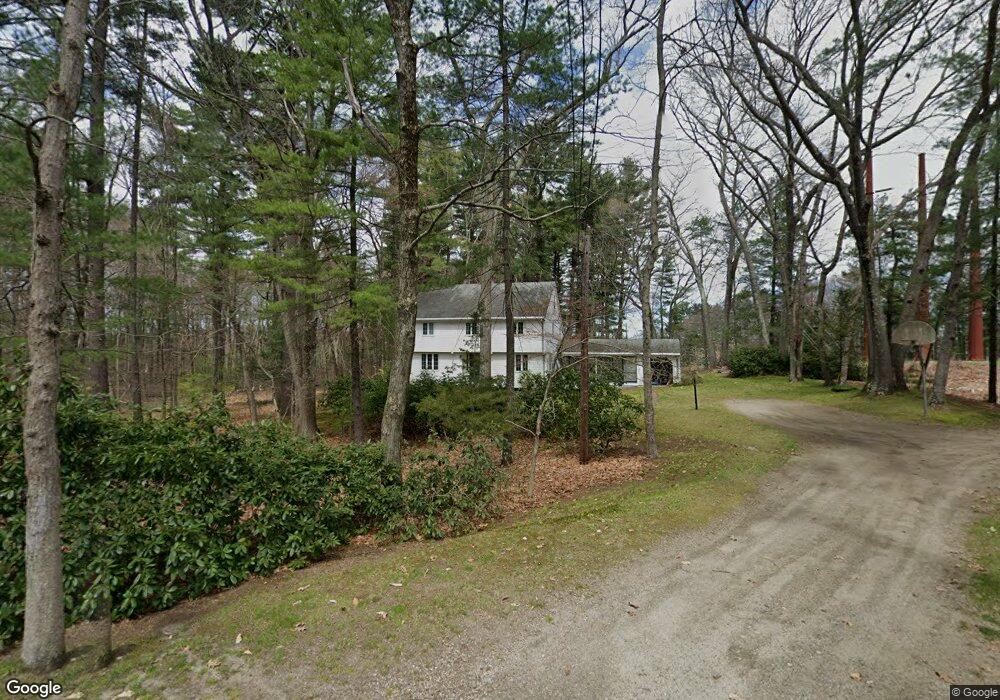
66 Pelham Island Rd Sudbury, MA 01776
Estimated Value: $935,647 - $1,181,000
4
Beds
2
Baths
2,052
Sq Ft
$509/Sq Ft
Est. Value
About This Home
This home is located at 66 Pelham Island Rd, Sudbury, MA 01776 and is currently estimated at $1,045,412, approximately $509 per square foot. 66 Pelham Island Rd is a home located in Middlesex County with nearby schools including Israel Loring Elementary School, Ephraim Curtis Middle School, and Lincoln-Sudbury Regional High School.
Ownership History
Date
Name
Owned For
Owner Type
Purchase Details
Closed on
Aug 19, 1994
Sold by
Est Morth Raymond H and Morth Irene
Bought by
Morth Carl A
Current Estimated Value
Home Financials for this Owner
Home Financials are based on the most recent Mortgage that was taken out on this home.
Original Mortgage
$90,000
Interest Rate
8.61%
Mortgage Type
Purchase Money Mortgage
Create a Home Valuation Report for This Property
The Home Valuation Report is an in-depth analysis detailing your home's value as well as a comparison with similar homes in the area
Home Values in the Area
Average Home Value in this Area
Purchase History
| Date | Buyer | Sale Price | Title Company |
|---|---|---|---|
| Morth Carl A | $224,600 | -- |
Source: Public Records
Mortgage History
| Date | Status | Borrower | Loan Amount |
|---|---|---|---|
| Closed | Morth Carl A | $90,000 |
Source: Public Records
Tax History Compared to Growth
Tax History
| Year | Tax Paid | Tax Assessment Tax Assessment Total Assessment is a certain percentage of the fair market value that is determined by local assessors to be the total taxable value of land and additions on the property. | Land | Improvement |
|---|---|---|---|---|
| 2025 | $12,889 | $880,400 | $527,900 | $352,500 |
| 2024 | $12,467 | $853,300 | $514,300 | $339,000 |
| 2023 | $12,045 | $763,800 | $481,100 | $282,700 |
| 2022 | $11,953 | $662,200 | $446,700 | $215,500 |
| 2021 | $11,789 | $626,100 | $446,700 | $179,400 |
| 2020 | $11,552 | $626,100 | $446,700 | $179,400 |
| 2019 | $11,213 | $626,100 | $446,700 | $179,400 |
| 2018 | $11,291 | $629,700 | $466,700 | $163,000 |
| 2017 | $11,056 | $623,200 | $461,900 | $161,300 |
| 2016 | $10,735 | $603,100 | $446,700 | $156,400 |
| 2015 | $10,298 | $585,100 | $431,900 | $153,200 |
| 2014 | $10,295 | $571,000 | $421,100 | $149,900 |
Source: Public Records
Map
Nearby Homes
- 216 Landham Rd
- 63 Landham Rd
- 0 Wagonwheel Rd
- 6 Old County Rd Unit 16
- 84 Hopestill Brown Rd
- 94 Goodmans Hill Rd
- 23 Massasoit Ave
- 36 Concord Rd
- 1011 Boston Post Rd
- 30 Edith Rd
- 353 Old Connecticut Path
- 8 Clara Rd
- 14 Eisenhower Rd
- 24 Pinewood Dr
- 17 Hastings Way Unit 17
- 29 Derby St
- 128 Nobscot Rd
- 81 Nicholas Rd Unit B
- 14 Francine Rd
- 71 Nicholas Rd Unit H
- 65 Pelham Island Rd
- 78 Pelham Island Rd
- 71 Pelham Island Rd
- 77 Pelham Island Rd
- 48 Pelham Island Rd
- 15 Hawthorne Rd
- 82 Pelham Island Rd
- 49 Pelham Island Rd
- 28 Guzzlebrook Dr
- 20 Guzzle Brook Dr
- 19 Hawthorne Rd
- 36 Guzzle Brook Dr
- 83 Pelham Island Rd
- 39 Pelham Island Rd
- 90 Pelham Island Rd
- 8 Hawthorne Rd
- 11 Beckwith St
- 91 Pelham Island Rd
- 35 Guzzle Brook Dr
- 35 Guzzlebrook Dr