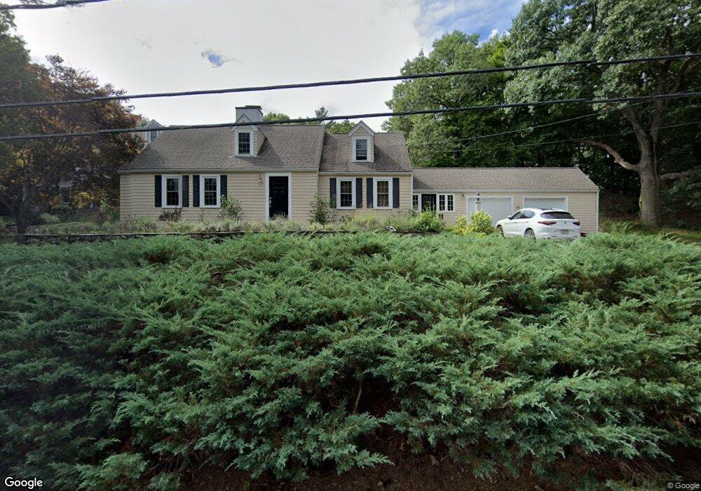
66 Robbins Rd Lexington, MA 02421
Follen Heights NeighborhoodEstimated Value: $1,463,000 - $1,965,000
4
Beds
2
Baths
1,937
Sq Ft
$899/Sq Ft
Est. Value
About This Home
This home is located at 66 Robbins Rd, Lexington, MA 02421 and is currently estimated at $1,741,903, approximately $899 per square foot. 66 Robbins Rd is a home located in Middlesex County with nearby schools including Bowman Elementary School, Jonas Clarke Middle School, and Lexington High School.
Ownership History
Date
Name
Owned For
Owner Type
Purchase Details
Closed on
Jul 25, 2008
Sold by
Mary A Hamilton Lt
Bought by
Robbins Road Dev Llc
Current Estimated Value
Home Financials for this Owner
Home Financials are based on the most recent Mortgage that was taken out on this home.
Original Mortgage
$1,325,000
Outstanding Balance
$870,487
Interest Rate
6.35%
Mortgage Type
Purchase Money Mortgage
Estimated Equity
$871,416
Purchase Details
Closed on
Oct 15, 2004
Sold by
Hamilton Mary A
Bought by
Hamilton John M and Hamilton Mary A
Purchase Details
Closed on
Jun 12, 2003
Sold by
Hamilton Mary A
Bought by
Mary A Hamilton Lt
Create a Home Valuation Report for This Property
The Home Valuation Report is an in-depth analysis detailing your home's value as well as a comparison with similar homes in the area
Home Values in the Area
Average Home Value in this Area
Purchase History
| Date | Buyer | Sale Price | Title Company |
|---|---|---|---|
| Robbins Road Dev Llc | $995,000 | -- | |
| Hamilton John M | -- | -- | |
| Mary A Hamilton Lt | -- | -- |
Source: Public Records
Mortgage History
| Date | Status | Borrower | Loan Amount |
|---|---|---|---|
| Open | Robbins Road Dev Llc | $1,325,000 |
Source: Public Records
Tax History Compared to Growth
Tax History
| Year | Tax Paid | Tax Assessment Tax Assessment Total Assessment is a certain percentage of the fair market value that is determined by local assessors to be the total taxable value of land and additions on the property. | Land | Improvement |
|---|---|---|---|---|
| 2025 | $20,167 | $1,649,000 | $1,113,000 | $536,000 |
| 2024 | $19,527 | $1,594,000 | $1,060,000 | $534,000 |
| 2023 | $18,668 | $1,436,000 | $964,000 | $472,000 |
| 2022 | $17,912 | $1,298,000 | $876,000 | $422,000 |
| 2021 | $17,872 | $1,242,000 | $834,000 | $408,000 |
| 2020 | $17,450 | $1,242,000 | $834,000 | $408,000 |
| 2019 | $16,619 | $1,177,000 | $795,000 | $382,000 |
| 2018 | $15,787 | $1,104,000 | $736,000 | $368,000 |
| 2017 | $14,867 | $1,026,000 | $701,000 | $325,000 |
| 2016 | $13,607 | $932,000 | $644,000 | $288,000 |
| 2015 | $12,958 | $872,000 | $585,000 | $287,000 |
| 2014 | $11,881 | $766,000 | $524,000 | $242,000 |
Source: Public Records
Map
Nearby Homes