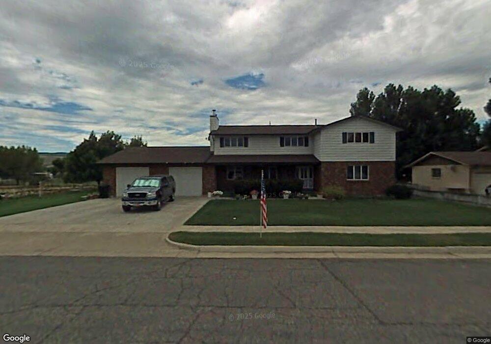
66 S 360 W Morgan, UT 84050
Estimated Value: $670,000 - $732,000
7
Beds
4
Baths
4,937
Sq Ft
$144/Sq Ft
Est. Value
About This Home
This home is located at 66 S 360 W, Morgan, UT 84050 and is currently estimated at $708,696, approximately $143 per square foot. 66 S 360 W is a home located in Morgan County with nearby schools including Morgan High School.
Ownership History
Date
Name
Owned For
Owner Type
Purchase Details
Closed on
Sep 15, 2022
Sold by
Johnson R B & E N F Tr
Bought by
Lindhardt Douglas S
Current Estimated Value
Home Financials for this Owner
Home Financials are based on the most recent Mortgage that was taken out on this home.
Original Mortgage
$434,500
Outstanding Balance
$413,394
Interest Rate
4.75%
Mortgage Type
Construction
Estimated Equity
$295,302
Create a Home Valuation Report for This Property
The Home Valuation Report is an in-depth analysis detailing your home's value as well as a comparison with similar homes in the area
Home Values in the Area
Average Home Value in this Area
Purchase History
| Date | Buyer | Sale Price | Title Company |
|---|---|---|---|
| Lindhardt Douglas S | $543,125 | Hickman Land Title Layton |
Source: Public Records
Mortgage History
| Date | Status | Borrower | Loan Amount |
|---|---|---|---|
| Open | Lindhardt Douglas S | $434,500 |
Source: Public Records
Tax History Compared to Growth
Tax History
| Year | Tax Paid | Tax Assessment Tax Assessment Total Assessment is a certain percentage of the fair market value that is determined by local assessors to be the total taxable value of land and additions on the property. | Land | Improvement |
|---|---|---|---|---|
| 2025 | $3,633 | $697,413 | $155,406 | $542,007 |
| 2024 | $3,910 | $689,775 | $155,406 | $534,369 |
| 2023 | $3,876 | $577,935 | $155,406 | $422,529 |
| 2022 | $3,881 | $515,448 | $155,406 | $360,042 |
| 2021 | $2,948 | $391,687 | $119,543 | $272,144 |
| 2020 | $2,866 | $380,819 | $108,675 | $272,144 |
| 2019 | $2,726 | $380,819 | $108,675 | $272,144 |
| 2018 | $2,375 | $197,496 | $0 | $0 |
| 2017 | $2,263 | $182,372 | $0 | $0 |
| 2016 | $2,059 | $163,903 | $0 | $0 |
| 2015 | $1,972 | $0 | $0 | $0 |
| 2013 | $1,778 | $0 | $0 | $0 |
Source: Public Records
Map
Nearby Homes
- 533 W 150 N
- 78 W 200 S
- 70 S 100 E
- 370 S State St
- 5959 N 5000 W
- 192 S Finch Cir
- 77 N River Cove Cir
- 269 River Cove Dr
- 560 400 W Unit 18
- 588 400 W
- 278 E 300 N
- 375 E 125 N Unit 11
- 970 S Morgan Valley Dr
- 1275 S Morgan Valley Dr
- 818 Mahogany Ridge Rd
- 881 Violet Dr
- 6745 N de Moisy Peak Dr
- 5849 N Jeeder Dr Unit 7
- 3437 W Spring Cir #60 N
- 6758 N 5200 W Unit 122