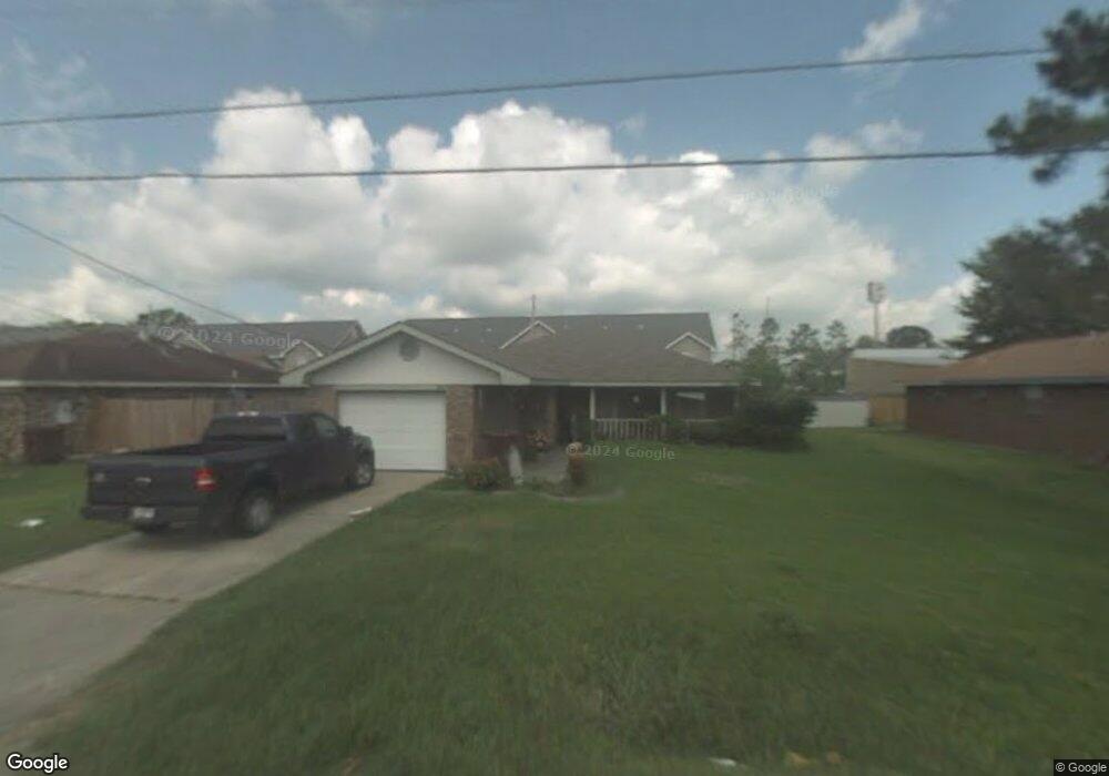
66 Saint Anthony St Luling, LA 70070
Estimated Value: $206,000 - $241,000
Studio
--
Bath
1,450
Sq Ft
$154/Sq Ft
Est. Value
About This Home
This home is located at 66 Saint Anthony St, Luling, LA 70070 and is currently estimated at $223,811, approximately $154 per square foot. 66 Saint Anthony St is a home located in St. Charles Parish with nearby schools including Mimosa Park Elementary School, Lakewood Elementary School, and J.B. Martin Middle School.
Ownership History
Date
Name
Owned For
Owner Type
Purchase Details
Closed on
Nov 21, 2017
Sold by
Dennis Karen Ann
Bought by
Ruiz Boudreaux Deborah Ellen
Current Estimated Value
Purchase Details
Closed on
May 10, 2016
Sold by
Ruiz Dyton Odis and Boudreaux Dawn Elizabeth
Bought by
Ruiz Boudreaux Deborah Ellen
Purchase Details
Closed on
Dec 13, 2010
Sold by
Boudreaux Deborah E Ruiz and Boudreaux Don W
Bought by
Ruiz Dyton Odis and Ruiz Dennis Karen
Create a Home Valuation Report for This Property
The Home Valuation Report is an in-depth analysis detailing your home's value as well as a comparison with similar homes in the area
Home Values in the Area
Average Home Value in this Area
Purchase History
| Date | Buyer | Sale Price | Title Company |
|---|---|---|---|
| Ruiz Boudreaux Deborah Ellen | $15,000 | Vintage Title Llc | |
| Ruiz Boudreaux Deborah Ellen | -- | Vintage Title | |
| Ruiz Dyton Odis | $85,000 | None Available |
Source: Public Records
Tax History
| Year | Tax Paid | Tax Assessment Tax Assessment Total Assessment is a certain percentage of the fair market value that is determined by local assessors to be the total taxable value of land and additions on the property. | Land | Improvement |
|---|---|---|---|---|
| 2025 | $1,228 | $19,650 | $6,330 | $13,320 |
| 2024 | $1,228 | $19,650 | $6,330 | $13,320 |
| 2023 | $1,247 | $14,500 | $4,640 | $9,860 |
| 2022 | $1,696 | $14,500 | $4,640 | $9,860 |
| 2021 | $1,435 | $12,163 | $4,176 | $7,987 |
| 2020 | $1,713 | $14,500 | $4,640 | $9,860 |
| 2019 | $1,429 | $12,055 | $3,500 | $8,555 |
| 2018 | $1,419 | $12,055 | $3,500 | $8,555 |
| 2017 | $1,417 | $12,055 | $3,500 | $8,555 |
| 2016 | $1,423 | $12,055 | $3,500 | $8,555 |
| 2015 | $307 | $10,107 | $1,961 | $8,146 |
| 2014 | $295 | $10,107 | $1,961 | $8,146 |
| 2013 | $296 | $10,107 | $1,961 | $8,146 |
Source: Public Records
Map
Nearby Homes
- 64 Saint Anthony St
- 68 Saint Anthony St
- 103 Perryl Ln
- 104 Perryl Ln
- 102 Perryl Ln
- 101 Perryl Ln
- 70 Saint Anthony St
- 204 Perryl Ln
- 62 Saint Anthony St
- 203 Perryl Ln
- 65 Saint Anthony St
- 69 Saint Anthony St
- 202 Perryl Ln
- 201 Perryl Ln
- 63 Saint Anthony St
- 71 Saint Anthony St
- 72 Saint Anthony St
- 304 Perryl Ln
- 404 Perryl Ln
- 403 Perryl Ln
Your Personal Tour Guide
Ask me questions while you tour the home.