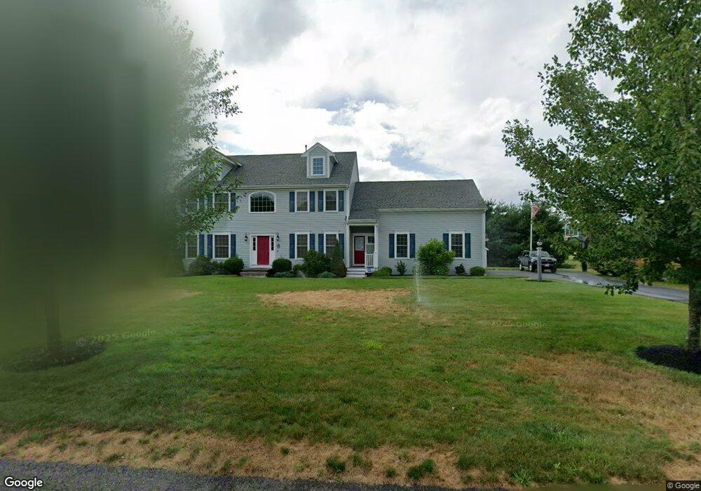
66 Sawmill Rd Duxbury, MA 02332
Estimated Value: $1,049,702 - $1,302,000
4
Beds
3
Baths
2,628
Sq Ft
$428/Sq Ft
Est. Value
About This Home
This home is located at 66 Sawmill Rd, Duxbury, MA 02332 and is currently estimated at $1,123,676, approximately $427 per square foot. 66 Sawmill Rd is a home located in Plymouth County with nearby schools including Chandler Elementary School, Alden School, and Duxbury Middle School.
Ownership History
Date
Name
Owned For
Owner Type
Purchase Details
Closed on
Oct 2, 2006
Sold by
Brainfrank Nt and Koplovsky Edward M
Bought by
Duxbury Farms Corp
Current Estimated Value
Home Financials for this Owner
Home Financials are based on the most recent Mortgage that was taken out on this home.
Original Mortgage
$2,000,000
Outstanding Balance
$1,197,392
Interest Rate
6.52%
Mortgage Type
Purchase Money Mortgage
Estimated Equity
-$73,716
Create a Home Valuation Report for This Property
The Home Valuation Report is an in-depth analysis detailing your home's value as well as a comparison with similar homes in the area
Home Values in the Area
Average Home Value in this Area
Purchase History
| Date | Buyer | Sale Price | Title Company |
|---|---|---|---|
| Duxbury Farms Corp | $2,600,000 | -- |
Source: Public Records
Mortgage History
| Date | Status | Borrower | Loan Amount |
|---|---|---|---|
| Open | Duxbury Farms Corp | $2,000,000 |
Source: Public Records
Tax History Compared to Growth
Tax History
| Year | Tax Paid | Tax Assessment Tax Assessment Total Assessment is a certain percentage of the fair market value that is determined by local assessors to be the total taxable value of land and additions on the property. | Land | Improvement |
|---|---|---|---|---|
| 2025 | $9,985 | $984,700 | $323,500 | $661,200 |
| 2024 | $9,940 | $988,100 | $323,500 | $664,600 |
| 2023 | $9,068 | $848,300 | $336,100 | $512,200 |
| 2022 | $9,410 | $732,900 | $296,500 | $436,400 |
| 2021 | $9,668 | $667,700 | $279,100 | $388,600 |
| 2020 | $9,838 | $671,100 | $264,400 | $406,700 |
| 2019 | $9,639 | $656,600 | $245,600 | $411,000 |
| 2018 | $9,601 | $633,300 | $235,300 | $398,000 |
| 2017 | $9,598 | $618,800 | $235,300 | $383,500 |
| 2016 | $9,467 | $608,800 | $225,300 | $383,500 |
| 2015 | $9,129 | $585,200 | $193,900 | $391,300 |
Source: Public Records
Map
Nearby Homes
- 249 High St
- 47 Wellington Ln
- 16 Chapel St
- 61 Chapel St
- 346 Summer St
- 234 Forest St
- 290 High St
- 72 Valley St
- 99 Old Washington St
- 676 Franklin St
- 30 Old Washington St Unit 9
- 118 Plain St
- 77 Old Cart Path Ln Unit Lot 4
- 72 Old Cart Path Ln Unit Lot 2
- 78 Old Cart Path Ln Unit Lot 3
- 0 East St
- 40 Brisan Way
- 599 Washington St Unit 14
- 10 Emily Ln
- 131 East St
- 66 Saw Mill Rd
- 72 Sawmill Rd
- 60 Sawmill Rd
- 72 Saw Mill Rd
- 63 Saw Mill Rd
- 69 Sawmill Rd
- 54 Sawmill Rd
- 63 Sawmill Rd
- 75 Sawmill Rd
- 78 Sawmill Rd
- Lot I Saw Mill Rd
- 1250 Franklin St
- Lot T Saw Mill Rd
- Lot B Saw Mill Rd
- Lot N Saw Mill Rd
- Lot F Saw Mill Rd
- Lot D Saw Mill Rd
- Lot S Saw Mill Rd
- Lot C Saw Hill Rd
- Lot O Saw Hill Rd