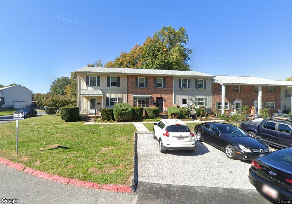
66 Shetland Cir Reisterstown, MD 21136
Estimated Value: $169,000 - $215,000
--
Bed
2
Baths
1,300
Sq Ft
$152/Sq Ft
Est. Value
About This Home
This home is located at 66 Shetland Cir, Reisterstown, MD 21136 and is currently estimated at $197,989, approximately $152 per square foot. 66 Shetland Cir is a home located in Baltimore County with nearby schools including Cedarmere Elementary School, Franklin Middle, and Franklin High.
Ownership History
Date
Name
Owned For
Owner Type
Purchase Details
Closed on
Oct 29, 2004
Sold by
Bennett Daphnee Maria
Current Estimated Value
Purchase Details
Closed on
Sep 7, 1995
Sold by
Schweer Linda J
Bought by
Bennett Daphnee M
Home Financials for this Owner
Home Financials are based on the most recent Mortgage that was taken out on this home.
Original Mortgage
$71,925
Interest Rate
7.8%
Purchase Details
Closed on
Dec 23, 1985
Sold by
Chelden Dale Brian
Bought by
Schweer Linda J
Create a Home Valuation Report for This Property
The Home Valuation Report is an in-depth analysis detailing your home's value as well as a comparison with similar homes in the area
Home Values in the Area
Average Home Value in this Area
Purchase History
| Date | Buyer | Sale Price | Title Company |
|---|---|---|---|
| -- | -- | -- | |
| -- | -- | -- | |
| Bennett Daphnee M | $70,000 | -- | |
| Schweer Linda J | $56,000 | -- |
Source: Public Records
Mortgage History
| Date | Status | Borrower | Loan Amount |
|---|---|---|---|
| Previous Owner | Bennett Daphnee M | $71,925 |
Source: Public Records
Tax History Compared to Growth
Tax History
| Year | Tax Paid | Tax Assessment Tax Assessment Total Assessment is a certain percentage of the fair market value that is determined by local assessors to be the total taxable value of land and additions on the property. | Land | Improvement |
|---|---|---|---|---|
| 2025 | $2,370 | $112,767 | -- | -- |
| 2024 | $2,370 | $98,600 | $30,000 | $68,600 |
| 2023 | $2,328 | $98,600 | $30,000 | $68,600 |
| 2022 | $2,267 | $98,600 | $30,000 | $68,600 |
| 2021 | $1,141 | $100,800 | $30,000 | $70,800 |
| 2020 | $1,154 | $95,233 | $0 | $0 |
| 2019 | $1,087 | $89,667 | $0 | $0 |
| 2018 | $2,001 | $84,100 | $33,700 | $50,400 |
| 2017 | $1,794 | $82,667 | $0 | $0 |
| 2016 | $1,613 | $81,233 | $0 | $0 |
| 2015 | $1,613 | $79,800 | $0 | $0 |
| 2014 | $1,613 | $79,800 | $0 | $0 |
Source: Public Records
Map
Nearby Homes
- 125 Hammershire Rd
- 133 Hammershire Rd
- 60 Ewing Dr
- 82 Ewing Dr
- 26 Mission Wood Way
- 118 Mardan Dr
- 22 Fox Run Ct
- 18 Austin Rd
- 231 Candytuft Rd
- 237 Candytuft Rd
- 247 Candytuft Rd
- 203 Cork Ln Unit T4
- 101 Fitz Ct Unit 202
- 105 Fitz Ct Unit 101
- 318 Bryanstone Rd
- 331 Bryanstone Rd
- 208 Parkholme Cir
- 200 Erin Way Unit 204
- 132 Cedarmere Rd
- 312 E Cherry Hill Rd
- 171 Shetland Cir
- 64 Shetland Cir
- 169 Shetland Cir
- 173 Shetland Cir
- 185 Shetland Cir
- 187 Shetland Cir
- 175 Shetland Cir
- 167 Shetland Cir
- 193 Shetland Cir
- 189 Shetland Cir
- 195 Shetland Cir Unit 1
- 195 Shetland Cir
- 165 Shetland Cir
- 183 Shetland Cir
- 177 Shetland Cir
- 191 Shetland Cir
- 179 Shetland Cir
- 181 Shetland Cir
- 30 Shetland Cir
- 2 Shetland Cir