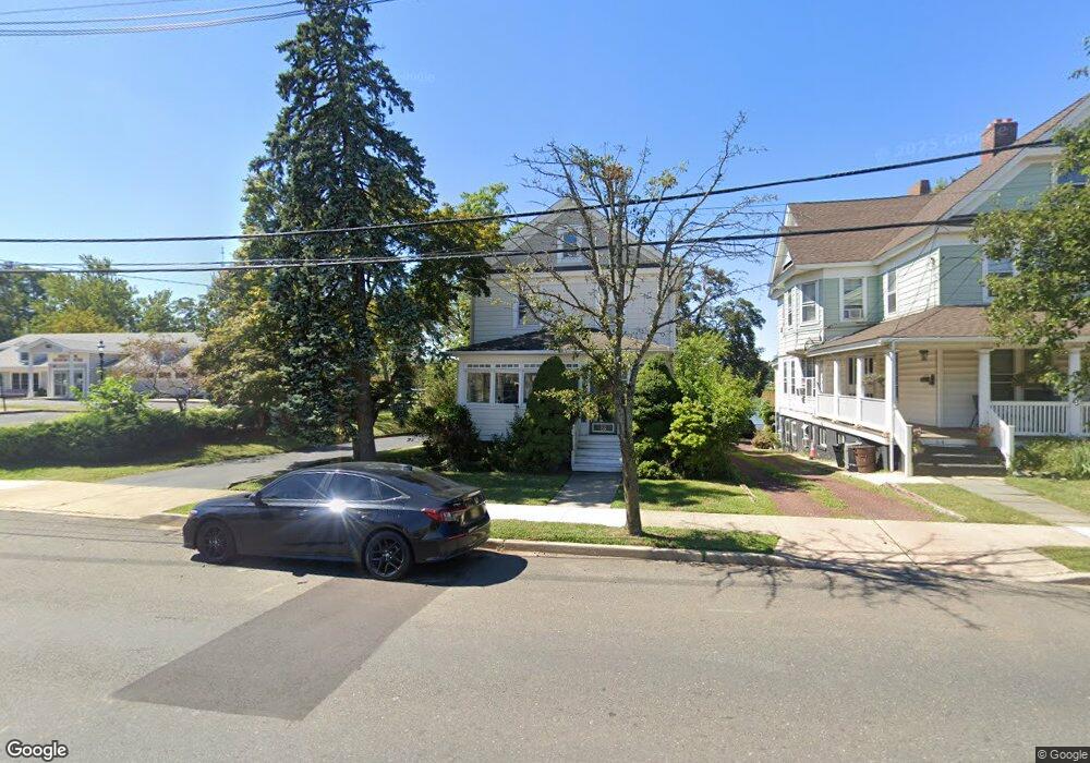
66 Shrewsbury Ave Red Bank, NJ 07701
Estimated Value: $684,000 - $848,000
2
Beds
2
Baths
1,402
Sq Ft
$538/Sq Ft
Est. Value
About This Home
This home is located at 66 Shrewsbury Ave, Red Bank, NJ 07701 and is currently estimated at $753,843, approximately $537 per square foot. 66 Shrewsbury Ave is a home located in Monmouth County with nearby schools including Red Bank Primary School, Red Bank Middle School, and Red Bank Reg High School.
Ownership History
Date
Name
Owned For
Owner Type
Purchase Details
Closed on
Jul 17, 2018
Sold by
Jenning Mary
Bought by
Jennings Mary
Current Estimated Value
Home Financials for this Owner
Home Financials are based on the most recent Mortgage that was taken out on this home.
Original Mortgage
$250,000
Outstanding Balance
$216,662
Interest Rate
4.5%
Mortgage Type
Adjustable Rate Mortgage/ARM
Estimated Equity
$537,181
Purchase Details
Closed on
Feb 9, 2012
Sold by
Gannon James and Gannon Jacqueline
Bought by
Jennings Mary
Purchase Details
Closed on
Jan 17, 1994
Sold by
Constellation Bank
Bought by
Gannon James and Gannon Jacqueline
Home Financials for this Owner
Home Financials are based on the most recent Mortgage that was taken out on this home.
Original Mortgage
$66,000
Interest Rate
8.49%
Create a Home Valuation Report for This Property
The Home Valuation Report is an in-depth analysis detailing your home's value as well as a comparison with similar homes in the area
Home Values in the Area
Average Home Value in this Area
Purchase History
| Date | Buyer | Sale Price | Title Company |
|---|---|---|---|
| Jennings Mary | -- | None Available | |
| Jennings Mary | -- | None Available | |
| Gannon James | $83,646 | -- |
Source: Public Records
Mortgage History
| Date | Status | Borrower | Loan Amount |
|---|---|---|---|
| Open | Jennings Mary | $250,000 | |
| Previous Owner | Gannon James | $66,000 |
Source: Public Records
Tax History Compared to Growth
Tax History
| Year | Tax Paid | Tax Assessment Tax Assessment Total Assessment is a certain percentage of the fair market value that is determined by local assessors to be the total taxable value of land and additions on the property. | Land | Improvement |
|---|---|---|---|---|
| 2025 | $10,595 | $593,100 | $414,200 | $178,900 |
| 2024 | $10,625 | $560,900 | $383,600 | $177,300 |
| 2023 | $10,625 | $556,000 | $383,600 | $172,400 |
| 2022 | $10,386 | $526,200 | $361,200 | $165,000 |
| 2021 | $10,386 | $464,300 | $314,100 | $150,200 |
| 2020 | $10,251 | $451,200 | $314,100 | $137,100 |
| 2019 | $9,885 | $447,100 | $314,100 | $133,000 |
| 2018 | $9,671 | $442,200 | $314,100 | $128,100 |
| 2017 | $9,314 | $441,400 | $314,100 | $127,300 |
| 2016 | $9,231 | $438,100 | $314,100 | $124,000 |
| 2015 | $7,919 | $389,500 | $292,800 | $96,700 |
| 2014 | $7,451 | $389,500 | $292,800 | $96,700 |
Source: Public Records
Map
Nearby Homes
- 32 Earl St
- 171-173 Bridge Ave
- 28 Riverside Ave Unit 2G
- 28 Riverside Ave Unit 2F
- 28 Riverside Ave Unit 1H
- 28 Riverside Ave Unit 9 G
- 195 Bridge Ave
- 24 River St
- 130 Bodman Place Unit 15
- 24 Cedar Crossing
- 38 Bank St
- 167 River St
- 23 Cedar Crossing
- 3 Cedar Crossing
- 44 Waverly Place
- 205 Maple Ave
- 4 Boat Club Ct Unit 3E
- 232 S Pearl St
- 17 Leroy Place Unit 3B
- 17 Leroy Place Unit 1C
- 62 Shrewsbury Ave Unit 64
- 62 Shrewsbury Ave Unit 62A
- 64 Shrewsbury Ave Unit B
- 220 Monmouth St
- 218 Monmouth St Unit 220
- 54 Shrewsbury Ave
- 73 Shrewsbury Ave
- 77 Shrewsbury Ave
- 81 Shrewsbury Ave
- 84 Shrewsbury Ave
- 211 Monmouth St
- 85 Shrewsbury Ave
- 90 Shrewsbury Ave Unit B
- 90 Shrewsbury Ave
- 90 Shrewsbury Ave Unit 2
- 90 Shrewsbury Ave Unit 1
- 89 Shrewsbury Ave
- 40 Shrewsbury Ave
- 92 Shrewsbury Ave
- 39 Shrewsbury Ave Unit 41