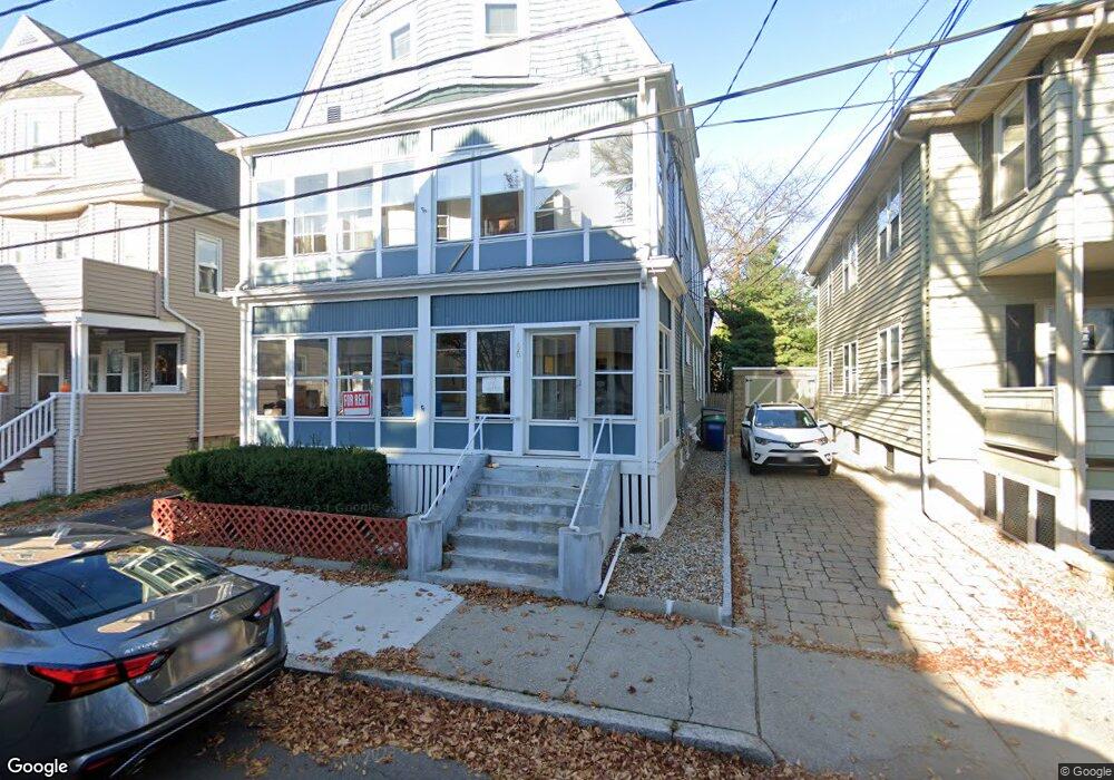
66 Simpson Ave Somerville, MA 02144
Davis Square NeighborhoodEstimated Value: $1,451,000 - $1,733,009
5
Beds
2
Baths
1,900
Sq Ft
$866/Sq Ft
Est. Value
About This Home
This home is located at 66 Simpson Ave, Somerville, MA 02144 and is currently estimated at $1,645,002, approximately $865 per square foot. 66 Simpson Ave is a home located in Middlesex County with nearby schools including Somerville High School, St. Clement Elementary School, and International School of Boston.
Create a Home Valuation Report for This Property
The Home Valuation Report is an in-depth analysis detailing your home's value as well as a comparison with similar homes in the area
Home Values in the Area
Average Home Value in this Area
Tax History Compared to Growth
Tax History
| Year | Tax Paid | Tax Assessment Tax Assessment Total Assessment is a certain percentage of the fair market value that is determined by local assessors to be the total taxable value of land and additions on the property. | Land | Improvement |
|---|---|---|---|---|
| 2025 | $15,165 | $1,390,000 | $791,100 | $598,900 |
| 2024 | $14,510 | $1,379,300 | $791,100 | $588,200 |
| 2023 | $14,172 | $1,370,600 | $791,100 | $579,500 |
| 2022 | $13,340 | $1,310,400 | $753,500 | $556,900 |
| 2021 | $12,980 | $1,273,800 | $748,000 | $525,800 |
| 2020 | $12,040 | $1,193,300 | $698,600 | $494,700 |
| 2019 | $11,893 | $1,105,300 | $681,300 | $424,000 |
| 2018 | $10,994 | $972,100 | $619,400 | $352,700 |
| 2017 | $2,772 | $923,300 | $584,400 | $338,900 |
| 2016 | $10,405 | $830,400 | $521,800 | $308,600 |
| 2015 | $9,669 | $766,800 | $481,900 | $284,900 |
Source: Public Records
Map
Nearby Homes
- 20 Electric Ave Unit 2
- 22 Ossipee Rd Unit 2
- 29 Packard Ave
- 23 Ossipee Rd
- 55 Packard Ave Unit 1
- 50 Howard St Unit 5
- 67-69 Cameron Ave
- 39 Seven Pines Ave
- 69 Clarendon Ave Unit A
- 32 Cameron Ave
- 11 Watson St Unit 1
- 11 Watson St Unit 2
- 24 Washburn Ave Unit 1
- 26 Warner St
- 17 Shea Rd
- 34 Day St
- 202 Powder House Blvd Unit 2
- 33 Conwell Ave
- 97 Elmwood St Unit 313
- 97 Elmwood St Unit 110
- 66 Simpson Ave
- 66 Simpson Ave Unit 2
- 66 Simpson Ave Unit 1
- 68 Simpson Ave
- 62 Simpson Ave
- 14 Corinthian Rd
- 14 Corinthian Rd Unit A
- 14 Corinthian Rd Unit B
- 58 Simpson Ave
- 58 Simpson Ave Unit 1
- 58 Simpson Ave Unit 2
- 74 Simpson Ave
- 72 Simpson Ave
- 18 Corinthian Rd
- 16 Corinthian Rd
- 16 Corinthian Rd Unit 2
- 67 Simpson Ave
- 67 Simpson Ave Unit 1
- 67 Simpson Ave Unit 2
- 20 Corinthian Rd Unit A