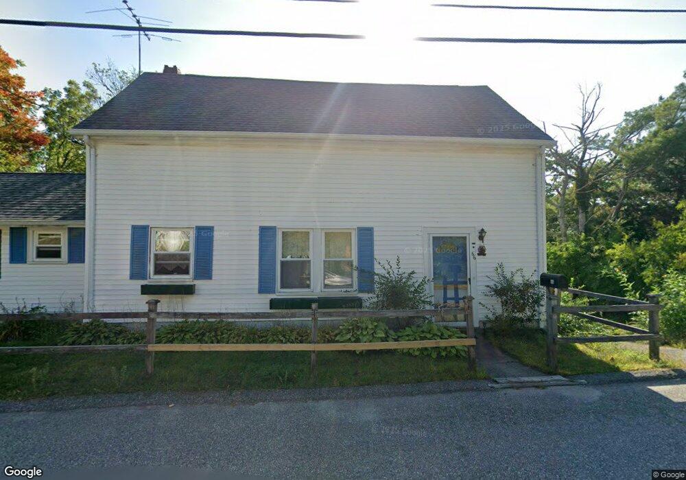
66 Sumner St Gloucester, MA 01930
West Gloucester NeighborhoodEstimated Value: $581,000 - $697,000
2
Beds
3
Baths
1,405
Sq Ft
$454/Sq Ft
Est. Value
About This Home
This home is located at 66 Sumner St, Gloucester, MA 01930 and is currently estimated at $637,514, approximately $453 per square foot. 66 Sumner St is a home located in Essex County with nearby schools including West Parish, Ralph B O'maley Middle School, and Gloucester High School.
Ownership History
Date
Name
Owned For
Owner Type
Purchase Details
Closed on
Oct 1, 2009
Sold by
Peckham Walter G
Bought by
66 Summer Street Llc
Current Estimated Value
Purchase Details
Closed on
Jan 29, 2007
Sold by
66 Sumner Street T
Bought by
Peckham Walter
Home Financials for this Owner
Home Financials are based on the most recent Mortgage that was taken out on this home.
Original Mortgage
$336,000
Interest Rate
9%
Purchase Details
Closed on
Dec 28, 2001
Sold by
Orlando Anthony M and Orlando Josephine A
Bought by
Peckham Walter and Peckham Courtney
Home Financials for this Owner
Home Financials are based on the most recent Mortgage that was taken out on this home.
Original Mortgage
$180,000
Interest Rate
6.61%
Mortgage Type
Purchase Money Mortgage
Create a Home Valuation Report for This Property
The Home Valuation Report is an in-depth analysis detailing your home's value as well as a comparison with similar homes in the area
Home Values in the Area
Average Home Value in this Area
Purchase History
| Date | Buyer | Sale Price | Title Company |
|---|---|---|---|
| 66 Summer Street Llc | $150,000 | -- | |
| Peckham Walter | -- | -- | |
| Peckham Walter | $200,000 | -- |
Source: Public Records
Mortgage History
| Date | Status | Borrower | Loan Amount |
|---|---|---|---|
| Previous Owner | Peckham Walter | $336,000 | |
| Previous Owner | Peckham Walter | $222,300 | |
| Previous Owner | Peckham Walter | $180,000 |
Source: Public Records
Tax History
| Year | Tax Paid | Tax Assessment Tax Assessment Total Assessment is a certain percentage of the fair market value that is determined by local assessors to be the total taxable value of land and additions on the property. | Land | Improvement |
|---|---|---|---|---|
| 2025 | $4,465 | $459,400 | $251,500 | $207,900 |
| 2024 | $4,352 | $447,300 | $239,400 | $207,900 |
| 2023 | $4,187 | $395,400 | $213,800 | $181,600 |
| 2022 | $4,045 | $344,800 | $185,700 | $159,100 |
| 2021 | $3,904 | $313,800 | $169,000 | $144,800 |
| 2020 | $3,844 | $311,800 | $169,000 | $142,800 |
| 2019 | $3,749 | $295,400 | $169,000 | $126,400 |
| 2018 | $3,668 | $283,700 | $169,000 | $114,700 |
| 2017 | $3,555 | $269,500 | $160,800 | $108,700 |
| 2016 | $3,600 | $264,500 | $167,900 | $96,600 |
| 2015 | $3,509 | $257,100 | $167,900 | $89,200 |
Source: Public Records
Map
Nearby Homes
- 7 Leaman Dr
- 587 Essex Ave
- 15 Lufkin Point Rd
- 368 Essex Ave
- 162 Main St
- 145 Main St Unit 1
- 145 Main St Unit 4
- 90 Southern Ave Unit 90
- 167 Atlantic St
- 178 Atlantic St
- 5 Samoset Rd Unit B
- 226 Atlantic St
- 34 & 34R Pickering St
- 5 Lepage Ln
- 24 Cobblestone Ln Unit 603
- 13 Honeysuckle Rd
- 145 Essex Ave Unit 402
- 3 Hardy Ln
- 85 Martin St
- 2 Breezy Point Rd
Your Personal Tour Guide
Ask me questions while you tour the home.