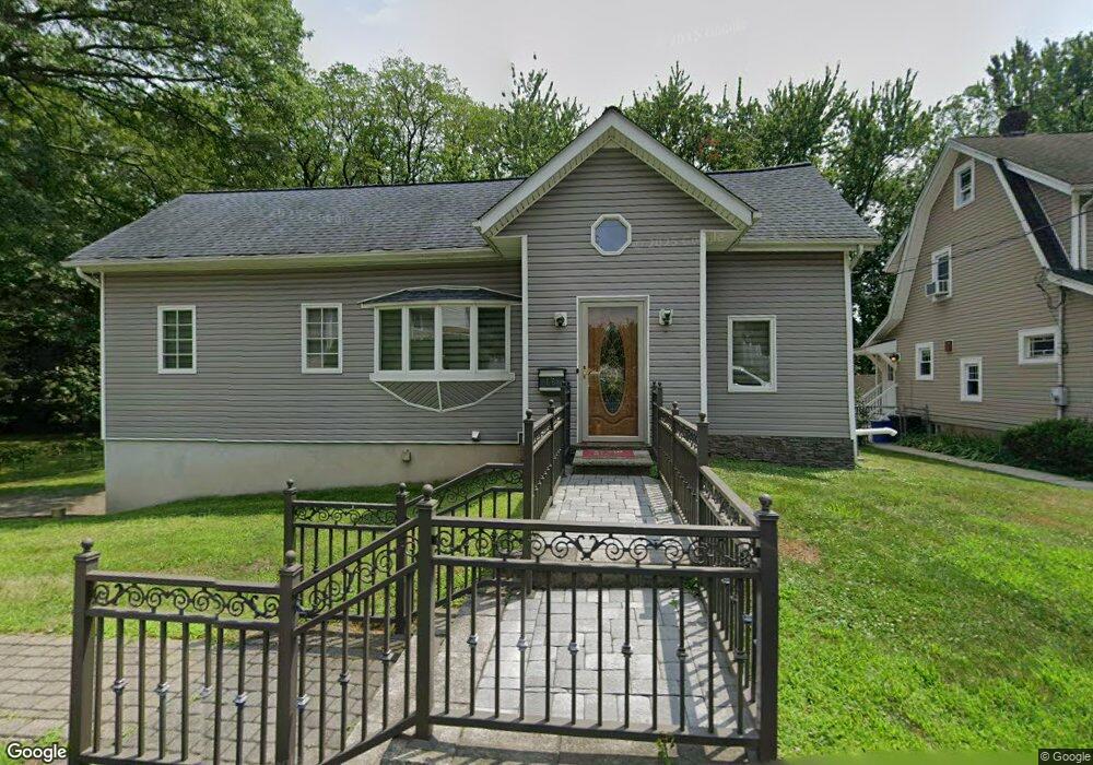
66 W Airmount Rd Mahwah, NJ 07430
Estimated Value: $609,000 - $714,070
--
Bed
--
Bath
1,562
Sq Ft
$422/Sq Ft
Est. Value
About This Home
This home is located at 66 W Airmount Rd, Mahwah, NJ 07430 and is currently estimated at $659,018, approximately $421 per square foot. 66 W Airmount Rd is a home located in Bergen County with nearby schools including Mahwah High School.
Ownership History
Date
Name
Owned For
Owner Type
Purchase Details
Closed on
Nov 12, 2016
Sold by
Moorjani Mona U
Bought by
Moorjani Mona U and Mona U Moorjani Revocable Trust
Current Estimated Value
Purchase Details
Closed on
Sep 11, 2007
Sold by
Wong Grace
Bought by
Moorjani Mona
Home Financials for this Owner
Home Financials are based on the most recent Mortgage that was taken out on this home.
Original Mortgage
$204,000
Outstanding Balance
$129,688
Interest Rate
6.65%
Mortgage Type
New Conventional
Estimated Equity
$529,330
Purchase Details
Closed on
May 24, 2007
Sold by
Wheeler William and Wheeler Elly
Bought by
Wong Grace S
Purchase Details
Closed on
Jan 31, 1994
Sold by
Bennett Real Estate Inc
Bought by
Wheeler William and Wheeler Kelly
Home Financials for this Owner
Home Financials are based on the most recent Mortgage that was taken out on this home.
Original Mortgage
$95,000
Interest Rate
7.12%
Create a Home Valuation Report for This Property
The Home Valuation Report is an in-depth analysis detailing your home's value as well as a comparison with similar homes in the area
Home Values in the Area
Average Home Value in this Area
Purchase History
| Date | Buyer | Sale Price | Title Company |
|---|---|---|---|
| Moorjani Mona U | -- | None Available | |
| Moorjani Mona | $255,000 | -- | |
| Wong Grace S | $150,000 | -- | |
| Wheeler William | $100,000 | -- |
Source: Public Records
Mortgage History
| Date | Status | Borrower | Loan Amount |
|---|---|---|---|
| Open | Moorjani Mona | $204,000 | |
| Previous Owner | Wheeler William | $95,000 |
Source: Public Records
Tax History Compared to Growth
Tax History
| Year | Tax Paid | Tax Assessment Tax Assessment Total Assessment is a certain percentage of the fair market value that is determined by local assessors to be the total taxable value of land and additions on the property. | Land | Improvement |
|---|---|---|---|---|
| 2025 | $7,730 | $374,500 | $206,900 | $167,600 |
| 2024 | $7,629 | $374,500 | $206,900 | $167,600 |
| 2023 | $7,385 | $374,500 | $206,900 | $167,600 |
| 2022 | $7,385 | $374,500 | $206,900 | $167,600 |
| 2021 | $7,004 | $374,500 | $206,900 | $167,600 |
| 2020 | $7,130 | $374,500 | $206,900 | $167,600 |
| 2019 | $6,895 | $374,500 | $206,900 | $167,600 |
| 2018 | $6,797 | $374,500 | $206,900 | $167,600 |
| 2017 | $6,689 | $374,500 | $206,900 | $167,600 |
| 2016 | $6,543 | $374,500 | $206,900 | $167,600 |
| 2015 | $6,453 | $374,500 | $206,900 | $167,600 |
| 2014 | $6,344 | $374,500 | $206,900 | $167,600 |
Source: Public Records
Map
Nearby Homes
- 199 Island Rd
- 112 Moffatt Rd
- 111 Moffatt Rd
- 16 Gardner St
- 324 Franklin Turnpike
- 37 Hillside Ave
- 13 Winter Terrace
- 18 Boulder Trail
- 12 Alcott Rd
- 46 Elbert Ct
- 38 N Railroad Ave
- 585 N Central Ave
- 163 Rutherford Rd
- 17 Mountain Ave
- 34 N Railroad Ave
- 128 Grove St
- 609 Glasmere Rd
- 435 Green Mountain Rd Unit 33
- 2120 Gunston Ct
- 2054 Charles Ct
- 68 W Airmount Rd
- 65 W Airmount Rd
- 63 W Airmount Rd
- 59 W Airmount Rd
- 67 W Airmount Rd
- 57 W Airmount Rd
- 69 W Airmount Rd
- 71 W Airmount Rd
- 73 W Airmount Rd
- 55 W Airmount Rd
- 209 Island Rd
- 195 Island Rd
- 53 W Airmount Rd
- 49 W Airmount Rd
- 197 Island Rd
- 67 Karen Dr
- 3 Breen Place
- 58 Karen Dr
- 186 Island Rd
- 63 Karen Dr