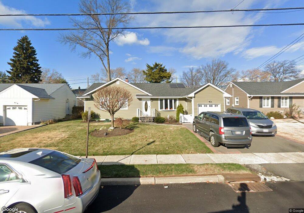
66 Warwick Rd Hillside, NJ 07205
Estimated Value: $473,184 - $590,000
Studio
--
Bath
1,220
Sq Ft
$439/Sq Ft
Est. Value
About This Home
This home is located at 66 Warwick Rd, Hillside, NJ 07205 and is currently estimated at $535,046, approximately $438 per square foot. 66 Warwick Rd is a home located in Union County with nearby schools including Abram P. Morris-Saybrook Elementary School, Hurden Looker School, and Calvin Coolidge Elementary School.
Ownership History
Date
Name
Owned For
Owner Type
Purchase Details
Closed on
Feb 21, 2017
Sold by
Coelho Antonio
Bought by
Cordeiro Daniel
Current Estimated Value
Home Financials for this Owner
Home Financials are based on the most recent Mortgage that was taken out on this home.
Original Mortgage
$170,000
Outstanding Balance
$140,437
Interest Rate
4.12%
Mortgage Type
New Conventional
Estimated Equity
$394,609
Purchase Details
Closed on
May 31, 2016
Sold by
Bank Of America Na
Bought by
Coelho Antonio
Purchase Details
Closed on
Oct 14, 2015
Sold by
Union County Sheriff
Bought by
Bank Of America N A
Purchase Details
Closed on
Nov 30, 1995
Sold by
Desmedt William D and Desmedt Marirose
Bought by
Cain Reginald and Cain Patricia
Create a Home Valuation Report for This Property
The Home Valuation Report is an in-depth analysis detailing your home's value as well as a comparison with similar homes in the area
Home Values in the Area
Average Home Value in this Area
Purchase History
| Date | Buyer | Sale Price | Title Company |
|---|---|---|---|
| Cordeiro Daniel | $295,000 | Title Masters Llc | |
| Coelho Antonio | $108,800 | -- | |
| Bank Of America N A | $1,000 | -- | |
| Cain Reginald | $130,000 | -- |
Source: Public Records
Mortgage History
| Date | Status | Borrower | Loan Amount |
|---|---|---|---|
| Open | Cordeiro Daniel | $170,000 |
Source: Public Records
Tax History
| Year | Tax Paid | Tax Assessment Tax Assessment Total Assessment is a certain percentage of the fair market value that is determined by local assessors to be the total taxable value of land and additions on the property. | Land | Improvement |
|---|---|---|---|---|
| 2025 | $11,018 | $133,500 | $65,000 | $68,500 |
| 2024 | $10,697 | $133,500 | $65,000 | $68,500 |
| 2023 | $10,697 | $133,500 | $65,000 | $68,500 |
| 2022 | $10,599 | $133,500 | $65,000 | $68,500 |
| 2021 | $10,529 | $133,500 | $65,000 | $68,500 |
| 2020 | $10,468 | $133,500 | $65,000 | $68,500 |
| 2019 | $10,265 | $133,500 | $65,000 | $68,500 |
| 2018 | $10,162 | $133,500 | $65,000 | $68,500 |
| 2017 | $10,101 | $133,500 | $65,000 | $68,500 |
| 2016 | $10,089 | $133,500 | $65,000 | $68,500 |
| 2015 | $9,999 | $133,500 | $65,000 | $68,500 |
| 2014 | $9,842 | $133,500 | $65,000 | $68,500 |
Source: Public Records
Map
Nearby Homes
- 600 Plymouth Rd
- 130 Valley View Rd
- 420 Hollywood Ave
- 985 Arnet Ave
- 128 Baltimore Ave
- 149 Baltimore Ave
- 222 Boston Ave
- 969 Arnet Ave
- 260 Millard Ave
- 1038 Fairview Place
- 345 Sanford Ave
- 1393 Cornell Place
- 950 Carteret Ave
- 1018 John Glenn Dr
- 359 Harvard Ave
- 875 Salem Rd
- 386 Yale Ave
- 161 Virginia St
- 1453 Morris Ave
- 137 Fairbanks St
Your Personal Tour Guide
Ask me questions while you tour the home.