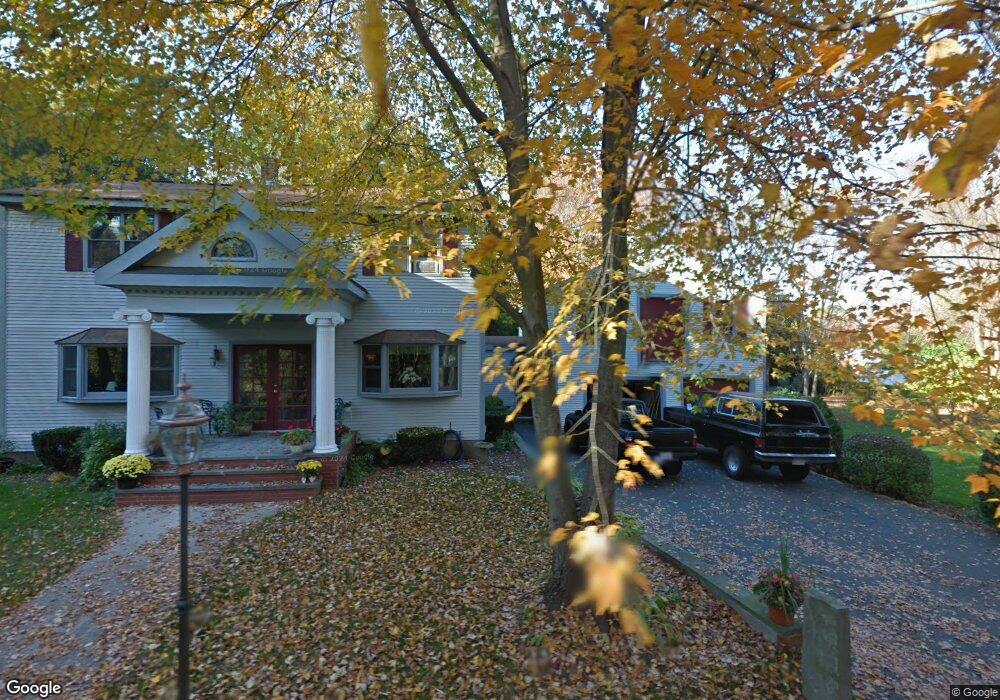
66 Wing Rd Whitinsville, MA 01588
Estimated Value: $513,000 - $656,000
3
Beds
2
Baths
3,250
Sq Ft
$179/Sq Ft
Est. Value
About This Home
This home is located at 66 Wing Rd, Whitinsville, MA 01588 and is currently estimated at $583,038, approximately $179 per square foot. 66 Wing Rd is a home located in Worcester County with nearby schools including Northbridge Elementary School, Northbridge Middle School, and Northbridge High School.
Ownership History
Date
Name
Owned For
Owner Type
Purchase Details
Closed on
Aug 11, 2023
Sold by
Deane Jeffrey J and Deane Alison A
Bought by
Deane Brendon A and Deane Allyce N
Current Estimated Value
Home Financials for this Owner
Home Financials are based on the most recent Mortgage that was taken out on this home.
Original Mortgage
$350,000
Outstanding Balance
$341,875
Interest Rate
6.71%
Mortgage Type
Purchase Money Mortgage
Estimated Equity
$241,163
Purchase Details
Closed on
Sep 23, 1994
Sold by
Bay Finance Co Inc
Bought by
Deane Jeffrey J and Deane Alison
Create a Home Valuation Report for This Property
The Home Valuation Report is an in-depth analysis detailing your home's value as well as a comparison with similar homes in the area
Home Values in the Area
Average Home Value in this Area
Purchase History
| Date | Buyer | Sale Price | Title Company |
|---|---|---|---|
| Deane Brendon A | $437,500 | None Available | |
| Deane Brendon A | $437,500 | None Available | |
| Deane Brendon A | $437,500 | None Available | |
| Deane Jeffrey J | $88,000 | -- | |
| Deane Jeffrey J | $88,000 | -- |
Source: Public Records
Mortgage History
| Date | Status | Borrower | Loan Amount |
|---|---|---|---|
| Open | Deane Brendon A | $350,000 | |
| Closed | Deane Brendon A | $350,000 | |
| Previous Owner | Deane Jeffrey J | $83,200 | |
| Previous Owner | Deane Jeffrey J | $35,000 | |
| Previous Owner | Deane Jeffrey J | $10,000 |
Source: Public Records
Tax History Compared to Growth
Tax History
| Year | Tax Paid | Tax Assessment Tax Assessment Total Assessment is a certain percentage of the fair market value that is determined by local assessors to be the total taxable value of land and additions on the property. | Land | Improvement |
|---|---|---|---|---|
| 2025 | $6,235 | $528,800 | $137,500 | $391,300 |
| 2024 | $5,199 | $430,000 | $137,500 | $292,500 |
| 2023 | $5,118 | $394,900 | $130,200 | $264,700 |
| 2022 | $4,771 | $346,500 | $100,200 | $246,300 |
| 2021 | $4,745 | $327,500 | $95,400 | $232,100 |
| 2020 | $4,386 | $316,900 | $95,400 | $221,500 |
| 2019 | $3,936 | $303,500 | $95,400 | $208,100 |
| 2018 | $3,764 | $290,900 | $90,800 | $200,100 |
| 2017 | $3,719 | $274,900 | $90,800 | $184,100 |
| 2016 | $3,499 | $254,500 | $77,900 | $176,600 |
Source: Public Records
Map
Nearby Homes
- 157 Rolling Ridge Dr Unit 84
- 1052 Providence Rd
- 140 Rolling Ridge Dr Unit 78
- 708 Marston Rd
- 169 Rolling Ridge Dr Unit 97
- 894 Marston Rd
- 33 Crestwood Cir Unit 45
- 159 Rolling Ridge Dr Unit 85
- 39 Crestwood Cir Unit 42
- 5 Summit St
- 831 Providence Rd Unit 837
- 90 Nathaniel Dr
- 21 Granite St
- 135 Windstone Dr
- 0 Puddon St
- 121 East St Unit 121
- 192 Rebecca Rd
- 86 Kingsnorth St
- 46 Rebecca Rd
- 1880 Providence Rd