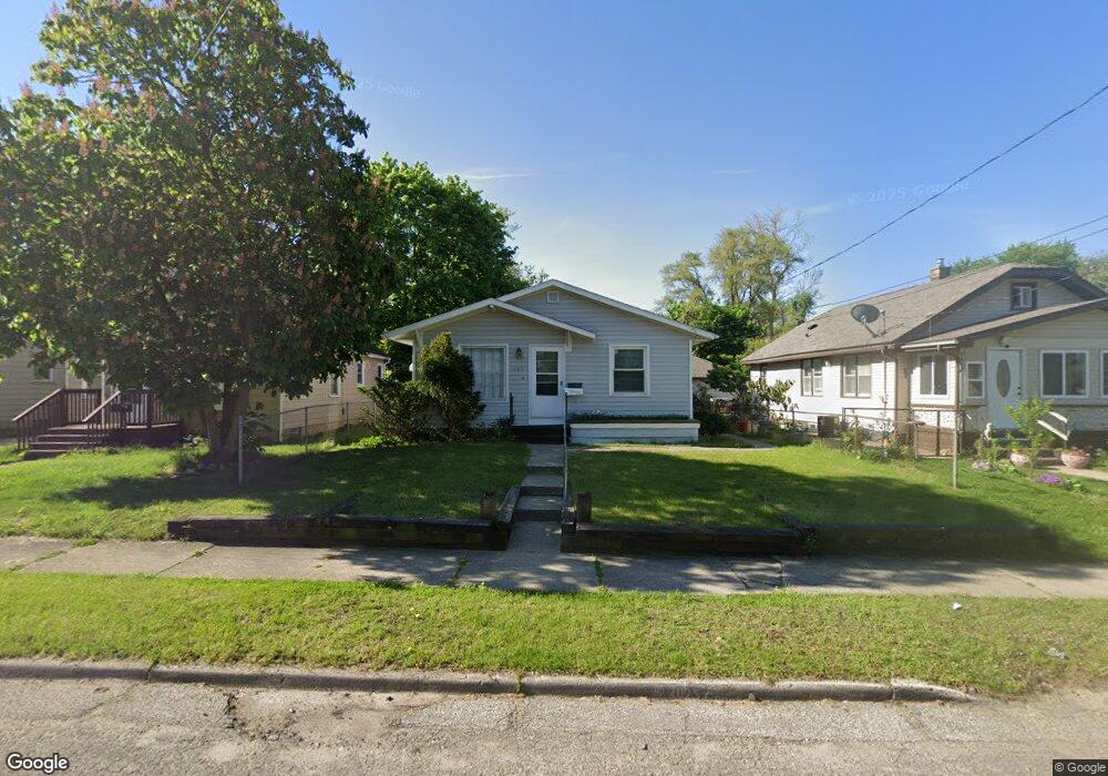
660 Burns St SW Grand Rapids, MI 49503
Garfield Park NeighborhoodEstimated Value: $186,000 - $240,000
2
Beds
1
Bath
1,040
Sq Ft
$209/Sq Ft
Est. Value
About This Home
This home is located at 660 Burns St SW, Grand Rapids, MI 49503 and is currently estimated at $217,510, approximately $209 per square foot. 660 Burns St SW is a home located in Kent County with nearby schools including Burton Elementary School, Burton Middle School, and Union High School.
Ownership History
Date
Name
Owned For
Owner Type
Purchase Details
Closed on
Dec 9, 2009
Sold by
Schultz Elroy E and Schultz Doris M
Bought by
Livi Schultz Elroy E and Elroy E Schultz Revocable Living Trust
Current Estimated Value
Purchase Details
Closed on
Jun 25, 1996
Sold by
Bailey Bailey D D and Bailey Schultz E
Bought by
Schultz Schultz E and Schultz Elroy E
Purchase Details
Closed on
Oct 24, 1990
Sold by
English English M M and English Bailey D
Bought by
Schultz Elroy E
Purchase Details
Closed on
Nov 8, 1989
Create a Home Valuation Report for This Property
The Home Valuation Report is an in-depth analysis detailing your home's value as well as a comparison with similar homes in the area
Home Values in the Area
Average Home Value in this Area
Purchase History
| Date | Buyer | Sale Price | Title Company |
|---|---|---|---|
| Livi Schultz Elroy E | -- | None Available | |
| Schultz Schultz E | $66,000 | -- | |
| Schultz Elroy E | $51,000 | -- | |
| -- | $44,500 | -- |
Source: Public Records
Tax History Compared to Growth
Tax History
| Year | Tax Paid | Tax Assessment Tax Assessment Total Assessment is a certain percentage of the fair market value that is determined by local assessors to be the total taxable value of land and additions on the property. | Land | Improvement |
|---|---|---|---|---|
| 2025 | $896 | $96,400 | $0 | $0 |
| 2024 | $896 | $93,000 | $0 | $0 |
| 2023 | $909 | $73,600 | $0 | $0 |
| 2022 | $863 | $64,000 | $0 | $0 |
| 2021 | $844 | $47,300 | $0 | $0 |
| 2020 | $807 | $47,600 | $0 | $0 |
| 2019 | $845 | $46,400 | $0 | $0 |
| 2018 | $816 | $36,500 | $0 | $0 |
| 2017 | $795 | $28,700 | $0 | $0 |
| 2016 | $804 | $27,900 | $0 | $0 |
| 2015 | $748 | $27,900 | $0 | $0 |
| 2013 | -- | $22,000 | $0 | $0 |
Source: Public Records
Map
Nearby Homes
- 818 Aldon St SW
- 2185 Clyde Park Ave SW
- 2541 Noel Ave SW
- 2204 Banner Dr SW
- 2140 Banner Dr SW
- 2142 Saint Charles Ave SW
- 886 Belfield St SW Unit 7
- 2620 Riley Ave SW
- 2050 Arnold Ave SW
- 2221 Palace Ave SW
- 2746 Tennyson Dr SW
- 2201 Darwin Ave SW
- 2107 Huizen Ave SW
- 922 Burton St SW
- 2517 Newstead Ave SW
- 2812 Longstreet Ave SW
- 2621 Doncaster Ave SW
- 1917 Osmer Ave SW
- 2101 Godfrey Ave SW
- 2831 Charlesgate Ave SW
- 652 Burns St SW
- 704 Burns St SW
- 648 Burns St SW
- 644 Burns St SW
- 708 Burns St SW
- 659 Alger St SW
- 2341 Ruth Ave SW
- 703 Alger St SW
- 655 Alger St SW
- 647 Burns St SW
- 657 Burns St SW
- 701 Burns St SW
- 709 Alger St SW
- 649 Burns St SW
- 649 Alger St SW
- 2333 Ruth Ave SW
- 2340 Mckee Ave SW
- 2344 Mckee Ave SW
- 2336 Mckee Ave SW
- 709 Burns St SW