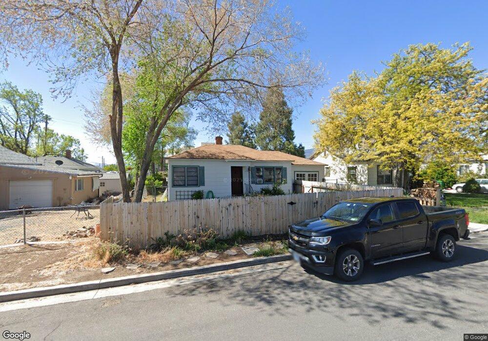
660 Cheney St Reno, NV 89502
Wells Avenue District NeighborhoodEstimated Value: $430,000 - $673,000
4
Beds
2
Baths
1,836
Sq Ft
$302/Sq Ft
Est. Value
About This Home
This home is located at 660 Cheney St, Reno, NV 89502 and is currently estimated at $554,185, approximately $301 per square foot. 660 Cheney St is a home located in Washoe County with nearby schools including Libby C Booth Elementary School, Vaughn Middle School, and Earl Wooster High School.
Ownership History
Date
Name
Owned For
Owner Type
Purchase Details
Closed on
Dec 5, 2022
Sold by
Dory Kevin L
Bought by
Dory Kevin L and Gilbert Beth Ann
Current Estimated Value
Purchase Details
Closed on
Dec 2, 2022
Sold by
Dory Family 1990 Trust
Bought by
Dory Kevin L
Purchase Details
Closed on
Aug 24, 2001
Sold by
Dory Glenn N and Dory Yvonne E
Bought by
Dory Glenn N and Dory Yvonne E
Purchase Details
Closed on
Nov 24, 1998
Sold by
Dory Kevin L and Dory Beth
Bought by
Gilbert Dory Kevin L and Gilbert Dory Beth
Create a Home Valuation Report for This Property
The Home Valuation Report is an in-depth analysis detailing your home's value as well as a comparison with similar homes in the area
Home Values in the Area
Average Home Value in this Area
Purchase History
| Date | Buyer | Sale Price | Title Company |
|---|---|---|---|
| Dory Kevin L | -- | -- | |
| Dory Kevin L | -- | -- | |
| Dory Glenn N | -- | -- | |
| Dory Glenn N | -- | -- | |
| Gilbert Dory Kevin L | -- | -- |
Source: Public Records
Tax History
| Year | Tax Paid | Tax Assessment Tax Assessment Total Assessment is a certain percentage of the fair market value that is determined by local assessors to be the total taxable value of land and additions on the property. | Land | Improvement |
|---|---|---|---|---|
| 2026 | $1,309 | $84,043 | $55,195 | $28,848 |
| 2025 | $1,704 | $84,650 | $55,195 | $29,455 |
| 2024 | $1,704 | $84,937 | $55,195 | $29,742 |
| 2023 | $1,579 | $85,750 | $57,505 | $28,245 |
| 2022 | $1,534 | $69,183 | $45,675 | $23,508 |
| 2021 | $1,423 | $54,853 | $31,465 | $23,388 |
| 2020 | $1,340 | $50,432 | $26,950 | $23,482 |
| 2019 | $1,278 | $48,385 | $25,690 | $22,695 |
| 2018 | $1,218 | $38,646 | $16,450 | $22,196 |
| 2017 | $1,171 | $38,694 | $16,450 | $22,244 |
| 2016 | $1,143 | $37,479 | $14,420 | $23,059 |
| 2015 | $862 | $33,466 | $10,430 | $23,036 |
| 2014 | $1,109 | $31,239 | $9,100 | $22,139 |
| 2013 | -- | $28,994 | $7,000 | $21,994 |
Source: Public Records
Map
Nearby Homes
- 661 Thoma St
- 459 Cheney St
- 453 Cheney St
- 943 S Wells Ave
- 400 Claremont St
- 446 Roberts St
- 243 Claremont St
- 736 Yori Ave
- 1339 Locust St
- 800 S Center St
- 330 Stewart St
- 536 Sinclair St
- 1522 Kirman Ave Unit 1520 / 1522
- 210 Stewart St
- 60 Caliente St
- 537 Colorado River Blvd
- 222 W Arroyo St Unit 2
- 512 Humboldt St
- 343 & 347 Mount Rose St St
- 343 Mount Rose St
- 650 Cheney St
- 805 Kirman Ave
- 815 Kirman Ave
- 640 Cheney St
- 835 Kirman Ave
- 630 Cheney St
- 651 Cheney St
- 691 E Taylor St
- 695 Cheney St
- 665 E Taylor St
- 665 E Taylor St Unit B
- 663 E Taylor St
- 631 Cheney St
- 616 Cheney St
- 673 E Taylor St
- 697 E Taylor St
- 641 Cheney St
- 840 Kirman Ave
- 663 E Taylor St
- 621 Cheney St