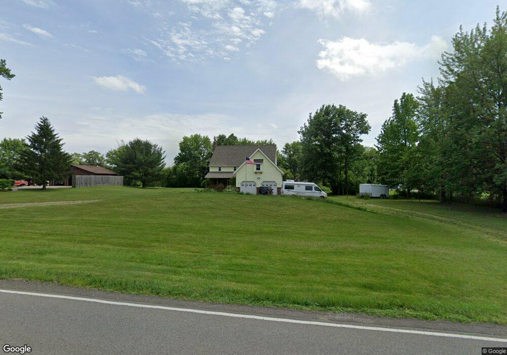
660 Eastern Rd Doylestown, OH 44230
Estimated Value: $474,000 - $569,000
4
Beds
2
Baths
3,128
Sq Ft
$165/Sq Ft
Est. Value
About This Home
This home is located at 660 Eastern Rd, Doylestown, OH 44230 and is currently estimated at $517,486, approximately $165 per square foot. 660 Eastern Rd is a home located in Wayne County with nearby schools including Hazel Harvey Elementary School, Chippewa Intermediate School, and Chippewa Jr./Sr. High School.
Ownership History
Date
Name
Owned For
Owner Type
Purchase Details
Closed on
Jun 12, 2024
Sold by
Roda Ronald R and Roda Diane M
Bought by
Roda Preservation Trust and Roda
Current Estimated Value
Purchase Details
Closed on
Jan 1, 1987
Bought by
Roda Ronald R and Roda Diane M
Create a Home Valuation Report for This Property
The Home Valuation Report is an in-depth analysis detailing your home's value as well as a comparison with similar homes in the area
Home Values in the Area
Average Home Value in this Area
Purchase History
| Date | Buyer | Sale Price | Title Company |
|---|---|---|---|
| Roda Preservation Trust | -- | None Listed On Document | |
| Roda Ronald R | -- | -- |
Source: Public Records
Tax History
| Year | Tax Paid | Tax Assessment Tax Assessment Total Assessment is a certain percentage of the fair market value that is determined by local assessors to be the total taxable value of land and additions on the property. | Land | Improvement |
|---|---|---|---|---|
| 2024 | $5,456 | $166,900 | $60,900 | $106,000 |
| 2023 | $5,494 | $166,900 | $60,900 | $106,000 |
| 2022 | $4,013 | $114,320 | $41,710 | $72,610 |
| 2021 | $4,042 | $114,320 | $41,710 | $72,610 |
| 2020 | $4,067 | $114,320 | $41,710 | $72,610 |
| 2019 | $3,615 | $99,190 | $38,710 | $60,480 |
| 2018 | $3,651 | $99,190 | $38,710 | $60,480 |
| 2017 | $3,561 | $99,190 | $38,710 | $60,480 |
| 2016 | $3,516 | $95,380 | $37,230 | $58,150 |
| 2015 | $3,502 | $95,380 | $37,230 | $58,150 |
| 2014 | $3,077 | $95,380 | $37,230 | $58,150 |
| 2013 | $3,145 | $94,680 | $36,570 | $58,110 |
Source: Public Records
Map
Nearby Homes
- 442 Madison Trail
- 970 Eastern Rd
- 15500 Freedom Dr
- V/L approx 67.56ac Gates St
- 500 W Clinton St
- 0 Akron Rd Unit 5123781
- 497 Gates St
- 9894 Silvercreek Rd
- 233 Homan Dr
- V/L 1050 Melanie Ln
- VL 1067 Homan Dr
- 1014 Marissa Dr
- 436 N Portage St
- 93 Cleveland Ave
- 14761 Calaboone Rd
- 247 Hillside Dr
- 680 Thorn Way
- 620 Thorn Way
- 593 Silvercrest Rd
- 580 Thorn Way
- 644 Eastern Rd
- 665 Eastern Rd
- 626 Eastern Rd
- 698 Eastern Rd
- 665 Eastern Rd
- 629 Eastern Rd
- 610 Eastern Rd
- 712 Eastern Rd
- 682 Eastern Rd
- 10500 Thicket Trail
- 576 Eastern Rd
- 15579 Serfass Rd
- 10480 Thicket Trail
- 15391 Serfass Rd
- 558 Eastern Rd
- 15518 Serfass Rd
- 15518 Serfass Rd
- 764 Eastern Rd
- 15494 Serfass Rd
- 10495 Thicket Trail
Your Personal Tour Guide
Ask me questions while you tour the home.