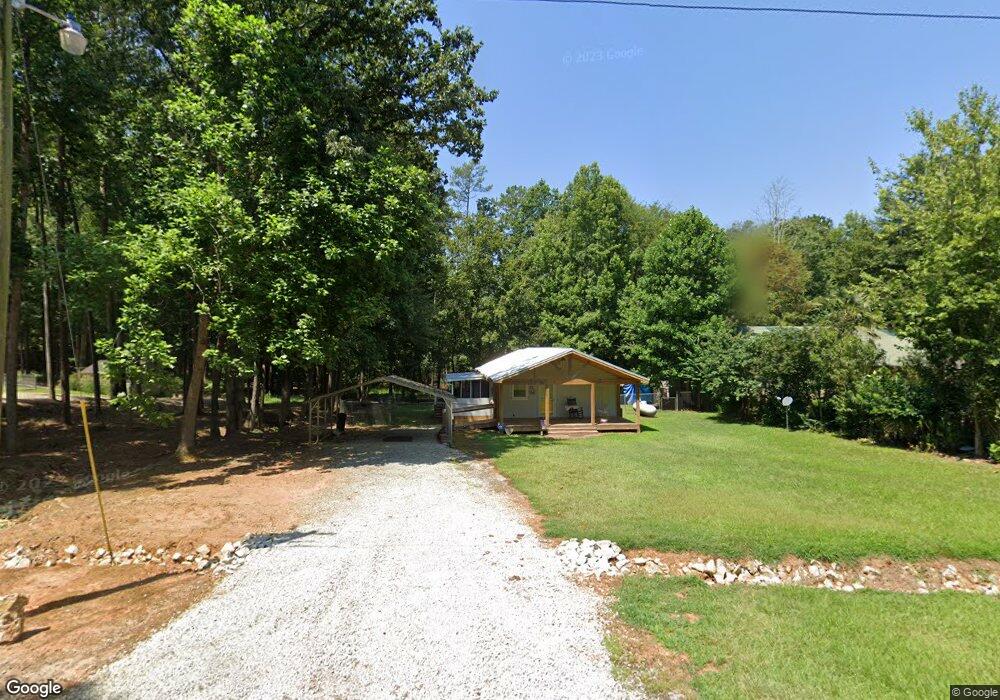
660 N Port Bass Dr Unit 65 & 66 Fair Play, SC 29643
Estimated Value: $258,000 - $342,000
1
Bed
1
Bath
760
Sq Ft
$393/Sq Ft
Est. Value
About This Home
This home is located at 660 N Port Bass Dr Unit 65 & 66, Fair Play, SC 29643 and is currently estimated at $298,972, approximately $393 per square foot. 660 N Port Bass Dr Unit 65 & 66 is a home located in Oconee County with nearby schools including Fair-Oak Elementary School, West Oak Middle School, and West-Oak High School.
Ownership History
Date
Name
Owned For
Owner Type
Purchase Details
Closed on
Jun 21, 2019
Sold by
Taylor Laura Marie
Bought by
Mcconnell Keith Brian Patrick and Mcconnell Keith Tammy
Current Estimated Value
Home Financials for this Owner
Home Financials are based on the most recent Mortgage that was taken out on this home.
Original Mortgage
$110,250
Outstanding Balance
$96,932
Interest Rate
4.2%
Mortgage Type
New Conventional
Estimated Equity
$202,040
Create a Home Valuation Report for This Property
The Home Valuation Report is an in-depth analysis detailing your home's value as well as a comparison with similar homes in the area
Home Values in the Area
Average Home Value in this Area
Purchase History
| Date | Buyer | Sale Price | Title Company |
|---|---|---|---|
| Mcconnell Keith Brian Patrick | $122,500 | None Available |
Source: Public Records
Mortgage History
| Date | Status | Borrower | Loan Amount |
|---|---|---|---|
| Open | Mcconnell Keith Brian Patrick | $110,250 |
Source: Public Records
Tax History Compared to Growth
Tax History
| Year | Tax Paid | Tax Assessment Tax Assessment Total Assessment is a certain percentage of the fair market value that is determined by local assessors to be the total taxable value of land and additions on the property. | Land | Improvement |
|---|---|---|---|---|
| 2025 | $1,691 | $5,245 | $2,312 | $2,933 |
| 2024 | $1,691 | $5,245 | $2,312 | $2,933 |
| 2023 | $1,691 | $5,245 | $2,312 | $2,933 |
| 2022 | $1,715 | $5,245 | $2,312 | $2,933 |
| 2021 | $443 | $4,824 | $2,040 | $2,784 |
| 2020 | $443 | $0 | $0 | $0 |
| 2019 | $443 | $0 | $0 | $0 |
| 2018 | $883 | $0 | $0 | $0 |
| 2017 | $400 | $0 | $0 | $0 |
| 2016 | $400 | $0 | $0 | $0 |
| 2015 | -- | $0 | $0 | $0 |
| 2014 | -- | $4,312 | $2,563 | $1,749 |
| 2013 | -- | $0 | $0 | $0 |
Source: Public Records
Map
Nearby Homes
- 676 N Port Bass Dr
- 278 N Port Bass Dr
- 130 Sherry Ln
- 126 Arrington Dr
- 348 N Port Bass Dr
- 114 N Port Bass Dr
- 725 Shelor Ferry Rd
- 719 Shelor Ferry Rd
- 0 Point Rd Unit LOT 515 10519867
- 0 Point Rd Unit Lot 515 20287478
- 600 Point Rd
- 114 Blue Ridge Place
- 396 Greenleaf Dr
- 570 Greenleaf Dr
- 123 Sequayah Dr
- 329 Greenleaf Dr
- 0 Rue St Joan Unit 10639022
- 00 Point Rd Unit 504 & 505
- Lot 1687 Point Rd
- 00 Point Rd
- 660 N Port Bass Dr
- 664 N Port Bass Dr
- 640 N Port Bass Dr
- 00 S Port Bass Dr
- 00 S Port Bass Dr Unit Lot 898
- 00 S Port Bass Dr Unit 139 S. Port Bass Dri
- 655 N Port Bass Dr
- 630 N Port Bass Dr
- 645 N Port Bass Dr
- 242 N Davis Dr
- 600 N Port Bass Dr
- Loit 58 Gladys Cir
- 00 Gladys Cir
- 112 Gladys Cir
- L-112 Gladys Cir
- Lot 55 Gladys Cir
- Lot 61 Gladys Cir
- Lot 172 Gladys Cir
- 228 N Davis Dr
- 114 Champion Dr