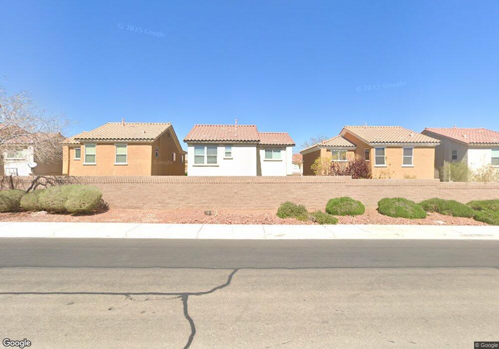
660 Port Talbot Ave Las Vegas, NV 89178
Estimated Value: $387,000 - $402,739
3
Beds
3
Baths
1,671
Sq Ft
$235/Sq Ft
Est. Value
About This Home
This home is located at 660 Port Talbot Ave, Las Vegas, NV 89178 and is currently estimated at $393,435, approximately $235 per square foot. 660 Port Talbot Ave is a home located in Clark County with nearby schools including Robert L. Forbuss Elementary School, Wilbur & Theresa Faiss Middle School, and Sierra Vista High School.
Ownership History
Date
Name
Owned For
Owner Type
Purchase Details
Closed on
Mar 7, 2007
Sold by
Kb Home Nevada Inc
Bought by
Alcazar Freddie C and Alcazar Cecilia
Current Estimated Value
Home Financials for this Owner
Home Financials are based on the most recent Mortgage that was taken out on this home.
Original Mortgage
$100,000
Outstanding Balance
$60,429
Interest Rate
6.23%
Mortgage Type
Unknown
Estimated Equity
$333,006
Create a Home Valuation Report for This Property
The Home Valuation Report is an in-depth analysis detailing your home's value as well as a comparison with similar homes in the area
Home Values in the Area
Average Home Value in this Area
Purchase History
| Date | Buyer | Sale Price | Title Company |
|---|---|---|---|
| Alcazar Freddie C | $268,948 | First Amer Title Co Of Nv |
Source: Public Records
Mortgage History
| Date | Status | Borrower | Loan Amount |
|---|---|---|---|
| Open | Alcazar Freddie C | $100,000 |
Source: Public Records
Tax History Compared to Growth
Tax History
| Year | Tax Paid | Tax Assessment Tax Assessment Total Assessment is a certain percentage of the fair market value that is determined by local assessors to be the total taxable value of land and additions on the property. | Land | Improvement |
|---|---|---|---|---|
| 2025 | $706 | $101,625 | $31,500 | $70,125 |
| 2024 | $1,352 | $101,625 | $31,500 | $70,125 |
| 2023 | $1,352 | $93,952 | $28,000 | $65,952 |
| 2022 | $1,313 | $82,903 | $22,750 | $60,153 |
| 2021 | $1,275 | $79,847 | $22,750 | $57,097 |
| 2020 | $1,235 | $77,872 | $21,350 | $56,522 |
| 2019 | $1,199 | $73,705 | $18,200 | $55,505 |
| 2018 | $1,164 | $67,303 | $14,350 | $52,953 |
| 2017 | $1,851 | $65,742 | $12,250 | $53,492 |
| 2016 | $1,103 | $56,259 | $9,450 | $46,809 |
| 2015 | $1,025 | $45,983 | $7,350 | $38,633 |
| 2014 | $1,031 | $35,323 | $5,250 | $30,073 |
Source: Public Records
Map
Nearby Homes
- 671 Port Talbot Ave
- 733 Shiva St
- 733 Secret London Ave
- 745 Shiva St
- 759 Star Apple Ln
- 753 Topocoba St
- 777 Star Apple Ln
- 741 Canary Wharf Dr
- 736 Saint Keyne St
- 766 Topocoba St
- 594 Crying Bird Ave
- 705 Shirehampton Dr
- 952 Pretty Fire St
- 728 Jewel Tower St
- 772 Loughton St
- 763 Looking Bear Ct
- 533 Warminster Ave
- 763 Magrath St
- 512 Bright Peridot Ave
- 791 Trumpington Ct
- 664 Port Talbot Ave
- 656 Port Talbot Ave
- 667 Stonehenge Walk Ave
- 661 Stonehenge Walk Ave
- 670 Port Talbot Ave
- 655 Stonehenge Walk Ave
- 661 Port Talbot Ave
- 684 Wessex Dr
- 657 Port Talbot Ave
- 657 Port Talbot Ave
- 665 Port Talbot Ave
- 644 Port Talbot Ave
- 676 Port Talbot Ave
- 651 Port Talbot Ave
- 649 Stonehenge Walk Ave
- 680 Wessex Dr
- 645 Port Talbot Ave
- 645 Port Talbot Ave Unit n/a
- 671 Wessex Dr
- 640 Port Talbot Ave