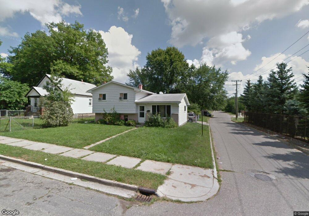
660 Scottwood St Pontiac, MI 48340
Estimated Value: $138,458 - $153,000
3
Beds
2
Baths
1,363
Sq Ft
$106/Sq Ft
Est. Value
About This Home
This home is located at 660 Scottwood St, Pontiac, MI 48340 and is currently estimated at $145,115, approximately $106 per square foot. 660 Scottwood St is a home located in Oakland County with nearby schools including Herrington Elementary School, Pontiac Middle School, and Pontiac High School.
Ownership History
Date
Name
Owned For
Owner Type
Purchase Details
Closed on
Jan 11, 2013
Sold by
Singh Inderjit and Briana Baljinder
Bought by
Raja Sonu Llc
Current Estimated Value
Purchase Details
Closed on
Feb 8, 2011
Sold by
Jefferson Janice M
Bought by
Federal Home Loan Mortgage Corp
Purchase Details
Closed on
Aug 10, 2004
Sold by
Jefferson Janice M
Bought by
Jefferson Janice M and Jefferson Joy
Purchase Details
Closed on
Nov 18, 2003
Sold by
Robertson Dennis L and Robertson Michelle
Bought by
Countrywide Home Loans Inc
Purchase Details
Closed on
May 26, 1998
Sold by
Robertson Dennis
Bought by
Robertson Dennis
Create a Home Valuation Report for This Property
The Home Valuation Report is an in-depth analysis detailing your home's value as well as a comparison with similar homes in the area
Home Values in the Area
Average Home Value in this Area
Purchase History
| Date | Buyer | Sale Price | Title Company |
|---|---|---|---|
| Raja Sonu Llc | -- | None Available | |
| Federal Home Loan Mortgage Corp | $11,325 | None Available | |
| Jefferson Janice M | -- | Philip R Seaver Title Co Inc | |
| Countrywide Home Loans Inc | $83,394 | -- | |
| Robertson Dennis | -- | -- |
Source: Public Records
Tax History Compared to Growth
Tax History
| Year | Tax Paid | Tax Assessment Tax Assessment Total Assessment is a certain percentage of the fair market value that is determined by local assessors to be the total taxable value of land and additions on the property. | Land | Improvement |
|---|---|---|---|---|
| 2024 | $1,105 | $48,880 | $0 | $0 |
| 2023 | $1,053 | $45,290 | $0 | $0 |
| 2022 | $1,404 | $39,040 | $0 | $0 |
| 2021 | $1,047 | $34,380 | $0 | $0 |
| 2020 | $957 | $30,740 | $0 | $0 |
| 2019 | $1,011 | $26,030 | $0 | $0 |
| 2018 | $972 | $22,880 | $0 | $0 |
| 2017 | $934 | $21,650 | $0 | $0 |
| 2016 | $958 | $18,140 | $0 | $0 |
| 2015 | -- | $16,460 | $0 | $0 |
| 2014 | -- | $15,940 | $0 | $0 |
| 2011 | -- | $28,150 | $0 | $0 |
Source: Public Records
Map
Nearby Homes
- 644 Brady Ln
- 608 Brady Ln
- 602 Brady Ln
- 597 Brady Ln
- 591 Brady Ln
- Fairfiled Plan at Fairview Village
- Enclave II Plan at Fairview Village
- Enclave Plan at Fairview Village
- Carlyle Plan at Fairview Village
- 715 Kenilworth Ave
- 457 Cameron Ave
- 790 Parkwood Ave
- 785 Kenilworth Ave
- 509 Cameron Ave
- 821 Robinwood St
- 770 Cameron Ave
- 472 Kenilworth Ave
- 790 Cameron Ave
- 514 Linda Vista Dr
- 802 Cameron Ave
- 664 Scottwood St
- 18 Manhattan St
- 670 Scottwood St
- 665 Robinwood St
- 661 Scottwood St
- 674 Scottwood St
- 661 Robinwood St
- 651 Brady Ln
- 671 Robinwood St
- 671 Scottwood St Unit Bldg-Unit
- 671 Scottwood St
- 645 Brady Ln
- 675 Robinwood St
- 675 Scottwood St
- 681 Robinwood St
- 639 Brady Ln
- 681 Scottwood St
- 684 Scottwood St
- 660 Parkwood Ave
- 664 Parkwood Ave