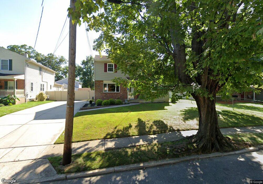
660 Sunset Ave Maple Shade, NJ 08052
Maple Shade NeighborhoodEstimated Value: $353,702 - $449,000
Studio
--
Bath
1,823
Sq Ft
$218/Sq Ft
Est. Value
About This Home
This home is located at 660 Sunset Ave, Maple Shade, NJ 08052 and is currently estimated at $397,926, approximately $218 per square foot. 660 Sunset Ave is a home located in Burlington County with nearby schools including Maude M. Wilkins Elementary School, Ralph J Steinhauer Elementary School, and Howard R Yocum School.
Ownership History
Date
Name
Owned For
Owner Type
Purchase Details
Closed on
Nov 1, 1999
Sold by
Smith Carl F
Bought by
Manou Rick S
Current Estimated Value
Home Financials for this Owner
Home Financials are based on the most recent Mortgage that was taken out on this home.
Original Mortgage
$128,200
Outstanding Balance
$37,071
Interest Rate
7.73%
Mortgage Type
Purchase Money Mortgage
Estimated Equity
$360,855
Create a Home Valuation Report for This Property
The Home Valuation Report is an in-depth analysis detailing your home's value as well as a comparison with similar homes in the area
Home Values in the Area
Average Home Value in this Area
Purchase History
| Date | Buyer | Sale Price | Title Company |
|---|---|---|---|
| Manou Rick S | $135,000 | -- |
Source: Public Records
Mortgage History
| Date | Status | Borrower | Loan Amount |
|---|---|---|---|
| Open | Manou Rick S | $128,200 |
Source: Public Records
Tax History
| Year | Tax Paid | Tax Assessment Tax Assessment Total Assessment is a certain percentage of the fair market value that is determined by local assessors to be the total taxable value of land and additions on the property. | Land | Improvement |
|---|---|---|---|---|
| 2025 | $8,116 | $213,800 | $48,500 | $165,300 |
| 2024 | $7,881 | $213,800 | $48,500 | $165,300 |
| 2023 | $7,881 | $213,800 | $48,500 | $165,300 |
| 2022 | $7,759 | $213,800 | $48,500 | $165,300 |
| 2021 | $7,684 | $213,800 | $48,500 | $165,300 |
| 2020 | $7,705 | $213,800 | $48,500 | $165,300 |
| 2019 | $7,423 | $213,800 | $48,500 | $165,300 |
| 2018 | $7,295 | $213,800 | $48,500 | $165,300 |
| 2017 | $7,209 | $213,800 | $48,500 | $165,300 |
| 2016 | $7,102 | $213,800 | $48,500 | $165,300 |
| 2015 | $6,949 | $213,800 | $48,500 | $165,300 |
| 2014 | $6,737 | $213,800 | $48,500 | $165,300 |
Source: Public Records
Map
Nearby Homes
- 452 Elm Ave
- 169 Cherry Tree Ln
- 114 Weather Vane Dr
- 206 S Maple Ave
- 66 W Center Ave
- 3005 Garfield Ave
- 115 E Kings Hwy Unit 187
- 115 E Kings Hwy Unit 125
- 102 Kings Croft
- 44 S Pine Ave
- 3001 Church Rd
- 61 S Maple Ave
- 15 S Pine Ave
- 42 Spruce Ave
- 318 Kings Croft
- 8 Fountain Ct
- 606 Kings Croft
- 47 S Lippincott Ave
- 57 S Terrace Ave
- 12 Colgate Dr
- 662 Sunset Ave
- 658 Sunset Ave
- 29 E Rudderow Ave
- 667 Sunset Ave
- 663 Sunset Ave
- 650 Sunset Ave
- 27 E Rudderow Ave
- 644 Sunset Ave
- 673 Sunset Ave
- 659 Sunset Ave
- 655 Sunset Ave
- 640 Sunset Ave
- 647 Sunset Ave
- 651 Sunset Ave
- 636 Sunset Ave
- 560 Estate Rd
- 556 Estate Rd
- 632 Sunset Ave
- 629 Sunset Ave
- 552 Estate Rd
Your Personal Tour Guide
Ask me questions while you tour the home.