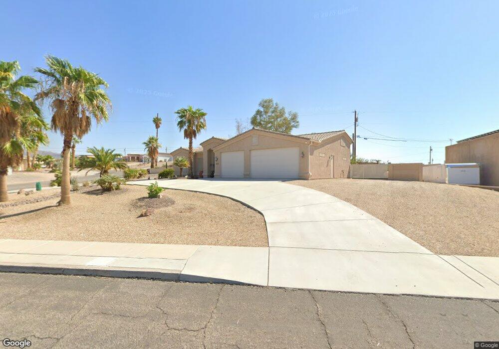
660 Thunderbolt Ave Lake Havasu City, AZ 86406
Estimated Value: $531,000 - $629,226
3
Beds
2
Baths
1,630
Sq Ft
$358/Sq Ft
Est. Value
About This Home
This home is located at 660 Thunderbolt Ave, Lake Havasu City, AZ 86406 and is currently estimated at $584,057, approximately $358 per square foot. 660 Thunderbolt Ave is a home located in Mohave County with nearby schools including Oro Grande Elementary School, Thunderbolt Middle School, and Lake Havasu High School.
Ownership History
Date
Name
Owned For
Owner Type
Purchase Details
Closed on
Feb 29, 2008
Sold by
Moore Gary K and Moore Diana L
Bought by
Stoddart Roy L and Stoddart Karen M
Current Estimated Value
Home Financials for this Owner
Home Financials are based on the most recent Mortgage that was taken out on this home.
Original Mortgage
$246,600
Outstanding Balance
$152,885
Interest Rate
5.65%
Mortgage Type
New Conventional
Estimated Equity
$431,172
Purchase Details
Closed on
Dec 21, 2000
Sold by
Shugars Lawrence
Bought by
Shugars Gertrude
Purchase Details
Closed on
Dec 6, 2000
Sold by
Shugars Gertrude
Bought by
Andreasen Peter
Purchase Details
Closed on
Dec 4, 2000
Sold by
Andreasen Peter
Bought by
Moore Gary K and Moore Diana L
Create a Home Valuation Report for This Property
The Home Valuation Report is an in-depth analysis detailing your home's value as well as a comparison with similar homes in the area
Home Values in the Area
Average Home Value in this Area
Purchase History
| Date | Buyer | Sale Price | Title Company |
|---|---|---|---|
| Stoddart Roy L | $274,000 | State Title Agency Inc | |
| Shugars Gertrude | -- | Capital Title Agency | |
| Andreasen Peter | -- | Capital Title Agency Inc | |
| Moore Gary K | $14,000 | Capital Title Agency Inc |
Source: Public Records
Mortgage History
| Date | Status | Borrower | Loan Amount |
|---|---|---|---|
| Open | Stoddart Roy L | $246,600 |
Source: Public Records
Tax History Compared to Growth
Tax History
| Year | Tax Paid | Tax Assessment Tax Assessment Total Assessment is a certain percentage of the fair market value that is determined by local assessors to be the total taxable value of land and additions on the property. | Land | Improvement |
|---|---|---|---|---|
| 2026 | $1,241 | -- | -- | -- |
| 2025 | $2,515 | $54,596 | $0 | $0 |
| 2024 | $2,515 | $55,460 | $0 | $0 |
| 2023 | $2,515 | $47,309 | $0 | $0 |
| 2022 | $2,407 | $35,164 | $0 | $0 |
| 2021 | $2,596 | $33,034 | $0 | $0 |
| 2019 | $2,463 | $29,025 | $0 | $0 |
| 2018 | $2,378 | $27,175 | $0 | $0 |
| 2017 | $2,354 | $26,234 | $0 | $0 |
| 2016 | $2,127 | $24,414 | $0 | $0 |
| 2015 | $2,035 | $21,581 | $0 | $0 |
Source: Public Records
Map
Nearby Homes
- 3135 Cotati Dr
- 532 Roanoke Dr
- 2970 War Eagle Dr
- 3150 Star Dr
- 3040 Gypsy Dr
- 815 Rolling Hills Plaza N
- 2910 Coconino Dr
- 691 Rolling Hills Dr
- 3066 Star Dr
- 786 Powder Dr
- 2997 Edgewood Dr
- 2951 Saddleback Dr
- 3306 Cinnamon Dr
- 700 Apache Dr
- 3261 Thundercloud Dr
- 850 Thunderbolt Ave
- 3235 Silverspoon Dr
- 3267 Saddleback Dr
- 3345 Cinnamon Dr
- 3260 Silverspoon Dr
- 0 Choctaw - On Your Lot Unit 873017
- 3140 Choctaw Dr
- 666 Thunderbolt Ave
- 666 Thunderbolt Ave
- 650 Thunderbolt Ave
- 3150 Choctaw Dr
- 659 Thunderbolt Ave
- 665 Thunderbolt Ave
- 670 Thunderbolt Ave
- 3155 Choctaw Dr
- 675 Thunderbolt Ave
- 655 Thunderbolt Ave
- 640 Thunderbolt Ave
- 3160 Choctaw Dr
- 676 Thunderbolt Ave
- 676 Thunderbolt Ave
- 3165 Choctaw Dr
- 685 Thunderbolt Ave
- 665 Apache Dr
- 3170 Choctaw Dr