Estimated Value: $88,000 - $117,150
1
Bed
1
Bath
672
Sq Ft
$151/Sq Ft
Est. Value
About This Home
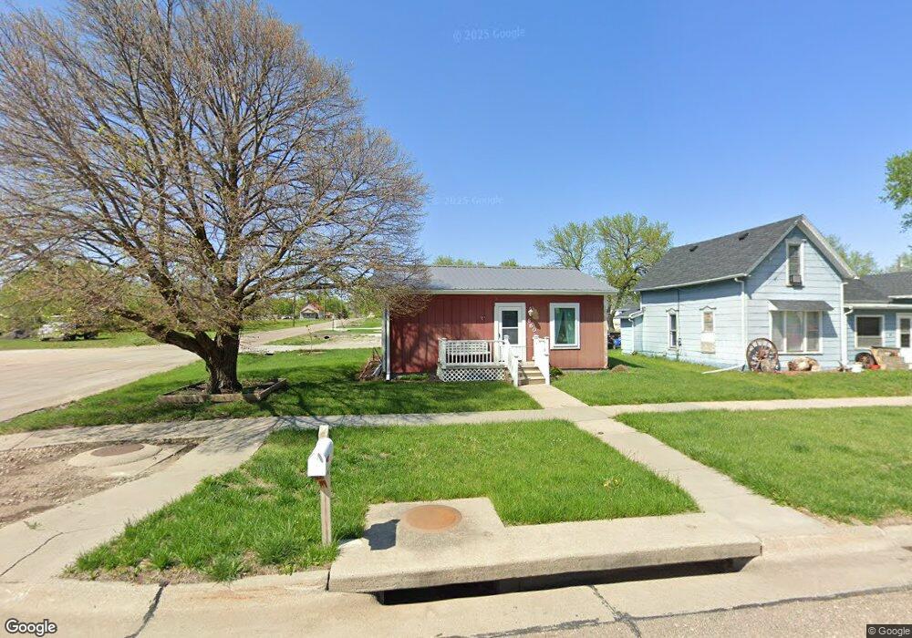
This home is located at 660 W 6th St, York, NE 68467 and is currently estimated at $101,288, approximately $150 per square foot. 660 W 6th St is a home located in York County with nearby schools including York Elementary School, York Middle School, and York High School.
Ownership History
Date
Name
Owned For
Owner Type
Purchase Details
Closed on
Nov 25, 2019
Sold by
Brandt John W and Brandt Kami
Bought by
Samson Joyce A
Current Estimated Value
Purchase Details
Closed on
Nov 13, 2019
Sold by
Brandt James A
Bought by
Samson Joyce A
Purchase Details
Closed on
Aug 29, 2016
Sold by
Brandt John B and Brandt Laverna
Bought by
Brandt John W and Samson Joyce A
Purchase Details
Closed on
Aug 25, 2006
Sold by
Samson Joyce A and Samson David L
Bought by
Brandt John B and Brandt Laverna
Purchase Details
Closed on
May 28, 2004
Sold by
Noyd Deverne J
Bought by
Samson Joyce A and Samson David L
Create a Home Valuation Report for This Property
The Home Valuation Report is an in-depth analysis detailing your home's value as well as a comparison with similar homes in the area
Home Values in the Area
Average Home Value in this Area
Purchase History
| Date | Buyer | Sale Price | Title Company |
|---|---|---|---|
| Samson Joyce A | $17,000 | None Available | |
| Samson Joyce A | $17,000 | None Available | |
| Brandt John W | -- | None Available | |
| Brandt John B | $30,000 | -- | |
| Samson Joyce A | $20,000 | -- |
Source: Public Records
Tax History Compared to Growth
Tax History
| Year | Tax Paid | Tax Assessment Tax Assessment Total Assessment is a certain percentage of the fair market value that is determined by local assessors to be the total taxable value of land and additions on the property. | Land | Improvement |
|---|---|---|---|---|
| 2024 | $988 | $58,813 | $7,835 | $50,978 |
| 2023 | $1,028 | $57,813 | $7,835 | $49,978 |
| 2022 | $1,017 | $57,813 | $7,835 | $49,978 |
| 2021 | $969 | $54,282 | $7,835 | $46,447 |
| 2020 | $863 | $49,483 | $7,835 | $41,648 |
| 2019 | $710 | $40,746 | $7,835 | $32,911 |
| 2018 | $688 | $40,746 | $7,835 | $32,911 |
| 2017 | $537 | $33,522 | $6,581 | $26,941 |
| 2016 | -- | $33,522 | $6,581 | $26,941 |
| 2015 | -- | $33,522 | $6,581 | $26,941 |
| 2014 | -- | $33,522 | $6,581 | $26,941 |
Source: Public Records
Map
Nearby Homes
- 652 W 5th St
- 921 N Beaver Ave
- 115 S York Ave
- 819 S Country Club Ave
- 927 S Hutchins Ave
- 841 S Country Club Dr
- 900 Saint Andrews Ct
- 907 W Nobes Rd
- 915 W Nobes Rd
- 320 E 4th St
- 1217 N Grant Ave
- 808 N Burlington Ave
- 215 N Burlington Ave
- 717 Nicholas Cir
- 418 E 5th St
- 1108 N Nebraska Ave
- 423 E 6th St
- 413 N Iowa Ave
- 714 N Iowa Ave
- 1125 N Burlington Ave