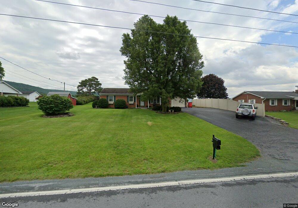
6600 Slabtown Rd Waynesboro, PA 17268
Estimated Value: $225,000 - $269,000
--
Bed
--
Bath
1,066
Sq Ft
$225/Sq Ft
Est. Value
About This Home
This home is located at 6600 Slabtown Rd, Waynesboro, PA 17268 and is currently estimated at $240,264, approximately $225 per square foot. 6600 Slabtown Rd is a home located in Franklin County with nearby schools including Waynesboro Area Senior High School and Providence School - Pigeon Hill Building.
Ownership History
Date
Name
Owned For
Owner Type
Purchase Details
Closed on
Mar 18, 2019
Sold by
Knepper Larry G
Bought by
Taylor Nicole H
Current Estimated Value
Home Financials for this Owner
Home Financials are based on the most recent Mortgage that was taken out on this home.
Original Mortgage
$119,000
Outstanding Balance
$104,621
Interest Rate
4.4%
Mortgage Type
New Conventional
Estimated Equity
$135,643
Purchase Details
Closed on
Aug 15, 2017
Sold by
Martin Ray L and Martin Gloria A
Bought by
Knepper Larry G and Knepper Sandra D
Create a Home Valuation Report for This Property
The Home Valuation Report is an in-depth analysis detailing your home's value as well as a comparison with similar homes in the area
Home Values in the Area
Average Home Value in this Area
Purchase History
| Date | Buyer | Sale Price | Title Company |
|---|---|---|---|
| Taylor Nicole H | -- | None Available | |
| Knepper Larry G | $140,000 | None Available |
Source: Public Records
Mortgage History
| Date | Status | Borrower | Loan Amount |
|---|---|---|---|
| Open | Taylor Nicole H | $119,000 |
Source: Public Records
Tax History Compared to Growth
Tax History
| Year | Tax Paid | Tax Assessment Tax Assessment Total Assessment is a certain percentage of the fair market value that is determined by local assessors to be the total taxable value of land and additions on the property. | Land | Improvement |
|---|---|---|---|---|
| 2025 | $2,482 | $17,010 | $900 | $16,110 |
| 2024 | $2,405 | $17,010 | $900 | $16,110 |
| 2023 | $2,339 | $17,010 | $900 | $16,110 |
| 2022 | $2,271 | $17,010 | $900 | $16,110 |
| 2021 | $2,203 | $17,010 | $900 | $16,110 |
| 2020 | $2,203 | $17,010 | $900 | $16,110 |
| 2019 | $2,152 | $17,010 | $900 | $16,110 |
| 2018 | $2,080 | $17,010 | $900 | $16,110 |
| 2017 | $2,033 | $17,010 | $900 | $16,110 |
| 2016 | $481 | $16,790 | $900 | $15,890 |
| 2015 | $448 | $16,790 | $900 | $15,890 |
| 2014 | $448 | $16,790 | $900 | $15,890 |
Source: Public Records
Map
Nearby Homes
- 7468 Anthony Hwy
- 5434 Manheim Rd
- 286 Verdier St
- 8620 Monns Gap Rd
- 207 University Dr
- 111 Poplar St
- 6 S Main St
- 8652 Mormon Church Rd
- 6159 Orphanage Rd
- 6456 Wayne Hwy
- 7205 Fairway Dr S
- 6158 Merion Dr
- 8655 Wayne Hwy
- 7130 St Annes Dr
- 7059 Duck Hook Ln
- 7136 Sandwich Ln
- 7060 Duck Hook Ln
- 7121 Sandwich Ln
- 6337 Medina Ridge Dr
- 6852 Lytham Ln
- 6582 Slabtown Rd
- 6616 Slabtown Rd
- 6569 Slabtown Rd
- 6599 Slabtown Rd
- 6621 Slabtown Rd
- 6634 Slabtown Rd
- 6568 Slabtown Rd
- 6552 Slabtown Rd
- 6551 Slabtown Rd
- 6536 Slabtown Rd
- 6667 Slabtown Rd
- 6660 Slabtown Rd
- 6539 Slabtown Rd
- 6518 Slabtown Rd
- 6682 Slabtown Rd
- 6501 Slabtown Rd
- 6714 Slabtown Rd
- 6788 Slabtown Rd
- 7328 Anthony Hwy
- 6472 Slabtown Rd