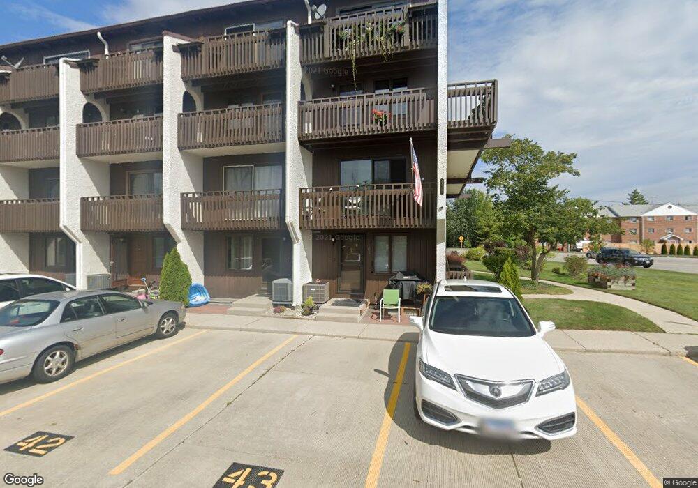
6600 W Wood River Dr Unit B205B Niles, IL 60714
Lawrencewood Gardens NeighborhoodEstimated Value: $255,091 - $306,000
2
Beds
2
Baths
67,516
Sq Ft
$4/Sq Ft
Est. Value
About This Home
This home is located at 6600 W Wood River Dr Unit B205B, Niles, IL 60714 and is currently estimated at $278,773, approximately $4 per square foot. 6600 W Wood River Dr Unit B205B is a home located in Cook County with nearby schools including Clarence E Culver School, Niles West High School, and Logos Christian Academy.
Ownership History
Date
Name
Owned For
Owner Type
Purchase Details
Closed on
May 5, 2016
Sold by
Lim Johnny and Lim Colleen
Bought by
Lims Family Properties Llc
Current Estimated Value
Purchase Details
Closed on
Oct 5, 2004
Sold by
Bae Boon Nam
Bought by
Lim Johnny K and Lim Colleen M
Home Financials for this Owner
Home Financials are based on the most recent Mortgage that was taken out on this home.
Original Mortgage
$156,000
Interest Rate
5.93%
Mortgage Type
Unknown
Purchase Details
Closed on
Aug 21, 2000
Sold by
Burns Thomas L
Bought by
Bae Boon Nam
Home Financials for this Owner
Home Financials are based on the most recent Mortgage that was taken out on this home.
Original Mortgage
$100,000
Interest Rate
8.12%
Purchase Details
Closed on
Jun 14, 1996
Sold by
Burns Thomas L
Bought by
Burns Thomas L
Create a Home Valuation Report for This Property
The Home Valuation Report is an in-depth analysis detailing your home's value as well as a comparison with similar homes in the area
Home Values in the Area
Average Home Value in this Area
Purchase History
| Date | Buyer | Sale Price | Title Company |
|---|---|---|---|
| Lims Family Properties Llc | -- | Attorney | |
| Lim Johnny K | $195,000 | Rtc | |
| Bae Boon Nam | $136,000 | Chicago Title Insurance Co | |
| Burns Thomas L | -- | -- |
Source: Public Records
Mortgage History
| Date | Status | Borrower | Loan Amount |
|---|---|---|---|
| Closed | Lim Johnny K | $156,000 | |
| Previous Owner | Bae Boon Nam | $100,000 |
Source: Public Records
Tax History Compared to Growth
Tax History
| Year | Tax Paid | Tax Assessment Tax Assessment Total Assessment is a certain percentage of the fair market value that is determined by local assessors to be the total taxable value of land and additions on the property. | Land | Improvement |
|---|---|---|---|---|
| 2024 | $5,167 | $20,112 | $1,952 | $18,160 |
| 2023 | $4,821 | $20,112 | $1,952 | $18,160 |
| 2022 | $4,821 | $20,112 | $1,952 | $18,160 |
| 2021 | $4,101 | $14,672 | $1,603 | $13,069 |
| 2020 | $3,900 | $14,672 | $1,603 | $13,069 |
| 2019 | $4,001 | $16,304 | $1,603 | $14,701 |
| 2018 | $2,820 | $9,911 | $1,394 | $8,517 |
| 2017 | $2,862 | $9,911 | $1,394 | $8,517 |
| 2016 | $2,674 | $9,911 | $1,394 | $8,517 |
| 2015 | $2,736 | $9,627 | $1,219 | $8,408 |
| 2014 | $2,605 | $9,627 | $1,219 | $8,408 |
| 2013 | $2,565 | $9,627 | $1,219 | $8,408 |
Source: Public Records
Map
Nearby Homes
- 7753 N Nordica Ave
- 6914 W Oakton Ct
- 8348 N Merrimac Ave
- 8349 N Merrimac Ave
- 6936 W Oakton Ct
- 6956 W Seward St
- 7939 N Neva Ave
- 8380 Miami Ave
- 6920 W Jarvis Ave
- 7700 N Neva Ave
- 8300 Callie Ave Unit F314
- 8300 Callie Ave Unit F610
- 6411 Elm St
- 6163 Mayfair St Unit 102714
- 7450 N Waukegan Rd Unit 509
- 7450 N Waukegan Rd Unit 206
- 7450 N Waukegan Rd Unit 404
- 6882 W Touhy Ave Unit D
- 8400 Callie Ave Unit D209
- 8400 Callie Ave Unit D207
- 6600 W Wood River Dr Unit B210
- 6600 W Wood River Dr Unit B207B
- 6600 W Wood River Dr Unit B201B
- 6600 W Wood River Dr Unit B206B
- 6600 W Wood River Dr Unit B109A
- 6600 W Wood River Dr Unit B210B
- 6600 W Wood River Dr Unit B108A
- 6600 W Wood River Dr Unit B107A
- 6600 W Wood River Dr Unit B202B
- 6600 W Wood River Dr Unit B208B
- 6600 W Wood River Dr Unit B204B
- 6600 W Wood River Dr Unit B102A
- 6600 W Wood River Dr Unit B203B
- 6600 W Wood River Dr Unit B105A
- 6600 W Wood River Dr Unit 211B
- 6600 W Wood River Dr Unit B109
- 6600 W Wood River Dr Unit B102
- 6600 W Wood River Dr Unit 206B
- 6600 W Wood River Dr Unit 202B
- 6660 W Woodriver Dr Unit 207