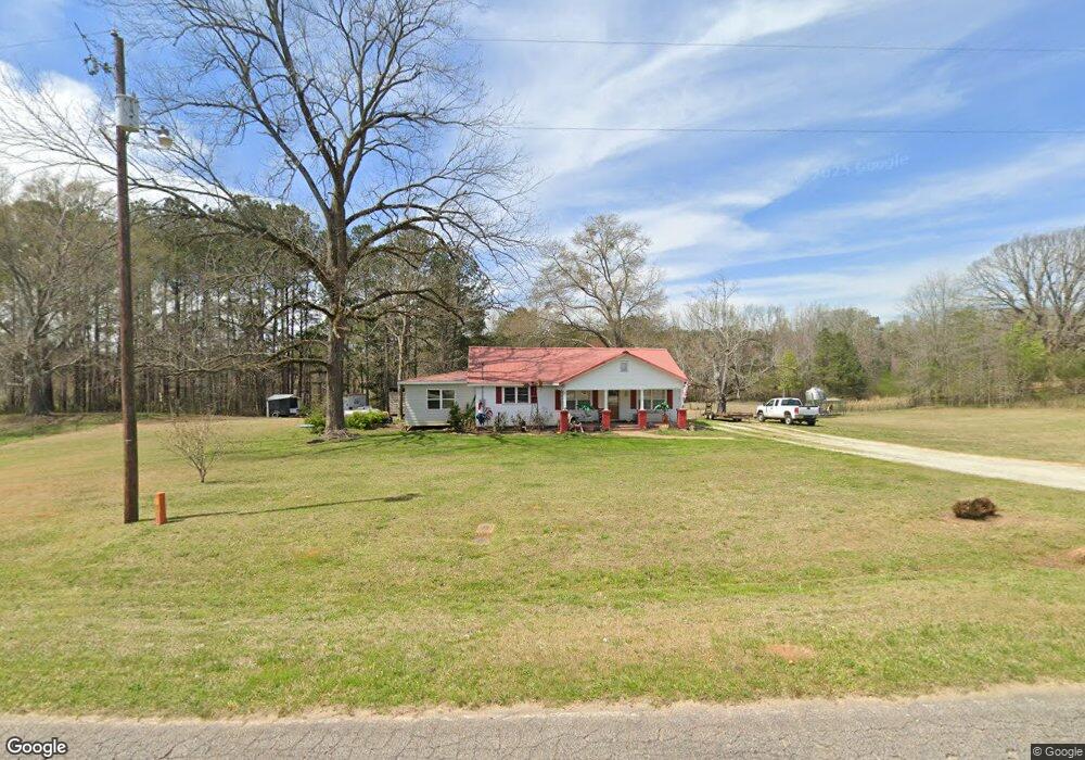
6601 County Road 87 Roanoke, AL 36274
Estimated Value: $162,000 - $226,000
--
Bed
--
Bath
1,416
Sq Ft
$134/Sq Ft
Est. Value
About This Home
This home is located at 6601 County Road 87, Roanoke, AL 36274 and is currently estimated at $189,341, approximately $133 per square foot. 6601 County Road 87 is a home.
Ownership History
Date
Name
Owned For
Owner Type
Purchase Details
Closed on
Dec 16, 2016
Sold by
Benefield Hugh Dorsey and Benefield Reba
Bought by
Benefield Bryson Hugh and Benefield Alyscia Leona
Current Estimated Value
Home Financials for this Owner
Home Financials are based on the most recent Mortgage that was taken out on this home.
Original Mortgage
$75,660
Outstanding Balance
$61,873
Interest Rate
3.94%
Mortgage Type
New Conventional
Estimated Equity
$127,468
Purchase Details
Closed on
Jul 21, 2006
Sold by
Benefield Donald Lee and Benefield Michael Gene
Bought by
Benefield Hugh Dorsey and Benefield Reba
Create a Home Valuation Report for This Property
The Home Valuation Report is an in-depth analysis detailing your home's value as well as a comparison with similar homes in the area
Home Values in the Area
Average Home Value in this Area
Purchase History
| Date | Buyer | Sale Price | Title Company |
|---|---|---|---|
| Benefield Bryson Hugh | $78,000 | -- | |
| Benefield Hugh Dorsey | -- | -- |
Source: Public Records
Mortgage History
| Date | Status | Borrower | Loan Amount |
|---|---|---|---|
| Open | Benefield Bryson Hugh | $75,660 |
Source: Public Records
Tax History Compared to Growth
Tax History
| Year | Tax Paid | Tax Assessment Tax Assessment Total Assessment is a certain percentage of the fair market value that is determined by local assessors to be the total taxable value of land and additions on the property. | Land | Improvement |
|---|---|---|---|---|
| 2024 | $401 | $13,200 | $9,500 | $3,700 |
| 2023 | $401 | $10,440 | $6,940 | $3,500 |
| 2022 | $292 | $10,440 | $6,940 | $3,500 |
| 2021 | $292 | $10,440 | $6,940 | $3,500 |
| 2020 | $284 | $10,440 | $6,940 | $3,500 |
| 2018 | $330 | $10,220 | $6,940 | $3,280 |
| 2017 | $432 | $13,400 | $6,940 | $6,460 |
| 2016 | $410 | $12,680 | $6,940 | $5,740 |
| 2015 | $410 | $98,185 | $0 | $0 |
| 2014 | $410 | $98,185 | $0 | $0 |
| 2013 | -- | $98,185 | $0 | $0 |
Source: Public Records
Map
Nearby Homes
- 431 County Road 30
- 0 County Road 632 Unit 10416893
- 0 County Road 632 Unit 105.96 acres
- 324 County Road 268
- Tract 7 County Road 268 Unit 7
- Tract 3 County Road 268 Unit 3
- Tract 4 County Road 268 Unit 4
- Tract 2 County Road 268 Unit 2
- Tract 8 County Road 268 Unit 8
- 0 County Road 655 Unit 25188732
- 0 County Road 655
- 0 County Road 655 Unit 177093
- 12785 County Road 65
- 0 Drummond Rd Unit 10576586
- 0 Drummond Rd Unit 7642521
- 24.3 + - Ac Awebreys Gin Rd
- 11 + - Ac Awebreys Gin Rd
- 13.9 + - Ac Awebreys Gin Rd
- 13.9 +/- AC Awbreys Gin Rd
- 24.5+/- AC Awbreys Gin Rd
- 6390 County Road 87
- 6390 County Road 87
- 105 County Road 638
- 0 County Road 638 Unit 11254135
- 0 County Road 638
- 6909 County Road 87
- 312 County Road 638
- 6789 County Road 87
- 6789 County Road 87
- 200 County Road 87
- Tract 4 County Road 87
- Tract 3 County Road 87
- Tract 2 County Road 87
- Tract 1 County Road 87 Unit Tract 1
- 439 County Road 638
- 7331 County Road 87
- 7289 County Road 87
- 7351 County Road 87
- 7423 County Road 87
- 5650 County Road 87