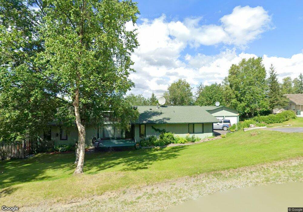
6601 Crooked Tree Dr Anchorage, AK 99507
Mid-Hillside NeighborhoodEstimated Value: $610,000 - $695,576
5
Beds
3
Baths
3,132
Sq Ft
$205/Sq Ft
Est. Value
About This Home
This home is located at 6601 Crooked Tree Dr, Anchorage, AK 99507 and is currently estimated at $642,394, approximately $205 per square foot. 6601 Crooked Tree Dr is a home located in Anchorage Municipality with nearby schools including O'Malley Elementary School, Hanshew Middle School, and Service High School.
Ownership History
Date
Name
Owned For
Owner Type
Purchase Details
Closed on
Oct 5, 1989
Sold by
Smith Janice K and Smith Gerald B
Bought by
Lee Robert A and Lee Donna R
Current Estimated Value
Home Financials for this Owner
Home Financials are based on the most recent Mortgage that was taken out on this home.
Original Mortgage
$30,000
Interest Rate
10.35%
Mortgage Type
New Conventional
Create a Home Valuation Report for This Property
The Home Valuation Report is an in-depth analysis detailing your home's value as well as a comparison with similar homes in the area
Home Values in the Area
Average Home Value in this Area
Purchase History
| Date | Buyer | Sale Price | Title Company |
|---|---|---|---|
| Lee Robert A | -- | -- |
Source: Public Records
Mortgage History
| Date | Status | Borrower | Loan Amount |
|---|---|---|---|
| Closed | Lee Robert A | $30,000 |
Source: Public Records
Tax History Compared to Growth
Tax History
| Year | Tax Paid | Tax Assessment Tax Assessment Total Assessment is a certain percentage of the fair market value that is determined by local assessors to be the total taxable value of land and additions on the property. | Land | Improvement |
|---|---|---|---|---|
| 2025 | $5,414 | $636,200 | $114,700 | $521,500 |
| 2024 | $5,414 | $586,300 | $109,300 | $477,000 |
| 2023 | $8,046 | $517,400 | $105,100 | $412,300 |
| 2022 | $4,894 | $511,700 | $105,100 | $406,600 |
| 2021 | $7,934 | $470,300 | $105,100 | $365,200 |
| 2020 | $3,642 | $455,600 | $105,100 | $350,500 |
| 2019 | $3,901 | $457,500 | $105,100 | $352,400 |
| 2018 | $3,764 | $448,600 | $119,100 | $329,500 |
| 2017 | $4,302 | $459,900 | $119,100 | $340,800 |
| 2016 | $5,703 | $472,300 | $119,100 | $353,200 |
| 2015 | $5,703 | $455,700 | $115,100 | $340,600 |
| 2014 | $5,703 | $433,100 | $100,600 | $332,500 |
Source: Public Records
Map
Nearby Homes
- 6411 Ridge Tree Cir
- 6460 Limestone Cir
- 6815 Double Tree Ct
- 5900 Orth Cir
- L7 Panorama Dr
- L13 Panorama Dr
- L3 Panorama Dr
- L6 Panorama Dr
- L11 Panorama Dr
- L2 Panorama Dr
- L10 Panorama Dr
- 000 Valley View Dr
- 6550 Rockridge Dr
- L3 Totem Rd
- 0 Rd
- 10960 Totem Rd
- 9203 Strutz Ave
- 11840 Coughlan Way
- 11800 Nebesna Dr
- 112 Chelsea St
- 10025 Main Tree Dr
- 10035 Main Tree Dr
- 6620 Crooked Tree Dr
- 6520 Crooked Tree Dr
- 10015 Main Tree Dr
- L25 B2 Main Tree Dr
- L28 B2 Main Tree Dr
- 6621 Crooked Tree Dr
- 10024 Main Tree Dr
- 6610 Round Tree Dr
- 6600 Round Tree Dr
- 10014 Main Tree Dr
- 6631 Crooked Tree Dr
- 6510 Crooked Tree Dr
- 10005 Main Tree Dr
- 6430 Ridge Tree Cir
- 10115 Main Tree Dr
- 10004 Main Tree Dr
- 6620 Round Tree Dr
- 105044 Main Tree Dr