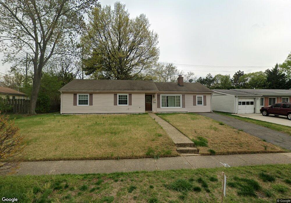
6603 Buckskin St Springfield, VA 22150
Springtown NeighborhoodEstimated Value: $603,000 - $652,000
About This Home
This home is located at 6603 Buckskin St, Springfield, VA 22150 and is currently estimated at $622,143, approximately $405 per square foot. 6603 Buckskin St is a home located in Fairfax County with nearby schools including Springfield Estates Elementary School, Key Middle, and Lewis High School.
Ownership History
We collect this data history from publicly available records. To have your information removed, we recommend requesting removal directly through your county’s website.
Purchase Details
Home Financials for this Owner
Home Financials are based on the most recent Mortgage that was taken out on this home.Purchase Details
Purchase Details
Home Financials for this Owner
Home Financials are based on the most recent Mortgage that was taken out on this home.Purchase Details
Home Financials for this Owner
Home Financials are based on the most recent Mortgage that was taken out on this home.Home Values in the Area
Average Home Value in this Area
Purchase History
We collect this data history from publicly available records. To have your information removed, we recommend requesting removal directly through your county’s website.
| Date | Buyer | Sale Price | Title Company |
|---|---|---|---|
| -- | None Available | ||
| -- | None Available | ||
| -- | None Available | ||
| $259,000 | -- | ||
| $146,000 | -- |
Mortgage History
We collect this data history from publicly available records. To have your information removed, we recommend requesting removal directly through your county’s website.
| Date | Status | Borrower | Loan Amount |
|---|---|---|---|
| Open | $240,100 | ||
| Closed | $240,100 | ||
| Previous Owner | $246,050 | ||
| Previous Owner | $141,718 |
Tax History
We collect this data history from publicly available records. To have your information removed, we recommend requesting removal directly through your county’s website.
| Year | Tax Paid | Tax Assessment Tax Assessment Total Assessment is a certain percentage of the fair market value that is determined by local assessors to be the total taxable value of land and additions on the property. | Land | Improvement |
|---|---|---|---|---|
| 2025 | $6,046 | $542,480 | $275,000 | $267,480 |
| 2024 | $6,046 | $521,900 | $265,000 | $256,900 |
| 2023 | $5,633 | $499,130 | $251,000 | $248,130 |
| 2022 | $5,208 | $455,400 | $227,000 | $228,400 |
| 2021 | $4,763 | $405,920 | $190,000 | $215,920 |
| 2020 | $4,647 | $392,630 | $183,000 | $209,630 |
| 2019 | $4,400 | $371,790 | $173,000 | $198,790 |
| 2018 | $4,175 | $363,000 | $170,000 | $193,000 |
| 2017 | $3,998 | $344,340 | $161,000 | $183,340 |
| 2016 | $3,989 | $344,340 | $161,000 | $183,340 |
| 2015 | $3,745 | $335,610 | $161,000 | $174,610 |
| 2014 | $3,398 | $305,190 | $142,000 | $163,190 |
Map
- 6430 Franconia Rd
- 6113 Pioneer Dr
- 6423 Cabell Ct
- 6270 Levi Ct
- 6388 Trips Way
- 6397 Stagg Ct
- 6385 Stagg Ct
- 6501 Terry Dr
- 5910 Flanders St
- 6409 Nice Place
- 6416 Fleetside Ct
- 7094 Spring Garden Dr Unit 202
- 7094 Spring Garden Dr Unit 2
- 7097 Spring Garden Dr Unit 101
- 6468 Windham Ave
- 6528 Windham Ave
- 6497 Windham Ave
- 6014 Hibbling Ave
- 6488 Sharon Kay Ct
- 6545 Greyledge Ct
- 6605 Buckskin St
- 6400 Frontier Dr
- 6602 Franconia Rd
- 6604 Franconia Rd
- 6404 Frontier Dr
- 6607 Buckskin St
- 6604 Buckskin St
- 6606 Franconia Rd
- 6320 Frontier Dr
- 6609 Buckskin St
- 6608 Franconia Rd
- 6319 Alamo St
- 6318 Frontier Dr
- 6401 Frontier Dr
- 6608 Buckskin St
- 6403 Frontier Dr
- 6323 Frontier Dr
- 6611 Buckskin St
- 6321 Frontier Dr
- 6405 Frontier Dr
Ask me questions while you tour the home.