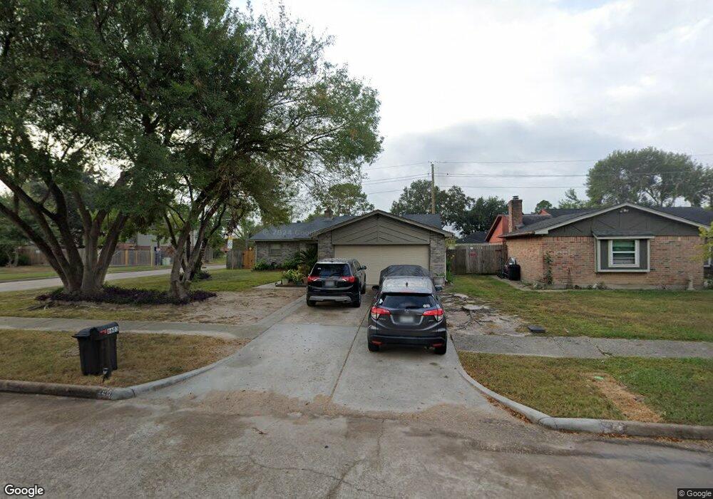
6603 Sandswept Ln Houston, TX 77086
North Houston NeighborhoodEstimated Value: $222,015 - $246,000
3
Beds
2
Baths
1,678
Sq Ft
$138/Sq Ft
Est. Value
About This Home
This home is located at 6603 Sandswept Ln, Houston, TX 77086 and is currently estimated at $231,504, approximately $137 per square foot. 6603 Sandswept Ln is a home located in Harris County with nearby schools including Kujawa EC/Pre-K/K School, Carmichael Elementary School, and Shotwell Middle School.
Ownership History
Date
Name
Owned For
Owner Type
Purchase Details
Closed on
Apr 27, 1999
Sold by
Mcgee James J and Mcgee Gertrude M
Bought by
Jaimes Roberto R
Current Estimated Value
Home Financials for this Owner
Home Financials are based on the most recent Mortgage that was taken out on this home.
Original Mortgage
$66,922
Outstanding Balance
$17,220
Interest Rate
6.99%
Mortgage Type
FHA
Estimated Equity
$214,284
Create a Home Valuation Report for This Property
The Home Valuation Report is an in-depth analysis detailing your home's value as well as a comparison with similar homes in the area
Home Values in the Area
Average Home Value in this Area
Purchase History
| Date | Buyer | Sale Price | Title Company |
|---|---|---|---|
| Jaimes Roberto R | -- | Fidelity National Title |
Source: Public Records
Mortgage History
| Date | Status | Borrower | Loan Amount |
|---|---|---|---|
| Open | Jaimes Roberto R | $66,922 |
Source: Public Records
Tax History Compared to Growth
Tax History
| Year | Tax Paid | Tax Assessment Tax Assessment Total Assessment is a certain percentage of the fair market value that is determined by local assessors to be the total taxable value of land and additions on the property. | Land | Improvement |
|---|---|---|---|---|
| 2025 | $3,118 | $218,373 | $38,545 | $179,828 |
| 2024 | $3,118 | $221,703 | $38,545 | $183,158 |
| 2023 | $3,118 | $229,292 | $38,545 | $190,747 |
| 2022 | $3,827 | $190,160 | $32,666 | $157,494 |
| 2021 | $3,471 | $158,215 | $32,666 | $125,549 |
| 2020 | $3,508 | $149,771 | $32,666 | $117,105 |
| 2019 | $3,316 | $145,823 | $16,634 | $129,189 |
| 2018 | $1,183 | $136,018 | $16,634 | $119,384 |
| 2017 | $2,642 | $127,500 | $14,936 | $112,564 |
| 2016 | $2,402 | $115,472 | $14,936 | $100,536 |
| 2015 | $1,696 | $108,810 | $14,936 | $93,874 |
| 2014 | $1,696 | $80,725 | $14,936 | $65,789 |
Source: Public Records
Map
Nearby Homes
- 6615 Winding Trace Dr
- 10522 Northview Dr
- 6502 Trail Valley Way
- 6630 Brownie Campbell Rd
- 6722 Winding Trace Dr
- 6654 Brownie Campbell Rd
- 10306 Jillana Kaye Dr
- 6610 Northleaf Dr
- 6606 Dusty Dawn Dr
- 6911 Silver Star Dr
- 10214 Trade Winds Dr
- 6822 Dusty Dawn Dr
- 13610 Kaltenbrun Rd
- 11009 Panicum Ct
- 13518 Kaltenbrun Rd
- 7002 Sandswept Ln
- 6703 Deer Ridge Ln
- 11006 Crinkleawn Dr
- 11021 Crenchrus Ct
- 7023 Sandswept Ln
- 6607 Sandswept Ln
- 6602 Trail Valley Way
- 6606 Trail Valley Way
- 6611 Sandswept Ln
- 6523 Sandswept Ln
- 6526 Trail Valley Way
- 6602 Sandswept Ln
- 6610 Trail Valley Way
- 6606 Sandswept Ln
- 6615 Sandswept Ln
- 6519 Sandswept Ln
- 6610 Sandswept Ln
- 6614 Trail Valley Way
- 6522 Trail Valley Way
- 10502 Trade Winds Dr
- 6614 Sandswept Ln
- 6619 Sandswept Ln
- 6515 Sandswept Ln
- 6518 Trail Valley Way
- 6618 Trail Valley Way