Estimated Value: $295,000 - $338,000
3
Beds
2
Baths
1,708
Sq Ft
$186/Sq Ft
Est. Value
About This Home
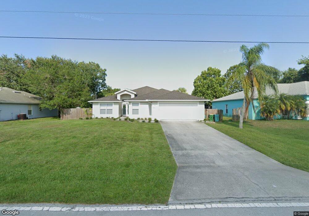
This home is located at 6605 Homestead Ave, Cocoa, FL 32927 and is currently estimated at $318,215, approximately $186 per square foot. 6605 Homestead Ave is a home located in Brevard County with nearby schools including Enterprise Elementary School, Space Coast Junior/Senior High School, and East Atlantic Prep of Brevard County.
Ownership History
Date
Name
Owned For
Owner Type
Purchase Details
Closed on
Nov 15, 2021
Sold by
6605 Homestead Llc
Bought by
Locuson Lita Christine
Current Estimated Value
Home Financials for this Owner
Home Financials are based on the most recent Mortgage that was taken out on this home.
Original Mortgage
$213,950
Interest Rate
3.01%
Mortgage Type
Seller Take Back
Purchase Details
Closed on
Apr 29, 2015
Sold by
Locuson Diana C and Miller Diana L
Bought by
6605 Homestead Llc
Purchase Details
Closed on
Jan 28, 1994
Sold by
Zito Leonard R and Zito Antonetta L
Bought by
Locuson Diana C
Create a Home Valuation Report for This Property
The Home Valuation Report is an in-depth analysis detailing your home's value as well as a comparison with similar homes in the area
Home Values in the Area
Average Home Value in this Area
Purchase History
| Date | Buyer | Sale Price | Title Company |
|---|---|---|---|
| Locuson Lita Christine | $228,000 | The Closing Place Inc | |
| 6605 Homestead Llc | -- | Attorney | |
| Locuson Diana C | -- | -- | |
| Locuson Diana C | $6,000 | -- |
Source: Public Records
Mortgage History
| Date | Status | Borrower | Loan Amount |
|---|---|---|---|
| Closed | Locuson Lita Christine | $213,950 |
Source: Public Records
Tax History Compared to Growth
Tax History
| Year | Tax Paid | Tax Assessment Tax Assessment Total Assessment is a certain percentage of the fair market value that is determined by local assessors to be the total taxable value of land and additions on the property. | Land | Improvement |
|---|---|---|---|---|
| 2025 | $3,423 | $268,100 | -- | -- |
| 2024 | $3,378 | $260,550 | -- | -- |
| 2023 | $3,378 | $252,970 | $0 | $0 |
| 2022 | $3,167 | $245,610 | $0 | $0 |
| 2021 | $3,034 | $197,410 | $42,000 | $155,410 |
| 2020 | $2,784 | $176,060 | $40,000 | $136,060 |
| 2019 | $2,643 | $169,080 | $35,000 | $134,080 |
| 2018 | $2,506 | $154,680 | $27,000 | $127,680 |
| 2017 | $2,392 | $140,410 | $24,000 | $116,410 |
| 2016 | $2,248 | $121,520 | $18,000 | $103,520 |
| 2015 | $2,140 | $97,330 | $15,000 | $82,330 |
| 2014 | $1,953 | $88,490 | $11,000 | $77,490 |
Source: Public Records
Map
Nearby Homes
- 6665 Addie Ave
- 6545 Addie Ave
- 6105 Banyan St
- 23-35-21-JX-B-2 Aruin St
- 6365 Homestead Ave
- 6115 Allmont St
- 5715 Fairbridge St
- 6643 Emil Ave
- 4650 N Highway 1 Hwy
- 5575 Curtis Blvd
- 6295 Banyan St
- 6581 Bancroft Ave
- 5915 Akers St
- 6309 Alleghany Ave
- 6615 Dock Ave
- 5720 Flint Rd
- 6010 Fay Blvd
- 6198 Dees Rd
- 6530 Bethel St
- 7065 Hundred Acre Dr
- 6615 Homestead Ave
- 6595 Homestead Ave
- 6622 Bamboo Ave
- 6610 Bamboo Ave
- 6634 Bamboo Ave
- 6625 Homestead Ave
- 6600 Homestead Ave
- 6610 Homestead Ave
- 6590 Homestead Ave
- 6598 Bamboo Ave
- 6646 Bamboo Ave
- 6635 Homestead Ave
- 6575 Homestead Ave
- 6630 Homestead Ave
- 6586 Bamboo Ave
- 6670 Bamboo Ave
- 6615 Addie Ave
- 6625 Addie Ave
- 6605 Addie Ave
- 6635 Addie Ave