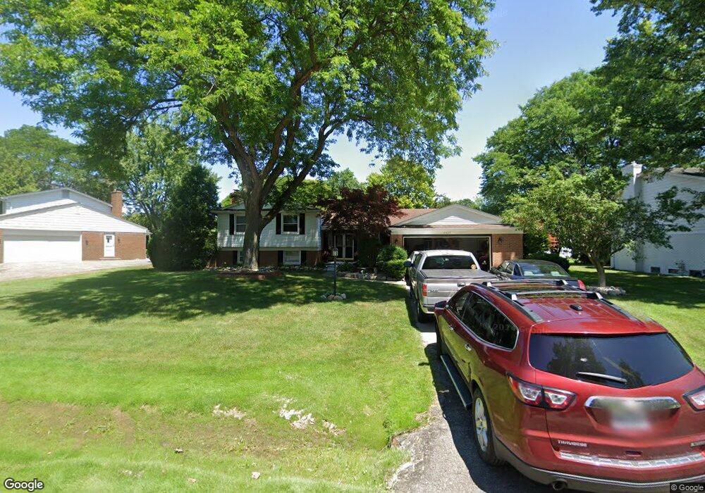
6605 Perham Dr West Bloomfield, MI 48322
Estimated Value: $439,168 - $557,000
5
Beds
4
Baths
2,789
Sq Ft
$177/Sq Ft
Est. Value
About This Home
This home is located at 6605 Perham Dr, West Bloomfield, MI 48322 and is currently estimated at $494,792, approximately $177 per square foot. 6605 Perham Dr is a home located in Oakland County with nearby schools including Sheiko Elementary School, West Bloomfield Middle School, and Bloomfield Maples Montessori.
Ownership History
Date
Name
Owned For
Owner Type
Purchase Details
Closed on
Jul 6, 2000
Sold by
Langlois John D
Bought by
Davis Jeffrey L
Current Estimated Value
Home Financials for this Owner
Home Financials are based on the most recent Mortgage that was taken out on this home.
Original Mortgage
$183,600
Outstanding Balance
$67,186
Interest Rate
8.55%
Estimated Equity
$427,606
Purchase Details
Closed on
Feb 25, 1997
Sold by
Benedict Joseph J
Bought by
Langlois John D
Create a Home Valuation Report for This Property
The Home Valuation Report is an in-depth analysis detailing your home's value as well as a comparison with similar homes in the area
Home Values in the Area
Average Home Value in this Area
Purchase History
| Date | Buyer | Sale Price | Title Company |
|---|---|---|---|
| Davis Jeffrey L | $229,500 | -- | |
| Langlois John D | $205,000 | -- |
Source: Public Records
Mortgage History
| Date | Status | Borrower | Loan Amount |
|---|---|---|---|
| Open | Davis Jeffrey L | $183,600 |
Source: Public Records
Tax History Compared to Growth
Tax History
| Year | Tax Paid | Tax Assessment Tax Assessment Total Assessment is a certain percentage of the fair market value that is determined by local assessors to be the total taxable value of land and additions on the property. | Land | Improvement |
|---|---|---|---|---|
| 2024 | $2,789 | $181,230 | $0 | $0 |
| 2022 | $2,670 | $159,410 | $40,000 | $119,410 |
| 2021 | $4,063 | $150,650 | $0 | $0 |
| 2020 | $2,617 | $148,370 | $34,100 | $114,270 |
| 2018 | $3,913 | $137,720 | $28,150 | $109,570 |
| 2015 | -- | $112,030 | $0 | $0 |
| 2014 | -- | $99,870 | $0 | $0 |
| 2011 | -- | $92,850 | $0 | $0 |
Source: Public Records
Map
Nearby Homes
- 6564 Alderley Way
- 6545 Post Oak Dr
- 6624 Mellow Wood Ln
- 7023 Wild Ridge Ln
- 6769 Heather Heath
- 5312 Cambourne Place
- 7251 N Briarcliff Knoll Dr
- 7209 Stonebrook Rd
- 3035 Parkland Dr
- 7027 Beverly Crest Dr
- 6843 Leslee Crest Dr
- 7335 Coach Ln
- 7477 Gramercy Cir Unit 17
- 7479 Gramercy Cir Unit 16
- 5815 Bloomfield Glens Rd
- 7507 Gramercy Cir
- 7496 Cornwall Ct
- 6151 Orchard Lake Rd Unit 103
- 6145 Orchard Lake Rd Unit 204
- 7250 Ten Hill
- 6583 Perham Dr
- 6619 Perham Dr
- 6552 Alderley Way
- 6633 Perham Dr
- 6603 Cottonwood Knoll
- 5389 Centerbrook Dr
- 6600 Cottonwood Knoll
- 5377 Centerbrook Dr
- 6626 Perham Dr
- 6574 Perham Dr
- 6576 Alderley Way
- 6647 Perham Dr
- 6640 Perham Dr
- 6611 Cottonwood Knoll
- 6540 Alderley Way
- 5365 Centerbrook Dr
- 6608 Cottonwood Knoll
- 6635 Cottonwood Knoll
- 5382 Centerbrook Dr
- 6612 Alderley Way