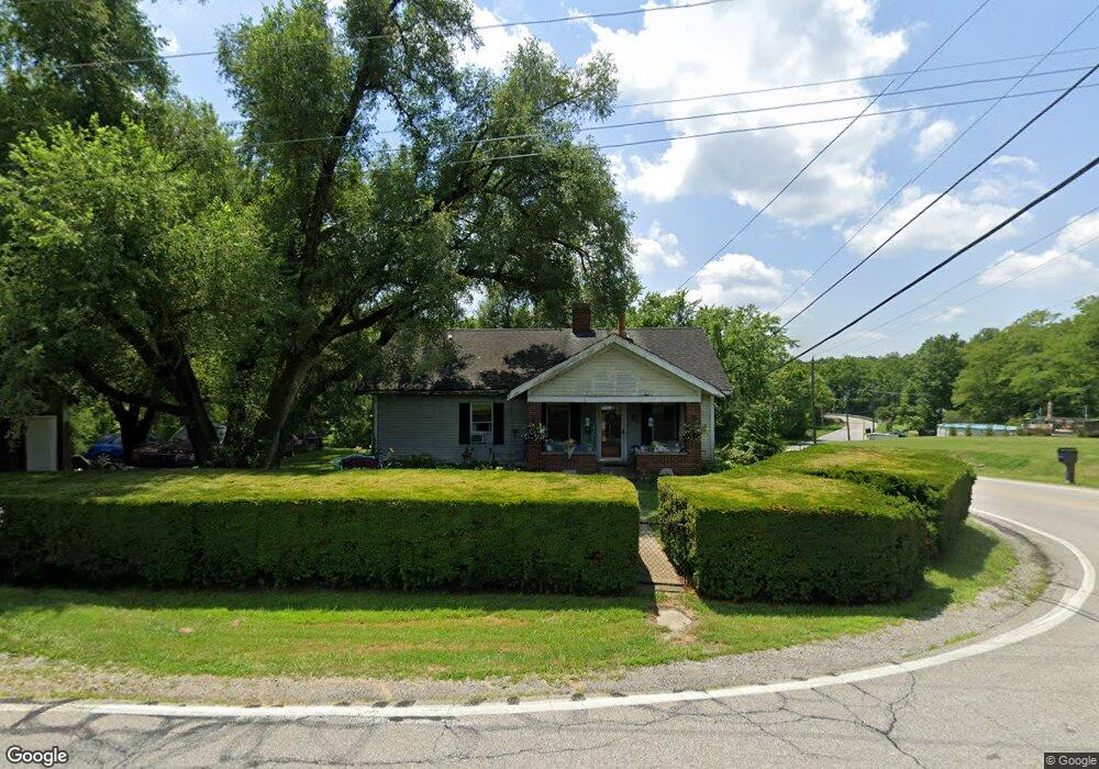
6606 Ash Ridge Arnheim Rd Georgetown, OH 45121
Estimated Value: $84,000 - $150,000
--
Bed
--
Bath
1,658
Sq Ft
$73/Sq Ft
Est. Value
About This Home
This home is located at 6606 Ash Ridge Arnheim Rd, Georgetown, OH 45121 and is currently estimated at $121,557, approximately $73 per square foot. 6606 Ash Ridge Arnheim Rd is a home located in Brown County with nearby schools including Sardinia Elementary School, Russellville Elementary School, and Eastern Middle School.
Ownership History
Date
Name
Owned For
Owner Type
Purchase Details
Closed on
Dec 9, 1998
Sold by
Fisher Ted E
Bought by
Wissing Mark
Current Estimated Value
Home Financials for this Owner
Home Financials are based on the most recent Mortgage that was taken out on this home.
Original Mortgage
$52,700
Outstanding Balance
$14,154
Interest Rate
9.49%
Mortgage Type
New Conventional
Estimated Equity
$107,403
Purchase Details
Closed on
Mar 13, 1997
Sold by
Tipton James H
Bought by
Fisher Ted E and Kessling Vicky L
Home Financials for this Owner
Home Financials are based on the most recent Mortgage that was taken out on this home.
Original Mortgage
$67,500
Interest Rate
10%
Mortgage Type
New Conventional
Create a Home Valuation Report for This Property
The Home Valuation Report is an in-depth analysis detailing your home's value as well as a comparison with similar homes in the area
Home Values in the Area
Average Home Value in this Area
Purchase History
| Date | Buyer | Sale Price | Title Company |
|---|---|---|---|
| Wissing Mark | $62,000 | -- | |
| Fisher Ted E | $63,000 | -- |
Source: Public Records
Mortgage History
| Date | Status | Borrower | Loan Amount |
|---|---|---|---|
| Open | Wissing Mark | $52,700 | |
| Previous Owner | Fisher Ted E | $67,500 |
Source: Public Records
Tax History Compared to Growth
Tax History
| Year | Tax Paid | Tax Assessment Tax Assessment Total Assessment is a certain percentage of the fair market value that is determined by local assessors to be the total taxable value of land and additions on the property. | Land | Improvement |
|---|---|---|---|---|
| 2024 | $863 | $26,710 | $3,730 | $22,980 |
| 2023 | $863 | $22,410 | $3,580 | $18,830 |
| 2022 | $767 | $22,410 | $3,580 | $18,830 |
| 2021 | $759 | $22,410 | $3,580 | $18,830 |
| 2020 | $682 | $19,500 | $3,130 | $16,370 |
| 2019 | $677 | $19,500 | $3,130 | $16,370 |
| 2018 | $671 | $19,500 | $3,130 | $16,370 |
| 2017 | $622 | $18,880 | $3,440 | $15,440 |
| 2016 | $621 | $18,880 | $3,440 | $15,440 |
| 2015 | $649 | $18,880 | $3,440 | $15,440 |
| 2014 | $649 | $18,570 | $3,130 | $15,440 |
| 2013 | $647 | $18,570 | $3,130 | $15,440 |
Source: Public Records
Map
Nearby Homes
- 6983 Yockey Rd
- 7144 Ashridge Arnheim Rd
- 1655 Waynoka Dr
- 106 Sequoia Dr
- 99 Waynoka Dr
- 18 Hammerhead Cove
- 14 Hammerhead Cove
- 314 Waynoka Dr
- 29 Mohave Dr
- 76 Navajo Dr
- 10898 Parker Lane Rd
- 10 Chippewa Cove
- 88 Navajo Dr
- 0 Zuni Dr Unit 1860578
- 0 Mohican Lots 388 & 399 Cove Unit 1834612
- lot 389 W Mohican Cove
- 0 Mohican Cove Unit 1834610
- 13 Beach Cove
- 119 Hogan Dr
- 440 Waynoka Dr
- 0 Day Hill Arnheim Rd Unit 1284201
- 0 Day Hill Arnheim Rd Unit 1186777
- 0 Day Hill Arnheim Rd Unit 1428470
- 0 Day Hill Arnheim Rd Unit 1458865
- 0 Day Hill Arnheim Rd Unit 1493989
- 0 Day Hill Arnheim Rd Unit 1097488
- 0 Day Hill Arnheim Rd Unit 991458
- 0 Day Hill Arnheim Rd Unit 750197
- 10743 Day Hill Arnheim Rd
- 10743 Arnheim Dayhill Rd
- 6614 Ash Ridge Arnheim Rd
- 10755 Brownstown Arnheim Rd
- 10726 Day Hill Arnheim Rd
- 6620 Ash Ridge Arnheim Rd
- 6611 Van Buren Ave
- 10709 Day Hill Arnheim Rd
- 6633 Van Buren Ave
- 6636 Ash Ridge Arnheim Rd
- 10709 Day Hill-Arnheim Rd
- 6559 Delhi Arnheim Rd