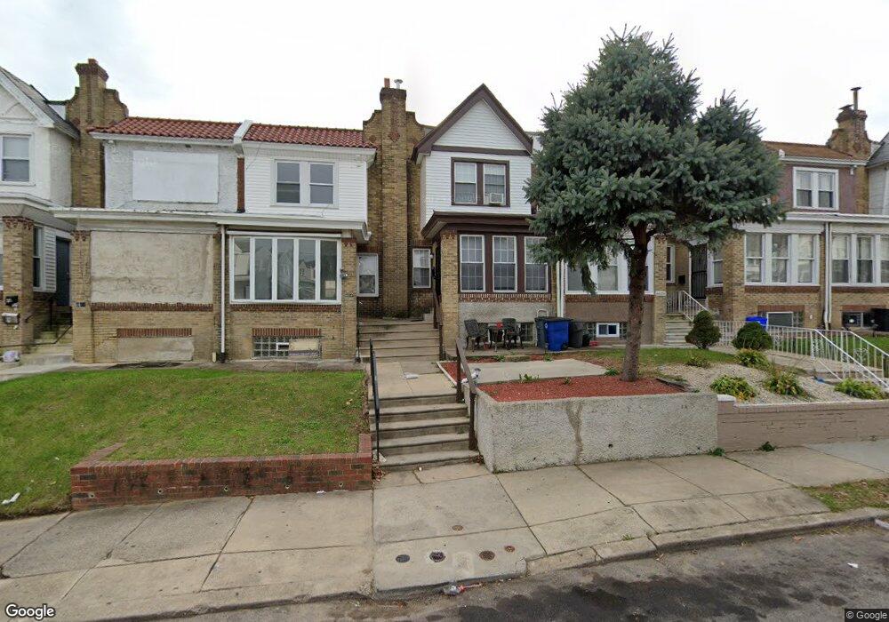
6606 Cornelius St Philadelphia, PA 19138
West Oak Lane NeighborhoodEstimated Value: $211,000 - $263,000
3
Beds
2
Baths
1,352
Sq Ft
$177/Sq Ft
Est. Value
About This Home
This home is located at 6606 Cornelius St, Philadelphia, PA 19138 and is currently estimated at $239,338, approximately $177 per square foot. 6606 Cornelius St is a home located in Philadelphia County with nearby schools including Anna B. Day School, Martin Luther King High School, and West Oak Lane Charter School.
Ownership History
Date
Name
Owned For
Owner Type
Purchase Details
Closed on
Nov 25, 2014
Sold by
Homes Plus Properties Inc
Bought by
Bennett Mason Tanya L and Bennett Jessica
Current Estimated Value
Home Financials for this Owner
Home Financials are based on the most recent Mortgage that was taken out on this home.
Original Mortgage
$116,745
Outstanding Balance
$90,502
Interest Rate
4.25%
Mortgage Type
FHA
Estimated Equity
$148,836
Purchase Details
Closed on
Jun 11, 2012
Sold by
Jones Emmaline and City Of Philadelphia
Bought by
Homes Plus Properties Inc
Create a Home Valuation Report for This Property
The Home Valuation Report is an in-depth analysis detailing your home's value as well as a comparison with similar homes in the area
Home Values in the Area
Average Home Value in this Area
Purchase History
| Date | Buyer | Sale Price | Title Company |
|---|---|---|---|
| Bennett Mason Tanya L | $118,900 | Downtown Abstract Inc | |
| Homes Plus Properties Inc | $30,500 | None Available |
Source: Public Records
Mortgage History
| Date | Status | Borrower | Loan Amount |
|---|---|---|---|
| Open | Bennett Mason Tanya L | $116,745 |
Source: Public Records
Tax History Compared to Growth
Tax History
| Year | Tax Paid | Tax Assessment Tax Assessment Total Assessment is a certain percentage of the fair market value that is determined by local assessors to be the total taxable value of land and additions on the property. | Land | Improvement |
|---|---|---|---|---|
| 2025 | $3,400 | $249,700 | $49,940 | $199,760 |
| 2024 | $3,400 | $249,700 | $49,940 | $199,760 |
| 2023 | $3,400 | $242,900 | $48,580 | $194,320 |
| 2022 | $2,403 | $242,900 | $48,580 | $194,320 |
| 2021 | $2,403 | $0 | $0 | $0 |
| 2020 | $2,403 | $0 | $0 | $0 |
| 2019 | $2,508 | $0 | $0 | $0 |
| 2018 | $1,641 | $0 | $0 | $0 |
| 2017 | $1,641 | $0 | $0 | $0 |
| 2016 | $1,641 | $0 | $0 | $0 |
| 2015 | $1,570 | $0 | $0 | $0 |
| 2014 | -- | $117,200 | $9,240 | $107,960 |
| 2012 | -- | $12,128 | $1,881 | $10,247 |
Source: Public Records
Map
Nearby Homes
- 6620 Cornelius St
- 6661 Cornelius St
- 6332 E Wister St
- 6635 Hollis St
- 1344 Narragansett St
- 1505 Beverly Rd
- 1521 E Walnut Ln
- 5843 Crittenden St
- 5839 Crittenden St
- 2152 Stenton Ave
- 5831 Crittenden St
- 6824 Rodney St
- 5829 Crittenden St
- 5827 Crittenden St
- 5852 Crittenden St
- 1537 Beverly Rd
- 1544 Beverly Rd
- 6531 N Beechwood St
- 2125 Stenton Ave
- 2120 66th Ave
- 6608 Cornelius St
- 6604 Cornelius St
- 6602 Cornelius St
- 6610 Cornelius St
- 6612 Cornelius St
- 6600 Cornelius St
- 6600 Cornelius St Unit C
- 6600 Cornelius St Unit B
- 6600 Cornelius St Unit A
- 6614 Cornelius St
- 6616 Cornelius St
- 6618 Cornelius St
- 6901 Stenton Ave
- 6622 Cornelius St
- 6917 Stenton Ave
- 6624 Cornelius St
- 6617 Cornelius St
- 6611 Cornelius St
- 2192 Homer St
- 2196 Homer St