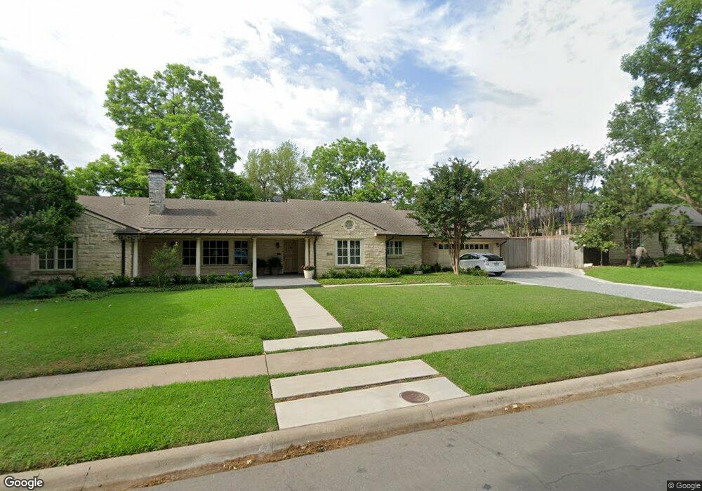
6606 Kenwood Ave Dallas, TX 75214
Lakewood NeighborhoodEstimated Value: $1,585,000 - $1,808,000
4
Beds
4
Baths
3,506
Sq Ft
$479/Sq Ft
Est. Value
About This Home
This home is located at 6606 Kenwood Ave, Dallas, TX 75214 and is currently estimated at $1,680,069, approximately $479 per square foot. 6606 Kenwood Ave is a home located in Dallas County with nearby schools including Lakewood Elementary School, J L Long Middle School, and Woodrow Wilson High School.
Ownership History
Date
Name
Owned For
Owner Type
Purchase Details
Closed on
Jun 17, 2005
Sold by
Elkins Rodney R and Elkins Barbara Hunt
Bought by
Denman Charles M and Denman Cynthia D
Current Estimated Value
Home Financials for this Owner
Home Financials are based on the most recent Mortgage that was taken out on this home.
Original Mortgage
$375,000
Outstanding Balance
$195,772
Interest Rate
5.76%
Mortgage Type
Fannie Mae Freddie Mac
Estimated Equity
$1,484,297
Create a Home Valuation Report for This Property
The Home Valuation Report is an in-depth analysis detailing your home's value as well as a comparison with similar homes in the area
Home Values in the Area
Average Home Value in this Area
Purchase History
| Date | Buyer | Sale Price | Title Company |
|---|---|---|---|
| Denman Charles M | -- | Fnt |
Source: Public Records
Mortgage History
| Date | Status | Borrower | Loan Amount |
|---|---|---|---|
| Open | Denman Charles M | $375,000 |
Source: Public Records
Tax History Compared to Growth
Tax History
| Year | Tax Paid | Tax Assessment Tax Assessment Total Assessment is a certain percentage of the fair market value that is determined by local assessors to be the total taxable value of land and additions on the property. | Land | Improvement |
|---|---|---|---|---|
| 2025 | $12,645 | $1,467,350 | $913,640 | $553,710 |
| 2024 | $12,645 | $1,467,350 | $913,640 | $553,710 |
| 2023 | $12,645 | $1,148,540 | $783,120 | $365,420 |
| 2022 | $28,718 | $1,148,540 | $783,120 | $365,420 |
| 2021 | $23,030 | $873,000 | $665,650 | $207,350 |
| 2020 | $23,683 | $873,000 | $665,650 | $207,350 |
| 2019 | $24,839 | $873,000 | $665,650 | $207,350 |
| 2018 | $22,456 | $825,840 | $548,180 | $277,660 |
| 2017 | $21,557 | $792,750 | $548,180 | $244,570 |
| 2016 | $21,557 | $792,750 | $548,180 | $244,570 |
| 2015 | $14,258 | $706,170 | $469,870 | $236,300 |
| 2014 | $14,258 | $622,160 | $326,300 | $295,860 |
Source: Public Records
Map
Nearby Homes
- 6625 Bob o Link Dr
- 6833 Northridge Dr
- 4010 Sperry St
- 6728 Winton St
- 6905 Northridge Dr
- 6814 Southridge Dr
- 6454 Kenwood Ave
- 6443 Kenwood Ave
- 6842 Merrilee Ln
- 3932 Frontier Ln
- 7007 Irongate Ln
- 6757 Lakefair Cir
- 6554 Sunnyland Ln
- 6742 Williamson Rd
- 6612 E Mockingbird Ln
- 6417 Malcolm Dr
- 6932 Chantilly Ct
- 6743 Sondra Dr
- 7034 Irongate Ln
- 6402 Kenwood Ave
- 6602 Kenwood Ave
- 6626 Kenwood Ave
- 6615 Bob o Link Dr
- 6605 Bob o Link Dr
- 6613 Kenwood Ave
- 6621 Kenwood Ave
- 6702 Kenwood Ave
- 6627 Kenwood Ave
- 6607 Kenwood Ave
- 6705 Bob o Link Dr
- 6703 Kenwood Ave
- 6710 Kenwood Ave
- 6572 Kenwood Ave
- 6565 Bob o Link Dr
- 6711 Bob o Link Dr
- 6573 Kenwood Ave
- 6711 Kenwood Ave
- 6616 Ellsworth Ave
- 6612 Ellsworth Ave
- 6716 Kenwood Ave