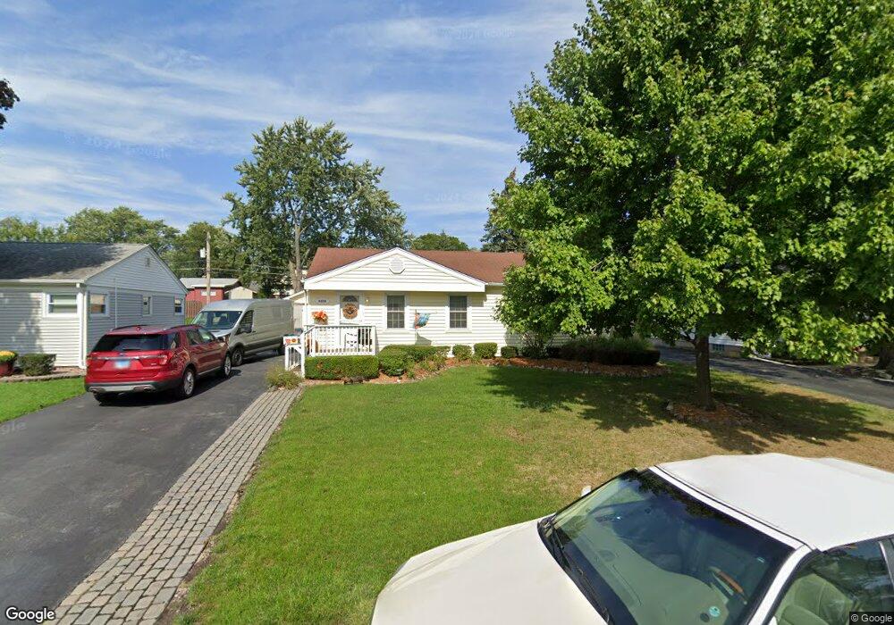
6606 Maple Lane Dr Tinley Park, IL 60477
Parkside-Bedford Park NeighborhoodEstimated Value: $286,229 - $325,000
3
Beds
1
Bath
1,251
Sq Ft
$243/Sq Ft
Est. Value
About This Home
This home is located at 6606 Maple Lane Dr, Tinley Park, IL 60477 and is currently estimated at $304,557, approximately $243 per square foot. 6606 Maple Lane Dr is a home located in Cook County with nearby schools including Fulton Elementary School, Central Middle School, and Tinley Park High School.
Ownership History
Date
Name
Owned For
Owner Type
Purchase Details
Closed on
Nov 30, 2007
Sold by
Huizenga Brian J and Huizenga Katherine J
Bought by
Smith David L and Maugeri Jayne
Current Estimated Value
Home Financials for this Owner
Home Financials are based on the most recent Mortgage that was taken out on this home.
Original Mortgage
$75,000
Outstanding Balance
$47,496
Interest Rate
6.31%
Mortgage Type
Unknown
Estimated Equity
$257,061
Create a Home Valuation Report for This Property
The Home Valuation Report is an in-depth analysis detailing your home's value as well as a comparison with similar homes in the area
Home Values in the Area
Average Home Value in this Area
Purchase History
| Date | Buyer | Sale Price | Title Company |
|---|---|---|---|
| Smith David L | $230,000 | Multiple |
Source: Public Records
Mortgage History
| Date | Status | Borrower | Loan Amount |
|---|---|---|---|
| Open | Smith David L | $75,000 |
Source: Public Records
Tax History Compared to Growth
Tax History
| Year | Tax Paid | Tax Assessment Tax Assessment Total Assessment is a certain percentage of the fair market value that is determined by local assessors to be the total taxable value of land and additions on the property. | Land | Improvement |
|---|---|---|---|---|
| 2024 | $2,552 | $21,000 | $3,510 | $17,490 |
| 2023 | $3,297 | $21,000 | $3,510 | $17,490 |
| 2022 | $3,297 | $15,668 | $3,120 | $12,548 |
| 2021 | $3,178 | $15,667 | $3,120 | $12,547 |
| 2020 | $2,937 | $15,667 | $3,120 | $12,547 |
| 2019 | $3,268 | $16,956 | $2,925 | $14,031 |
| 2018 | $3,240 | $16,956 | $2,925 | $14,031 |
| 2017 | $3,204 | $16,956 | $2,925 | $14,031 |
| 2016 | $5,192 | $14,495 | $2,535 | $11,960 |
| 2015 | $5,037 | $14,495 | $2,535 | $11,960 |
| 2014 | $5,005 | $14,495 | $2,535 | $11,960 |
| 2013 | $5,230 | $16,284 | $2,535 | $13,749 |
Source: Public Records
Map
Nearby Homes
- 16903 Oak Park Ave
- 6666 Ravinia Dr
- 6815 169th St
- 6337 Carlsbad Dr Unit 2
- 16966 Forest Glen Dr
- 6241 Gaynelle Rd
- 16961 Forest Glen Dr
- 16957 Sayre Ave
- 16411 Oxford Dr
- 7025 167th St Unit B
- 6931 Coachwood Trail
- 7101 166th St Unit 1C
- LINCOLN Plan at Oak Ridge - Townhomes
- GARFIELD Plan at Oak Ridge - Townhomes
- 7124 168th St
- HENLEY Plan at Oak Ridge - Traditional Single Family
- COVENTRY Plan at Oak Ridge - Traditional Single Family
- FAIRFIELD Plan at Oak Ridge - Traditional Single Family
- Bellamy Plan at Oak Ridge - Traditional Single Family
- 16726 Westwind Ct
- 6612 Maple Lane Dr
- 6600 Maple Lane Dr
- 6560 Maple Lane Dr
- 6618 Maple Lane Dr
- 6613 Parkside Dr
- 6607 Parkside Dr
- 6601 Parkside Dr
- 6624 Maple Lane Dr
- 6607 Maple Lane Dr
- 6561 Parkside Dr
- 6613 Maple Lane Dr
- 6625 Parkside Dr
- 6601 Maple Lane Dr
- 6561 Maple Lane Dr
- 6548 Maple Lane Dr
- 6630 Maple Lane Dr
- 6555 Parkside Dr
- 6631 Parkside Dr
- 6625 Maple Lane Dr
- 6555 Maple Lane Dr