Estimated Value: $240,424 - $263,000
3
Beds
2
Baths
904
Sq Ft
$281/Sq Ft
Est. Value
About This Home
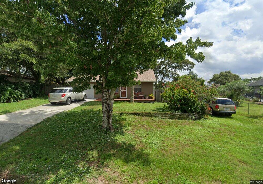
This home is located at 6609 Cecil Rd, Cocoa, FL 32927 and is currently estimated at $253,856, approximately $280 per square foot. 6609 Cecil Rd is a home located in Brevard County with nearby schools including Enterprise Elementary School, Space Coast Junior/Senior High School, and Sculptor Charter School.
Ownership History
Date
Name
Owned For
Owner Type
Purchase Details
Closed on
May 13, 2016
Sold by
Cunnigham Kandy B
Bought by
Cunningham Kandy L and The Kaandy L Cunningham Revoca
Current Estimated Value
Purchase Details
Closed on
May 1, 2016
Bought by
Kandy L Cunningham Revocable T
Purchase Details
Closed on
Mar 1, 2016
Bought by
Kandy L Cunningham Revocable T
Purchase Details
Closed on
Dec 1, 2003
Sold by
Landers Zaida
Bought by
Cunningham Thomas A and Cunningham Kandy B
Home Financials for this Owner
Home Financials are based on the most recent Mortgage that was taken out on this home.
Original Mortgage
$64,000
Interest Rate
6.07%
Create a Home Valuation Report for This Property
The Home Valuation Report is an in-depth analysis detailing your home's value as well as a comparison with similar homes in the area
Home Values in the Area
Average Home Value in this Area
Purchase History
| Date | Buyer | Sale Price | Title Company |
|---|---|---|---|
| Cunningham Kandy L | -- | None Available | |
| Kandy L Cunningham Revocable T | $100 | -- | |
| Kandy L Cunningham Revocable T | -- | -- | |
| Cunningham Thomas A | $80,000 | Security First Title Partner |
Source: Public Records
Mortgage History
| Date | Status | Borrower | Loan Amount |
|---|---|---|---|
| Previous Owner | Cunningham Thomas A | $64,000 |
Source: Public Records
Tax History
| Year | Tax Paid | Tax Assessment Tax Assessment Total Assessment is a certain percentage of the fair market value that is determined by local assessors to be the total taxable value of land and additions on the property. | Land | Improvement |
|---|---|---|---|---|
| 2025 | $2,914 | $189,040 | -- | -- |
| 2024 | $2,809 | $192,180 | -- | -- |
| 2023 | $2,809 | $180,300 | $52,000 | $128,300 |
| 2022 | $2,615 | $171,510 | $0 | $0 |
| 2021 | $841 | $58,350 | $0 | $0 |
| 2020 | $808 | $57,550 | $0 | $0 |
| 2019 | $755 | $56,260 | $0 | $0 |
| 2018 | $1,608 | $98,570 | $27,000 | $71,570 |
| 2017 | $1,514 | $85,930 | $24,000 | $61,930 |
| 2016 | $1,413 | $72,540 | $18,000 | $54,540 |
| 2015 | $1,341 | $55,860 | $15,000 | $40,860 |
| 2014 | $1,226 | $50,790 | $11,000 | $39,790 |
Source: Public Records
Map
Nearby Homes
- 6450 Ember Ave
- 00 Unknown
- 6615 Dock Ave
- 6760 Cairo Rd
- 6815 Bryant Rd
- 5095 Hogan Place
- 6581 Bancroft Ave
- 6481 La Brea Ave
- 6438 Hudson Rd
- 6620 Grissom Pkwy
- 0000 Grissom Pkwy
- 5220 Holden Rd
- 6375 Cable Ave
- 5215 Holden Rd
- 5680 Banos Ave
- 5715 Fairbridge St
- 5555 Brandon St
- 7065 Hundred Acre Dr
- 5155 Mayflower St
- 5221 Carrick Rd
- 6617 Cecil Rd
- 6575 Elliott Ave
- 6565 Elliott Ave
- 5360 Curtis Blvd
- 5330 Curtis Blvd Unit 7
- 6600 Cecil Rd
- 6633 Cecil Rd
- 6620 Cecil Rd
- 5300 Curtis Blvd
- 6555 Elliot Ave
- 6555 Elliott Ave
- 5290 Curtis Blvd
- 6580 Elliott Ave
- 6570 Elliott Ave
- 6590 Elliott Ave
- 6665 Cairo Rd
- 6671 Cairo Rd
- 6560 Elliott Ave
- 6641 Cecil Rd
- 6600 Elliott Ave
Your Personal Tour Guide
Ask me questions while you tour the home.