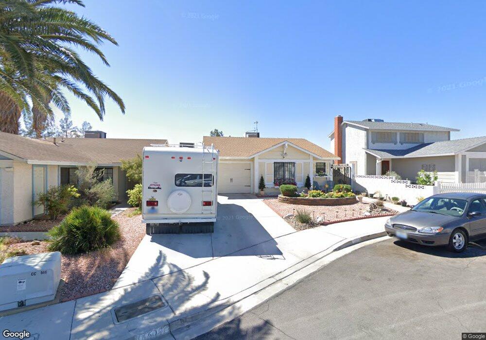
6609 Dunsmuir Cir Las Vegas, NV 89108
Michael Way NeighborhoodEstimated Value: $341,479 - $383,000
3
Beds
2
Baths
1,304
Sq Ft
$275/Sq Ft
Est. Value
About This Home
This home is located at 6609 Dunsmuir Cir, Las Vegas, NV 89108 and is currently estimated at $358,120, approximately $274 per square foot. 6609 Dunsmuir Cir is a home located in Clark County with nearby schools including Lilly & Wing Fong Elementary School, J. Harold Brinley Middle School, and Western High School.
Ownership History
Date
Name
Owned For
Owner Type
Purchase Details
Closed on
Apr 30, 2019
Sold by
Barry James Naft Living Trust
Bought by
Bjn Living Trust
Current Estimated Value
Purchase Details
Closed on
Aug 6, 2014
Sold by
Naft Barry J
Bought by
Naft Barry James and Barry James Naft Living Trust
Purchase Details
Closed on
Jan 25, 2013
Sold by
Naft Barry J
Bought by
Naft Mildred H
Purchase Details
Closed on
Oct 14, 2004
Sold by
Naft Mildred H
Bought by
Naft Barry J
Purchase Details
Closed on
May 1, 2002
Sold by
Naft Robin L
Bought by
Naft Barry James
Purchase Details
Closed on
Apr 12, 2002
Sold by
Naft Barry James
Bought by
Naft Mildred H and The Naft Trust
Create a Home Valuation Report for This Property
The Home Valuation Report is an in-depth analysis detailing your home's value as well as a comparison with similar homes in the area
Home Values in the Area
Average Home Value in this Area
Purchase History
| Date | Buyer | Sale Price | Title Company |
|---|---|---|---|
| Bjn Living Trust | -- | None Available | |
| Naft Barry James | -- | None Available | |
| Naft Mildred H | -- | None Available | |
| Naft Barry J | -- | -- | |
| Naft Mildred H | -- | -- | |
| Naft Barry James | -- | Lawyers Title | |
| Naft Mildred H | -- | Lawyers Title |
Source: Public Records
Tax History Compared to Growth
Tax History
| Year | Tax Paid | Tax Assessment Tax Assessment Total Assessment is a certain percentage of the fair market value that is determined by local assessors to be the total taxable value of land and additions on the property. | Land | Improvement |
|---|---|---|---|---|
| 2025 | $1,112 | $56,774 | $24,150 | $32,624 |
| 2024 | $1,080 | $56,774 | $24,150 | $32,624 |
| 2023 | $1,080 | $57,879 | $26,600 | $31,279 |
| 2022 | $1,049 | $50,236 | $21,350 | $28,886 |
| 2021 | $1,018 | $47,540 | $19,950 | $27,590 |
| 2020 | $986 | $46,167 | $18,550 | $27,617 |
| 2019 | $974 | $42,475 | $15,050 | $27,425 |
| 2018 | $929 | $38,326 | $11,900 | $26,426 |
| 2017 | $1,106 | $33,736 | $10,850 | $22,886 |
| 2016 | $754 | $32,143 | $8,750 | $23,393 |
| 2015 | $751 | $26,994 | $5,950 | $21,044 |
| 2014 | $699 | $20,692 | $4,900 | $15,792 |
Source: Public Records
Map
Nearby Homes
- 6631 Frosted Harvest Ave
- 1701 Goodrich Cir
- 1630 Harvest Pecan Ct
- 6612 Belcamp Cir Unit 1
- 1801 Marathon Dr
- 1646 Discus Dr
- 6633 Gazelle Dr
- 1909 Betsy Ross Dr
- 6637 Lund Dr
- 1436 Padre Bay Dr
- 6520 Lombard Dr
- 1325 Nugget Creek Dr
- 1816 N Torrey Pines Dr
- 6400 Starcrest Dr
- 1624 N Torrey Pines Dr Unit 104
- 1620 N Torrey Pines Dr Unit 203
- 1608 N Torrey Pines Dr Unit 103
- 1600 N Torrey Pines Dr Unit 101
- 1600 N Torrey Pines Dr Unit 202
- 6500 W Lake Mead Blvd Unit 227
- 6605 Dunsmuir Cir
- 6613 Dunsmuir Cir
- 6601 Dunsmuir Cir
- 6608 Crockett Cir
- 6604 Crockett Cir
- 6612 Crockett Cir
- 1666 Crisp Pear Ct
- 1660 Crisp Pear Ct
- 1672 Crisp Pear Ct
- 6600 Crockett Cir
- 1654 Crisp Pear Ct
- 1701 Kismet Cir Unit n/a
- 1701 Kismet Cir
- 1648 Crisp Pear Ct
- 6604 Dunsmuir Cir
- 6612 Dunsmuir Cir
- 6608 Dunsmuir Cir
- 1705 Kismet Cir
- 6600 Dunsmuir Cir
- 1642 Crisp Pear Ct