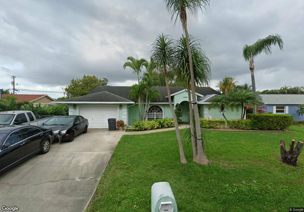
6609 Massachusetts Dr Lake Worth, FL 33462
Estimated Value: $485,000 - $588,000
--
Bed
2
Baths
2,219
Sq Ft
$242/Sq Ft
Est. Value
About This Home
This home is located at 6609 Massachusetts Dr, Lake Worth, FL 33462 and is currently estimated at $535,917, approximately $241 per square foot. 6609 Massachusetts Dr is a home located in Palm Beach County with nearby schools including Santaluces Community High School, Starlight Cove Elementary School, and Lantana Middle School.
Ownership History
Date
Name
Owned For
Owner Type
Purchase Details
Closed on
Dec 12, 2009
Sold by
Bolko Ryszard and Bolko Rafal
Bought by
Bolko Rafal and Bolko Ryszard
Current Estimated Value
Purchase Details
Closed on
Aug 4, 2006
Sold by
Bolko Boleslaw and Bolko Maria
Bought by
Bolko Rafal and Bolko Maria
Purchase Details
Closed on
Aug 23, 2001
Sold by
Mauermann Roger P and Mauermann Debra R
Bought by
Bolko Boleslaw and Bolko Maria
Home Financials for this Owner
Home Financials are based on the most recent Mortgage that was taken out on this home.
Original Mortgage
$126,900
Interest Rate
6.97%
Purchase Details
Closed on
Jul 8, 1993
Sold by
Holder Mary V
Bought by
Hauermann Roger P and Hauermann Debra R
Create a Home Valuation Report for This Property
The Home Valuation Report is an in-depth analysis detailing your home's value as well as a comparison with similar homes in the area
Home Values in the Area
Average Home Value in this Area
Purchase History
| Date | Buyer | Sale Price | Title Company |
|---|---|---|---|
| Bolko Rafal | -- | None Available | |
| Bolko Rafal | $25,000 | None Available | |
| Bolko Boleslaw | $141,000 | Universal Land Title Inc | |
| Hauermann Roger P | $20,000 | -- |
Source: Public Records
Mortgage History
| Date | Status | Borrower | Loan Amount |
|---|---|---|---|
| Previous Owner | Bolko Boleslaw | $126,900 |
Source: Public Records
Tax History Compared to Growth
Tax History
| Year | Tax Paid | Tax Assessment Tax Assessment Total Assessment is a certain percentage of the fair market value that is determined by local assessors to be the total taxable value of land and additions on the property. | Land | Improvement |
|---|---|---|---|---|
| 2024 | $3,428 | $190,426 | -- | -- |
| 2023 | $3,337 | $184,880 | $0 | $0 |
| 2022 | $3,375 | $179,495 | $0 | $0 |
| 2021 | $3,315 | $174,267 | $0 | $0 |
| 2020 | $3,280 | $171,861 | $0 | $0 |
| 2019 | $3,247 | $167,997 | $0 | $0 |
| 2018 | $3,015 | $164,865 | $0 | $0 |
| 2017 | $2,965 | $161,474 | $0 | $0 |
| 2016 | $2,962 | $158,153 | $0 | $0 |
| 2015 | $3,016 | $157,054 | $0 | $0 |
| 2014 | $3,029 | $155,808 | $0 | $0 |
Source: Public Records
Map
Nearby Homes
- 2829 Northside Dr
- 2815 Northside Dr
- 2718 Northside Dr
- 2745 Cambridge Rd
- 3187 Buccaneer Rd
- 6289 Lear Dr Unit 301
- 6289 Lear Dr Unit 308
- 6289 Lear Dr Unit 306
- 6289 Lear Dr Unit 403
- 2623 Northside Dr
- 2878 Donnelly 106 Dr Unit 106
- 6858 S Congress Ave
- 3267 Hurricane Dr
- 3298 Plaza Place
- 6607 Eastview Dr
- 2886 Floral Rd
- 6719 Eastview Dr
- 3374 Parade Place
- 3229 Starboard Dr
- 6604 Eastview Dr
- 6595 Massachusetts Dr
- 6623 Massachusetts Dr
- 6608 S Congress Ave
- 6594 S Congress Ave
- 6622 S Congress Ave
- 6570 Massachusetts Dr
- 6608 Massachusetts Dr
- 2959 Somerset Rd
- 6622 Massachusetts Dr
- 6594 Massachusetts Dr
- 6580 S Congress Ave
- 2981 Somerset Rd
- 6567 Massachusetts Dr
- 6640 Massachusetts Dr
- 6584 Massachusetts Dr
- 6566 S Congress Ave
- 0 Massachusetts Dr
- 2889 Somerset Rd
- 6663 Massachusetts Dr
- 6551 Massachusetts Dr