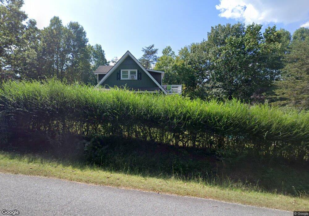
661 Alfred Taylor Dr Demorest, GA 30535
Estimated Value: $214,895 - $337,000
2
Beds
2
Baths
1,434
Sq Ft
$182/Sq Ft
Est. Value
About This Home
This home is located at 661 Alfred Taylor Dr, Demorest, GA 30535 and is currently estimated at $260,724, approximately $181 per square foot. 661 Alfred Taylor Dr is a home located in Habersham County with nearby schools including Fairview Elementary School, North Habersham Middle School, and Habersham Success Academy.
Ownership History
Date
Name
Owned For
Owner Type
Purchase Details
Closed on
Dec 20, 2019
Sold by
Lowe Denver Randall
Bought by
Nathan Sharon K
Current Estimated Value
Purchase Details
Closed on
Jan 10, 2014
Sold by
Welch Beverly Ann
Bought by
Lowe Denver Randall
Home Financials for this Owner
Home Financials are based on the most recent Mortgage that was taken out on this home.
Original Mortgage
$60,000
Interest Rate
4.44%
Mortgage Type
New Conventional
Create a Home Valuation Report for This Property
The Home Valuation Report is an in-depth analysis detailing your home's value as well as a comparison with similar homes in the area
Home Values in the Area
Average Home Value in this Area
Purchase History
| Date | Buyer | Sale Price | Title Company |
|---|---|---|---|
| Nathan Sharon K | $132,979 | -- | |
| Lowe Denver Randall | $30,000 | -- |
Source: Public Records
Mortgage History
| Date | Status | Borrower | Loan Amount |
|---|---|---|---|
| Previous Owner | Lowe Denver Randall | $60,000 |
Source: Public Records
Tax History
| Year | Tax Paid | Tax Assessment Tax Assessment Total Assessment is a certain percentage of the fair market value that is determined by local assessors to be the total taxable value of land and additions on the property. | Land | Improvement |
|---|---|---|---|---|
| 2025 | $1,338 | $81,948 | $16,000 | $65,948 |
| 2024 | -- | $73,120 | $12,000 | $61,120 |
| 2023 | $743 | $62,460 | $12,000 | $50,460 |
| 2022 | $1,347 | $51,652 | $8,000 | $43,652 |
| 2021 | $1,163 | $44,792 | $6,000 | $38,792 |
| 2020 | $1,003 | $37,300 | $4,000 | $33,300 |
| 2019 | $818 | $30,368 | $4,000 | $26,368 |
| 2018 | $811 | $30,368 | $4,000 | $26,368 |
| 2017 | $753 | $28,036 | $4,000 | $24,036 |
| 2016 | $731 | $70,090 | $4,000 | $24,036 |
| 2015 | $722 | $70,090 | $4,000 | $24,036 |
| 2014 | $589 | $66,400 | $3,200 | $23,360 |
| 2013 | -- | $24,420 | $3,200 | $21,220 |
Source: Public Records
Map
Nearby Homes
- 474 White Pine Cir
- 239 Cool Springs Lot #8 Rd
- 239 Cool Springs Rd Unit LOT 8
- 244 Stone Hedge Dr
- 244 Stonehedge Dr
- 600 Smith Fork Dr
- 5074 Highway 255 S Unit 2
- 5074 Highway 255 S
- 2446 Dean Mountain Rd
- 125 Rainbow Cir
- 125 AND 87 Rainbow Cir
- 515 Cool Springs Rd
- 2239 Dean Mountain Rd
- 552 LOT 47 Riverside Dr
- 618 Riverside Dr
- 1045 Fairview School Rd
- 110 Corbett York Rd
- 0 Amys Ford Trail Unit 10667130
- 1008 River Estates Rd
- 2123 Goat Neck Rd
- 695 Alfred Taylor Dr
- 650 Alfred Taylor Rd
- 571 White Pine Cir
- 637 White Pine Cir
- 645 Alfred Taylor Dr
- 745 Alfred Taylor Dr
- 510 White Pine Cir
- 668 Alfred Taylor Dr
- 525 White Pine Cir
- 748 Alfred Taylor Dr
- 404 Mandys Cove Dr
- 509 White Pine Cir
- 623 Alfred Taylor Rd Unit 35
- 623 Alfred Taylor Rd
- Lot 16 White Pine Cir
- 0 White Pine Cir Unit 16 7267908
- 0 White Pine Cir Unit 10197489
- 0 White Pine Cir Unit 10143040
- 0 White Pine Cir Unit 10137077
- 0 White Pine Cir Unit 10137068
Your Personal Tour Guide
Ask me questions while you tour the home.