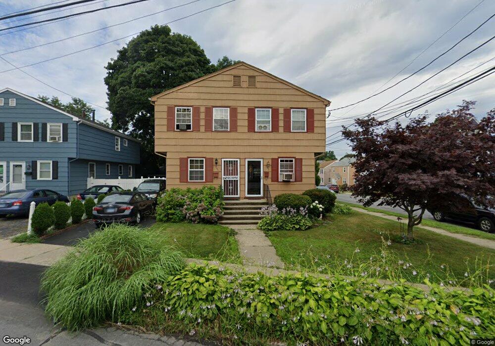
661 Ellsworth St Bridgeport, CT 06605
Black Rock NeighborhoodEstimated Value: $256,000 - $412,000
3
Beds
2
Baths
1,232
Sq Ft
$288/Sq Ft
Est. Value
About This Home
This home is located at 661 Ellsworth St, Bridgeport, CT 06605 and is currently estimated at $355,263, approximately $288 per square foot. 661 Ellsworth St is a home located in Fairfield County with nearby schools including Black Rock School, Bassick High School, and Park City Prep Charter School.
Ownership History
Date
Name
Owned For
Owner Type
Purchase Details
Closed on
Jan 12, 1999
Sold by
Joseph Jean R and Joseph Claudie
Bought by
Querette Ronald
Current Estimated Value
Home Financials for this Owner
Home Financials are based on the most recent Mortgage that was taken out on this home.
Original Mortgage
$68,100
Outstanding Balance
$14,421
Interest Rate
6.8%
Estimated Equity
$340,842
Purchase Details
Closed on
Dec 21, 1987
Sold by
Mast Robt
Bought by
Dorman Diane
Create a Home Valuation Report for This Property
The Home Valuation Report is an in-depth analysis detailing your home's value as well as a comparison with similar homes in the area
Home Values in the Area
Average Home Value in this Area
Purchase History
| Date | Buyer | Sale Price | Title Company |
|---|---|---|---|
| Querette Ronald | $70,000 | -- | |
| Querette Ronald | $70,000 | -- | |
| Dorman Diane | $132,000 | -- |
Source: Public Records
Mortgage History
| Date | Status | Borrower | Loan Amount |
|---|---|---|---|
| Open | Dorman Diane | $25,000 | |
| Closed | Dorman Diane | $6,220 | |
| Open | Dorman Diane | $68,100 | |
| Closed | Dorman Diane | $68,100 |
Source: Public Records
Tax History
| Year | Tax Paid | Tax Assessment Tax Assessment Total Assessment is a certain percentage of the fair market value that is determined by local assessors to be the total taxable value of land and additions on the property. | Land | Improvement |
|---|---|---|---|---|
| 2025 | $7,151 | $164,575 | $69,465 | $95,110 |
| 2024 | $7,151 | $164,575 | $69,465 | $95,110 |
| 2023 | $7,151 | $164,575 | $69,465 | $95,110 |
| 2022 | $7,151 | $164,575 | $69,465 | $95,110 |
| 2021 | $7,151 | $164,575 | $69,465 | $95,110 |
| 2020 | $5,779 | $107,030 | $45,120 | $61,910 |
| 2019 | $5,779 | $107,030 | $45,120 | $61,910 |
| 2018 | $5,819 | $107,030 | $45,120 | $61,910 |
| 2017 | $5,819 | $107,030 | $45,120 | $61,910 |
| 2016 | $5,819 | $107,030 | $45,120 | $61,910 |
| 2015 | $5,035 | $119,310 | $37,910 | $81,400 |
| 2014 | $5,035 | $119,310 | $37,910 | $81,400 |
Source: Public Records
Map
Nearby Homes
- 287 Hansen Ave
- 31 Whittier St
- 75 Hemlock St
- 25 Whittier St
- 188 Monroe St Unit 190
- 115 King St Unit 117
- 22 Monroe St Unit 24
- 855 Brewster St Unit 857
- 78 Rowsley St Unit 4
- 78 Haddon St Unit 1
- 118 Berwick Ave
- 130 Brentwood Ave
- 27 Nash Ln Unit 5
- 156 Halley Ave
- 145 Brentwood Ave
- 554 Brewster St Unit 4
- 132 Bennett St Unit 302
- 187 Halley Ave
- 165 Bennett St
- 57 Hibiscus St Unit 1
- 663 Ellsworth St
- 649 Ellsworth St
- 647 Ellsworth St
- 85 Crowther Ave
- 39 Crowther Ave
- 691 Ellsworth St
- 94 Crowther Ave Unit 1
- 94 Crowther Ave Unit 2
- 86 Crowther Ave Unit 3
- 86 Crowther Ave
- 599 Ellsworth St Unit 601
- 2 Crowther Ave
- 662 Ellsworth St Unit 664
- 593 Ellsworth St Unit 595
- 652 Ellsworth St
- 47 Crowther Ave
- 693 Ellsworth St Unit 695
- 192 Martin Terrace Unit 196
- 44 Crowther Ave
- 34 Crowther Ave Unit 36
Your Personal Tour Guide
Ask me questions while you tour the home.