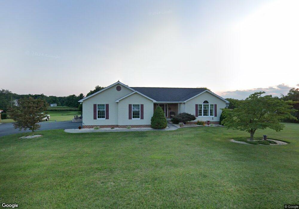
661 Kindig Rd Unit 14 Littlestown, PA 17340
Estimated Value: $379,000 - $478,000
3
Beds
2
Baths
2,015
Sq Ft
$216/Sq Ft
Est. Value
About This Home
This home is located at 661 Kindig Rd Unit 14, Littlestown, PA 17340 and is currently estimated at $434,806, approximately $215 per square foot. 661 Kindig Rd Unit 14 is a home located in Adams County with nearby schools including Rolling Acres El School, Maple Avenue Middle School, and Littlestown Senior High School.
Ownership History
Date
Name
Owned For
Owner Type
Purchase Details
Closed on
Oct 15, 2014
Sold by
Storey Brian J and Storey Brenda K
Bought by
Storey Brian J and Storey Brenda K
Current Estimated Value
Purchase Details
Closed on
May 14, 1998
Bought by
Storey Brian J and Storey Brenda K
Create a Home Valuation Report for This Property
The Home Valuation Report is an in-depth analysis detailing your home's value as well as a comparison with similar homes in the area
Home Values in the Area
Average Home Value in this Area
Purchase History
| Date | Buyer | Sale Price | Title Company |
|---|---|---|---|
| Storey Brian J | -- | None Available | |
| Storey Brian J | $33,900 | -- |
Source: Public Records
Tax History Compared to Growth
Tax History
| Year | Tax Paid | Tax Assessment Tax Assessment Total Assessment is a certain percentage of the fair market value that is determined by local assessors to be the total taxable value of land and additions on the property. | Land | Improvement |
|---|---|---|---|---|
| 2025 | $6,458 | $341,200 | $149,300 | $191,900 |
| 2024 | $6,208 | $341,200 | $149,300 | $191,900 |
| 2023 | $6,051 | $341,200 | $149,300 | $191,900 |
| 2022 | $6,007 | $341,200 | $149,300 | $191,900 |
| 2021 | $5,794 | $341,200 | $149,300 | $191,900 |
| 2020 | $5,710 | $341,200 | $149,300 | $191,900 |
| 2019 | $5,587 | $341,200 | $149,300 | $191,900 |
| 2018 | $5,421 | $341,200 | $149,300 | $191,900 |
| 2017 | $5,252 | $341,200 | $149,300 | $191,900 |
| 2016 | -- | $317,200 | $149,300 | $167,900 |
| 2015 | -- | $305,800 | $135,400 | $170,400 |
| 2014 | -- | $305,800 | $135,400 | $170,400 |
Source: Public Records
Map
Nearby Homes
- LOT 9 Mehring Rd
- 567 Lumber St
- 559 Lumber St
- 535 Lumber St
- 241 M St
- 2100 Blacks School House Rd
- 1175 Bollinger Rd
- 43 Ashfield Dr Unit 14
- 22 Cemetery St
- 61 E King St
- 106 E King St
- 41 Smith Cir
- 115 Charles St
- 117 Charles St
- 1 Hickory Ln
- 893 Georgetown Rd
- 15 Yorktowne Ct Unit 97
- 22 Rita Marie Ave
- 2199 Blacks School House Rd
- 162 Newark St
- 655 Kindig Rd Unit 15
- 645 Kindig Rd Unit 16
- 15 Logan Cir
- 291 Lucas Dr
- 16 Logan Cir
- 316 Lucas Dr
- 49 Logan Cir
- 45 Logan Cir
- 51 Logan Cir
- 46 Logan Cir Unit 17
- 725 Kindig Rd Unit 13
- 720 Kindig Rd Unit 1
- 280 Lucas Dr
- 48 Logan Cir
- 250 Bollinger Rd Unit 2
- 660 Kindig Rd
- 240 Lucas Dr
- 730 Kindig Rd Unit 2
- 745 Kindig Rd Unit 12
- 74 Logan Cir Unit 18