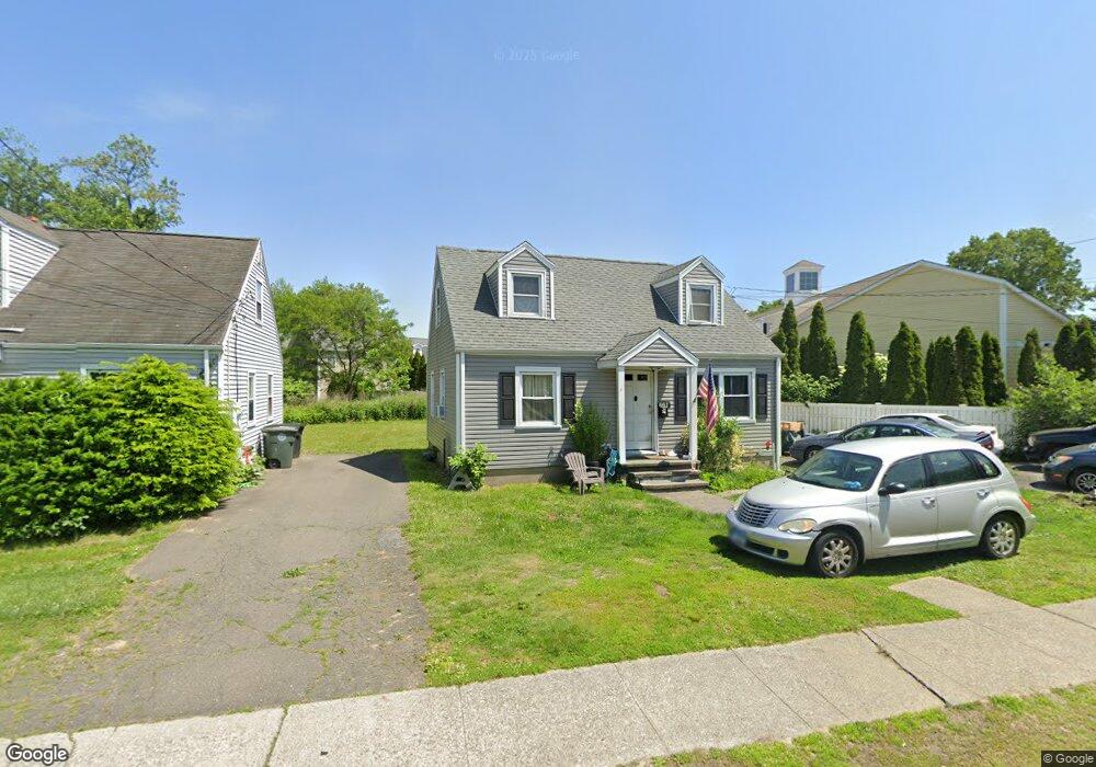
661 Milford Point Rd Milford, CT 06460
Devon NeighborhoodEstimated Value: $408,000 - $452,000
3
Beds
1
Bath
1,116
Sq Ft
$378/Sq Ft
Est. Value
About This Home
This home is located at 661 Milford Point Rd, Milford, CT 06460 and is currently estimated at $421,881, approximately $378 per square foot. 661 Milford Point Rd is a home located in New Haven County with nearby schools including Meadowside School, West Shore Middle School, and Jonathan Law High School.
Ownership History
Date
Name
Owned For
Owner Type
Purchase Details
Closed on
Nov 30, 2017
Sold by
Jaser Spiser S
Bought by
Jaser Sultaneh S
Current Estimated Value
Purchase Details
Closed on
Nov 30, 1994
Sold by
Jaser George J
Bought by
Jaser Spiser S and Jaser Sultaneh S
Create a Home Valuation Report for This Property
The Home Valuation Report is an in-depth analysis detailing your home's value as well as a comparison with similar homes in the area
Home Values in the Area
Average Home Value in this Area
Purchase History
| Date | Buyer | Sale Price | Title Company |
|---|---|---|---|
| Jaser Sultaneh S | -- | -- | |
| Jaser Sultaneh S | -- | -- | |
| Jaser Spiser S | $70,000 | -- | |
| Jaser Spiser S | $70,000 | -- |
Source: Public Records
Mortgage History
| Date | Status | Borrower | Loan Amount |
|---|---|---|---|
| Previous Owner | Jaser Spiser S | $206,820 |
Source: Public Records
Tax History Compared to Growth
Tax History
| Year | Tax Paid | Tax Assessment Tax Assessment Total Assessment is a certain percentage of the fair market value that is determined by local assessors to be the total taxable value of land and additions on the property. | Land | Improvement |
|---|---|---|---|---|
| 2025 | $5,739 | $194,230 | $88,220 | $106,010 |
| 2024 | $5,660 | $194,230 | $88,220 | $106,010 |
| 2023 | $5,277 | $194,230 | $88,220 | $106,010 |
| 2022 | $5,176 | $194,230 | $88,220 | $106,010 |
| 2021 | $4,296 | $155,360 | $53,520 | $101,840 |
| 2020 | $4,300 | $155,360 | $53,520 | $101,840 |
| 2019 | $4,305 | $155,360 | $53,520 | $101,840 |
| 2018 | $4,310 | $155,360 | $53,520 | $101,840 |
| 2017 | $4,317 | $155,360 | $53,520 | $101,840 |
| 2016 | $4,302 | $154,520 | $53,520 | $101,000 |
| 2015 | $4,308 | $154,520 | $53,520 | $101,000 |
| 2014 | $4,206 | $154,520 | $53,520 | $101,000 |
Source: Public Records
Map
Nearby Homes
- 18 Dewey Ave
- 15 Pickett St
- 775 Milford Point Rd
- 82 Miller Ave
- 47 Peak Ave
- 6 Spindrift Ln
- 151 Naugatuck Ave
- 10 Eastern Pkwy
- 0 Saco St
- 98 Naugatuck Ave
- 20 York St
- 96 Naugatuck Ave
- 12 Woodland Dr
- 42 Devonshire Rd
- 261 Bridgeport Ave
- 63 Stowe Ave
- 27 S Kerema Ave
- 58 Laurel Ave
- 47 Beach Shore Dr Unit 47
- 66 Birch Ave
- 663 Milford Point Rd
- 666 Milford Point Rd
- 658 Milford Point Rd
- 675 Milford Point Rd
- 303 Naugatuck Ave Unit 3
- 303 Naugatuck Ave Unit d20
- 303 Naugatuck Ave Unit d-19
- 303 Naugatuck Ave Unit 4
- 303 Naugatuck Ave
- 668 Milford Point Rd
- 654 Milford Point Rd
- 650 Milford Point Rd
- 673 Milford Point Rd
- 18 Lincoln Ave
- 19 Roswell St
- 682 Milford Point Rd
- 284 Naugatuck Ave
- 23 Roswell St
- 13 Roswell St
- 277 Naugatuck Ave