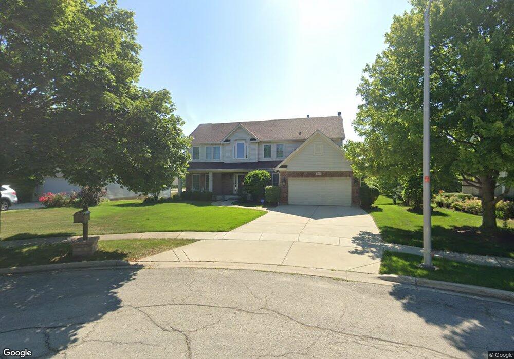
661 Morningside Ct Schaumburg, IL 60173
East Schaumburg NeighborhoodEstimated Value: $804,000 - $873,000
4
Beds
3
Baths
2,896
Sq Ft
$290/Sq Ft
Est. Value
About This Home
This home is located at 661 Morningside Ct, Schaumburg, IL 60173 and is currently estimated at $839,617, approximately $289 per square foot. 661 Morningside Ct is a home located in Cook County with nearby schools including Fairview Elementary School, Helen Keller Junior High School, and J B Conant High School.
Ownership History
Date
Name
Owned For
Owner Type
Purchase Details
Closed on
Aug 26, 1998
Sold by
The Northern Trust Company
Bought by
Kolder Robert and Kolder Lori
Current Estimated Value
Home Financials for this Owner
Home Financials are based on the most recent Mortgage that was taken out on this home.
Original Mortgage
$281,300
Interest Rate
6.88%
Create a Home Valuation Report for This Property
The Home Valuation Report is an in-depth analysis detailing your home's value as well as a comparison with similar homes in the area
Home Values in the Area
Average Home Value in this Area
Purchase History
| Date | Buyer | Sale Price | Title Company |
|---|---|---|---|
| Kolder Robert | $375,500 | Ticor Title |
Source: Public Records
Mortgage History
| Date | Status | Borrower | Loan Amount |
|---|---|---|---|
| Previous Owner | Kolder Robert | $281,300 |
Source: Public Records
Tax History Compared to Growth
Tax History
| Year | Tax Paid | Tax Assessment Tax Assessment Total Assessment is a certain percentage of the fair market value that is determined by local assessors to be the total taxable value of land and additions on the property. | Land | Improvement |
|---|---|---|---|---|
| 2024 | $16,439 | $62,000 | $14,547 | $47,453 |
| 2023 | $15,912 | $62,000 | $14,547 | $47,453 |
| 2022 | $15,912 | $62,000 | $14,547 | $47,453 |
| 2021 | $12,058 | $43,114 | $10,650 | $32,464 |
| 2020 | $11,918 | $43,114 | $10,650 | $32,464 |
| 2019 | $12,847 | $51,359 | $10,650 | $40,709 |
| 2018 | $14,352 | $51,258 | $8,832 | $42,426 |
| 2017 | $14,144 | $51,258 | $8,832 | $42,426 |
| 2016 | $13,469 | $51,258 | $8,832 | $42,426 |
| 2015 | $14,423 | $50,833 | $7,793 | $43,040 |
| 2014 | $14,281 | $50,833 | $7,793 | $43,040 |
| 2013 | $13,897 | $50,833 | $7,793 | $43,040 |
Source: Public Records
Map
Nearby Homes
- 709 Whalom Ln Unit 7A
- 751 Edgelake Point Unit 68C
- 325 Bayview Point Unit 56B
- 465 Apache Ln
- 609 Hanover Ct Unit X1
- 601 Hanover Ct Unit Z2
- 1250 Woodfield Rd
- 600 Eastview Ct Unit X1
- 121 Chatsworth Cir
- 760 Buckeye Dr
- 1535 Columbine Dr Unit 1
- 15 Bar Harbour Rd Unit 4F
- 1527 Lexington Cir
- 22 Ascot Cir
- 28 Ascot Cir
- 700 Cumberland St
- 1300 Woodside Ct Unit B1
- 1257 Rosewood Ct Unit D1
- 350 Newgate Ct Unit 2Z
- 1180 Apple St
- 665 Morningside Ct
- 657 Morningside Ct
- 654 Kathy Ln
- 658 Kathy Ln
- 650 Kathy Ln
- 653 Morningside Ct
- 804 Heatherstone Dr
- 808 Heatherstone Dr
- 658 Morningside Ct
- 800 Heatherstone Dr
- 812 Heatherstone Dr
- 654 Morningside Ct
- 662 Morningside Ct
- 824 Morningside Dr
- 828 Morningside Dr
- 832 Morningside Dr
- 820 Morningside Dr
- 836 Morningside Dr
- 668 Morningside Ct
- 657 Kathy Ln