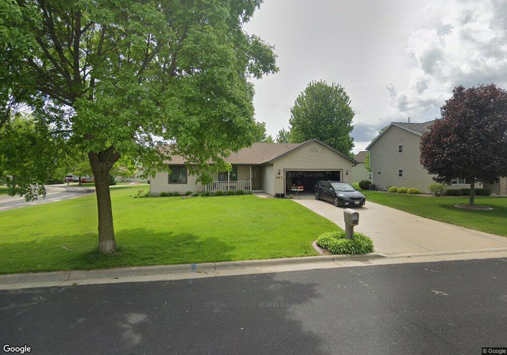
661 Ruxton Ridge Dr Sun Prairie, WI 53590
Northern Sun Prairie NeighborhoodEstimated Value: $382,000 - $420,332
3
Beds
2
Baths
2,077
Sq Ft
$193/Sq Ft
Est. Value
About This Home
This home is located at 661 Ruxton Ridge Dr, Sun Prairie, WI 53590 and is currently estimated at $401,333, approximately $193 per square foot. 661 Ruxton Ridge Dr is a home located in Dane County with nearby schools including Bird Elementary School, Patrick Marsh Middle School, and Peace Lutheran School & Prekindergarten.
Ownership History
Date
Name
Owned For
Owner Type
Purchase Details
Closed on
Nov 29, 2010
Sold by
Heartland Credit Union
Bought by
Pauls Dennis and Pauls Rose M Huber
Current Estimated Value
Home Financials for this Owner
Home Financials are based on the most recent Mortgage that was taken out on this home.
Original Mortgage
$145,200
Interest Rate
4.19%
Mortgage Type
New Conventional
Purchase Details
Closed on
Dec 19, 2006
Sold by
Tataje Edgardo R
Bought by
Heartland Cu
Create a Home Valuation Report for This Property
The Home Valuation Report is an in-depth analysis detailing your home's value as well as a comparison with similar homes in the area
Home Values in the Area
Average Home Value in this Area
Purchase History
| Date | Buyer | Sale Price | Title Company |
|---|---|---|---|
| Pauls Dennis | $181,500 | None Available | |
| Heartland Cu | $196,175 | None Available |
Source: Public Records
Mortgage History
| Date | Status | Borrower | Loan Amount |
|---|---|---|---|
| Previous Owner | Pauls Dennis | $145,200 |
Source: Public Records
Tax History Compared to Growth
Tax History
| Year | Tax Paid | Tax Assessment Tax Assessment Total Assessment is a certain percentage of the fair market value that is determined by local assessors to be the total taxable value of land and additions on the property. | Land | Improvement |
|---|---|---|---|---|
| 2024 | $6,327 | $336,900 | $70,500 | $266,400 |
| 2023 | $5,732 | $336,900 | $70,500 | $266,400 |
| 2021 | $5,229 | $252,700 | $65,000 | $187,700 |
| 2020 | $5,372 | $252,700 | $65,000 | $187,700 |
| 2019 | $5,109 | $214,100 | $59,100 | $155,000 |
| 2018 | $4,739 | $214,100 | $59,100 | $155,000 |
| 2017 | $4,706 | $214,100 | $59,100 | $155,000 |
| 2016 | $4,583 | $188,500 | $52,200 | $136,300 |
| 2015 | $4,437 | $188,500 | $52,200 | $136,300 |
| 2014 | $4,416 | $186,100 | $52,200 | $133,900 |
| 2013 | $4,946 | $186,100 | $52,200 | $133,900 |
Source: Public Records
Map
Nearby Homes
- 633 Stonehaven Dr
- 680 Stonehaven Dr
- 955 Liberty Blvd Unit 103
- 1048 Stonewood Crossing
- 856 Saint Albert the Great Dr Unit 856
- 1171 School St Unit 1171
- 972 Chandler Ln Unit 972
- 994 Chandler Ln
- 952 Chandler Ln Unit 952
- 1046 Stonehaven Dr
- 208 Scenic Ct
- 1325 Bunker Hill Dr Unit 3104
- 6532 N Bird St
- 1180 Patriot Way
- 1010 Andrews Dr
- 1295 Stonehaven Dr
- 1013 Vandenburg St
- 921 Pine St
- 1294 Saint Albert the Great Dr
- 706 Woodland Dr
- 673 Ruxton Ridge Dr
- 671 Grandview Dr
- 680 Grandview Dr
- 658 Ruxton Ridge Dr
- 668 Grandview Dr
- 668 Ruxton Ridge Dr
- 650 Ruxton Ridge Dr
- 663 Grandview Dr
- 676 Ruxton Ridge Dr
- 642 Ruxton Ridge Dr
- 652 Grandview Dr
- 635 Ruxton Ridge Dr
- 684 Ruxton Ridge Dr
- 641 Stonehaven Dr
- Lot 51 Stonewood Crossing
- L1-8 Stonewood Crossing
- L56 Stonewood Crossing
- L55 Stonewood Crossing
- L53 Stonewood Crossing
- L52 Stonewood Crossing