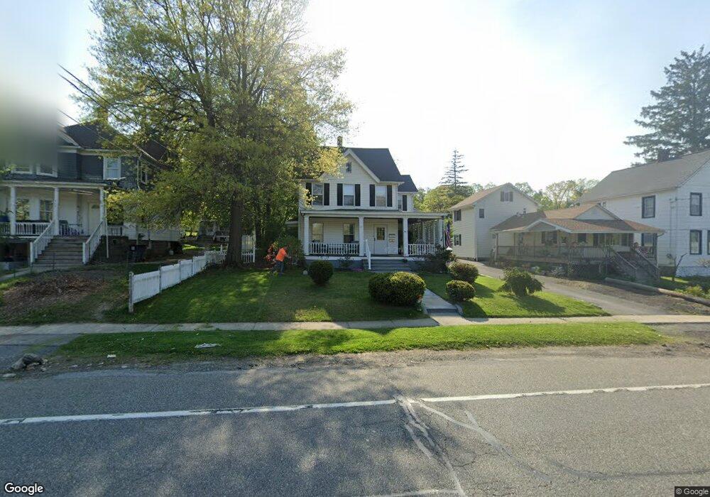
661 State Route 17m Unit 1 Monroe, NY 10950
Estimated Value: $502,263 - $820,000
4
Beds
2
Baths
2,299
Sq Ft
$269/Sq Ft
Est. Value
About This Home
This home is located at 661 State Route 17m Unit 1, Monroe, NY 10950 and is currently estimated at $619,066, approximately $269 per square foot. 661 State Route 17m Unit 1 is a home located in Orange County with nearby schools including Monroe-Woodbury Middle School, Monroe-Woodbury High School, and United Talmudical Academy Of Kiryas Joel.
Ownership History
Date
Name
Owned For
Owner Type
Purchase Details
Closed on
Feb 4, 2022
Sold by
Birish John and Birish Lorraine
Bought by
Daven Gary M and Daven Katie E
Current Estimated Value
Purchase Details
Closed on
Dec 14, 2015
Sold by
Carolan Kevin
Bought by
Stoker Terence J and Stoker S
Home Financials for this Owner
Home Financials are based on the most recent Mortgage that was taken out on this home.
Original Mortgage
$196,000
Interest Rate
3.21%
Mortgage Type
New Conventional
Create a Home Valuation Report for This Property
The Home Valuation Report is an in-depth analysis detailing your home's value as well as a comparison with similar homes in the area
Home Values in the Area
Average Home Value in this Area
Purchase History
| Date | Buyer | Sale Price | Title Company |
|---|---|---|---|
| Daven Gary M | $350,000 | None Available | |
| Stoker Terence J | $245,000 | Lisa Felicissimo |
Source: Public Records
Mortgage History
| Date | Status | Borrower | Loan Amount |
|---|---|---|---|
| Previous Owner | Stoker Terence J | $196,000 |
Source: Public Records
Tax History Compared to Growth
Tax History
| Year | Tax Paid | Tax Assessment Tax Assessment Total Assessment is a certain percentage of the fair market value that is determined by local assessors to be the total taxable value of land and additions on the property. | Land | Improvement |
|---|---|---|---|---|
| 2024 | $10,076 | $40,500 | $13,400 | $27,100 |
| 2023 | $10,076 | $40,500 | $13,400 | $27,100 |
| 2022 | $9,770 | $40,500 | $13,400 | $27,100 |
| 2021 | $9,820 | $40,500 | $13,400 | $27,100 |
| 2020 | $9,829 | $40,500 | $13,400 | $27,100 |
| 2019 | $10,058 | $40,500 | $13,400 | $27,100 |
| 2018 | $10,058 | $40,500 | $13,400 | $27,100 |
| 2017 | $9,212 | $40,500 | $13,400 | $27,100 |
| 2016 | $9,212 | $40,500 | $13,400 | $27,100 |
| 2015 | -- | $40,500 | $13,400 | $27,100 |
| 2014 | -- | $40,500 | $13,400 | $27,100 |
Source: Public Records
Map
Nearby Homes
- 1 Lakes Rd
- 10 Sunset Heights
- 0 Lakes Rd Unit ONEH6277946
- 2 Lakes Rd
- 20 N Main St
- 106 Maple Ave
- 7 Brook Dr
- 6 Brooks Ave
- 32 Center Hill Rd
- 129 Franklin Ave
- 261 Spring St
- 46 Quaker Hill Rd
- 34 Round Lake Ave
- 27 Forshee St
- 26 Silas Seaman St Unit 85
- 23 Highland Ave
- 512 High St
- 3 Forshee St
- 15 Freeland St
- 14 Hidden Creek Blvd
- 663 State Route 17m
- 657 State Route 17m
- 657 Route 17m
- 16 Block Alley
- 665 State Route 17m
- 18 Bridge St
- 14 Block Alley
- 655 State Route 17m
- 20 Bridge St
- 653 State Route 17m
- 59 High St
- 339 Beamer Rd
- 57 High St
- 651 State Route 17m
- 15 Bridge St
- 7 Block Alley
- 65 High St
- 671 Nys Rte 17m
- 671 State Route 17m
- 19 Bridge St