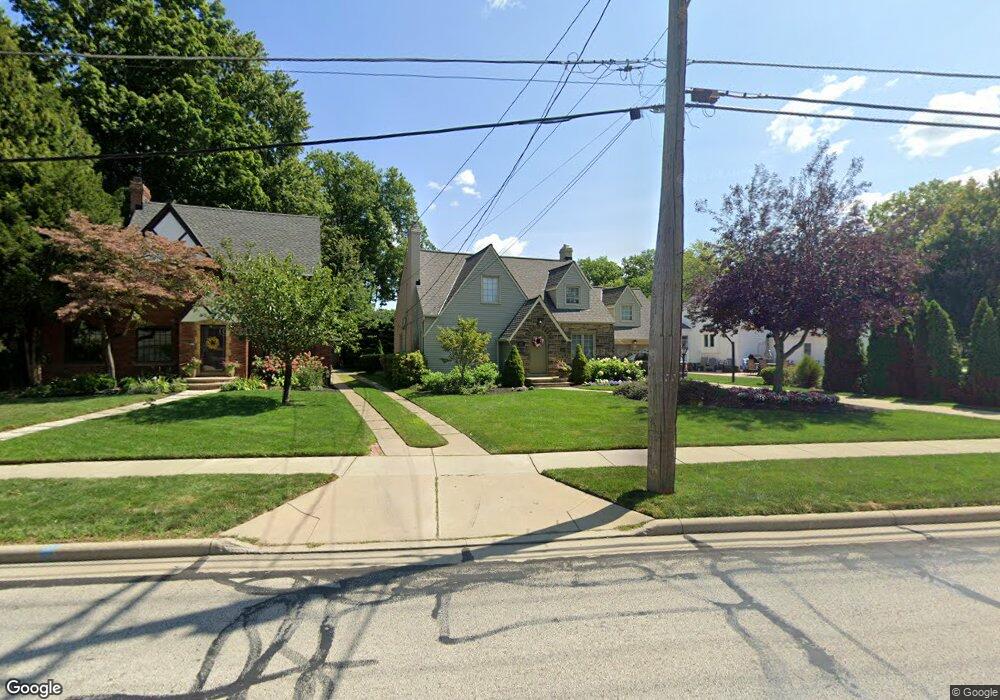
661 Wagar Rd Rocky River, OH 44116
Estimated Value: $527,581 - $688,000
4
Beds
2
Baths
2,012
Sq Ft
$298/Sq Ft
Est. Value
About This Home
This home is located at 661 Wagar Rd, Rocky River, OH 44116 and is currently estimated at $599,895, approximately $298 per square foot. 661 Wagar Rd is a home located in Cuyahoga County with nearby schools including Kensington Intermediate Elementary School, Goldwood Primary Elementary School, and Rocky River Middle School.
Ownership History
Date
Name
Owned For
Owner Type
Purchase Details
Closed on
Jul 23, 1998
Sold by
Coletta Thomas L and Louise Coletta Mary
Bought by
Dorenkott Craig A and Dorenkott Connie I
Current Estimated Value
Home Financials for this Owner
Home Financials are based on the most recent Mortgage that was taken out on this home.
Original Mortgage
$140,000
Outstanding Balance
$28,725
Interest Rate
7.03%
Estimated Equity
$571,170
Purchase Details
Closed on
May 28, 1992
Sold by
Nash David E
Bought by
Coletta Thomas L
Purchase Details
Closed on
Mar 23, 1984
Sold by
Yospyn Marlene A
Bought by
Nash David E
Purchase Details
Closed on
Sep 6, 1977
Sold by
Hunt Richard V and C M
Bought by
Yospyn Marlene A
Purchase Details
Closed on
Jan 1, 1975
Bought by
Hunt Richard and C M
Create a Home Valuation Report for This Property
The Home Valuation Report is an in-depth analysis detailing your home's value as well as a comparison with similar homes in the area
Home Values in the Area
Average Home Value in this Area
Purchase History
| Date | Buyer | Sale Price | Title Company |
|---|---|---|---|
| Dorenkott Craig A | $221,000 | Chicago Title Insurance Comp | |
| Coletta Thomas L | $151,000 | -- | |
| Nash David E | $90,000 | -- | |
| Yospyn Marlene A | $61,000 | -- | |
| Hunt Richard | -- | -- |
Source: Public Records
Mortgage History
| Date | Status | Borrower | Loan Amount |
|---|---|---|---|
| Open | Dorenkott Craig A | $140,000 |
Source: Public Records
Tax History Compared to Growth
Tax History
| Year | Tax Paid | Tax Assessment Tax Assessment Total Assessment is a certain percentage of the fair market value that is determined by local assessors to be the total taxable value of land and additions on the property. | Land | Improvement |
|---|---|---|---|---|
| 2024 | $10,161 | $183,820 | $31,185 | $152,635 |
| 2023 | $9,614 | $144,210 | $28,180 | $116,030 |
| 2022 | $9,547 | $144,200 | $28,180 | $116,030 |
| 2021 | $8,743 | $144,200 | $28,180 | $116,030 |
| 2020 | $8,200 | $118,200 | $23,100 | $95,100 |
| 2019 | $8,058 | $337,700 | $66,000 | $271,700 |
| 2018 | $7,108 | $118,200 | $23,100 | $95,100 |
| 2017 | $7,032 | $93,950 | $22,090 | $71,860 |
| 2016 | $6,229 | $84,810 | $22,090 | $62,720 |
| 2015 | $5,535 | $84,810 | $22,090 | $62,720 |
| 2014 | $5,535 | $72,490 | $18,870 | $53,620 |
Source: Public Records
Map
Nearby Homes
- 459 Wagar Rd
- 20695 Beaconsfield Blvd
- 829 Elmwood Rd
- 20333 Detroit Rd Unit 311B
- 20333 Detroit Rd Unit 213B
- 21891 Avalon Dr
- 505 Beachcliff Row Dr
- 1744 Lakeview Ave
- 12 Hidden Valley Unit 12
- 19740 Lake Rd Unit 19740
- 22100 Lake Rd
- 19665 Roslyn Dr
- 1736 Wagar Rd Unit 303
- 19575 Shoreland Ave
- 1055 Medfield Dr
- 1700 Southbend Dr
- 19712 Laurel Ave
- 3 Windsor Ct
- 21405 Cherry Way Unit 13
- 19334 Frazier Dr
- 641 Wagar Rd
- 20952 Beaconsfield Blvd
- 20916 Beaconsfield Blvd
- 644 Wagar Rd
- 20997 Lake Rd
- 20880 Beaconsfield Blvd
- 20965 Lake Rd
- 21039 Lake Rd
- 21072 Kenwood Ave
- 20852 Beaconsfield Blvd
- 21067 Kenwood Ave
- 20947 Lake Rd
- 21075 Lake Rd
- 21098 Kenwood Ave
- 20834 Beaconsfield Blvd
- 20933 Lake Rd
- 21093 Lake Rd
- 715 Wagar Rd
- 21122 Kenwood Ave
- 21115 Kenwood Ave