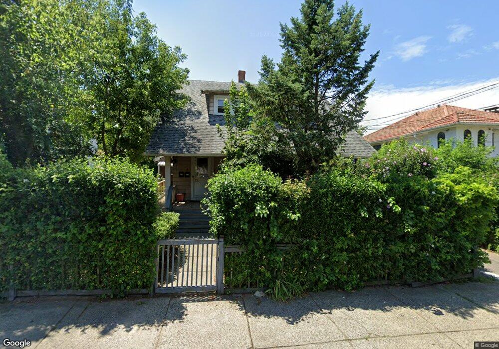
661 Wayne St Bridgeport, CT 06606
North End NeighborhoodEstimated Value: $543,009 - $660,000
5
Beds
3
Baths
2,777
Sq Ft
$222/Sq Ft
Est. Value
About This Home
This home is located at 661 Wayne St, Bridgeport, CT 06606 and is currently estimated at $615,752, approximately $221 per square foot. 661 Wayne St is a home located in Fairfield County with nearby schools including Blackham School, Central High School, and Northeastern Adventist Academy - Fairfield County.
Ownership History
Date
Name
Owned For
Owner Type
Purchase Details
Closed on
Dec 29, 2005
Sold by
Storms Robert and Storms Julie
Bought by
Celadon Erlande
Current Estimated Value
Home Financials for this Owner
Home Financials are based on the most recent Mortgage that was taken out on this home.
Original Mortgage
$324,000
Outstanding Balance
$200,849
Interest Rate
8.6%
Estimated Equity
$414,903
Purchase Details
Closed on
Jun 30, 1998
Sold by
Furmato Angelo
Bought by
Storms Julie T
Create a Home Valuation Report for This Property
The Home Valuation Report is an in-depth analysis detailing your home's value as well as a comparison with similar homes in the area
Home Values in the Area
Average Home Value in this Area
Purchase History
| Date | Buyer | Sale Price | Title Company |
|---|---|---|---|
| Celadon Erlande | $405,000 | -- | |
| Celadon Erlande | $405,000 | -- | |
| Storms Julie T | $145,000 | -- | |
| Storms Julie T | $145,000 | -- |
Source: Public Records
Mortgage History
| Date | Status | Borrower | Loan Amount |
|---|---|---|---|
| Open | Storms Julie T | $324,000 | |
| Closed | Storms Julie T | $324,000 |
Source: Public Records
Tax History
| Year | Tax Paid | Tax Assessment Tax Assessment Total Assessment is a certain percentage of the fair market value that is determined by local assessors to be the total taxable value of land and additions on the property. | Land | Improvement |
|---|---|---|---|---|
| 2025 | $9,445 | $217,370 | $84,110 | $133,260 |
| 2024 | $9,445 | $217,370 | $84,110 | $133,260 |
| 2023 | $9,445 | $217,370 | $84,110 | $133,260 |
| 2022 | $9,445 | $217,370 | $84,110 | $133,260 |
| 2021 | $9,445 | $217,370 | $84,110 | $133,260 |
| 2020 | $8,558 | $158,510 | $47,430 | $111,080 |
| 2019 | $8,558 | $158,510 | $47,430 | $111,080 |
| 2018 | $8,618 | $158,510 | $47,430 | $111,080 |
| 2017 | $8,618 | $158,510 | $47,430 | $111,080 |
| 2016 | $8,618 | $158,510 | $47,430 | $111,080 |
| 2015 | $8,605 | $203,900 | $57,360 | $146,540 |
| 2014 | $8,605 | $203,900 | $57,360 | $146,540 |
Source: Public Records
Map
Nearby Homes
- 234 Savoy St
- 26 Marsdale Ave
- 95 Savoy St
- 120 Clark St
- 3461 Main St
- 405 Westfield Ave
- 25 Westfield Ave
- 631 Fairview Ave
- 671 Fairview Ave
- 74 Harlem Ave
- 105 Tremont Ave Unit E
- 105 Tremont Ave Unit 2
- 457 Summit St
- 254 Wayne St
- 525 Westfield Ave
- 574 Thorme St
- 123 Harlem Ave
- 45 Stevens St Unit 3L
- 1265 Lindley St
- 208 Fairview Ave Unit 210
Your Personal Tour Guide
Ask me questions while you tour the home.