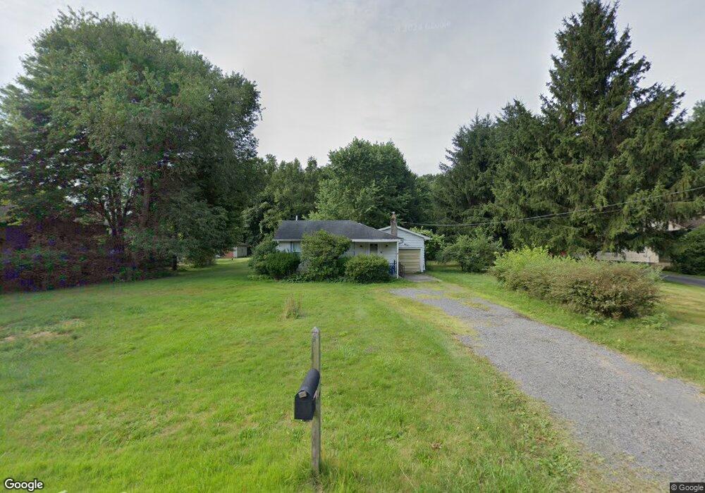
6610 Chestnut Ridge Rd Hubbard, OH 44425
Estimated Value: $52,844 - $136,000
2
Beds
1
Bath
620
Sq Ft
$155/Sq Ft
Est. Value
About This Home
This home is located at 6610 Chestnut Ridge Rd, Hubbard, OH 44425 and is currently estimated at $95,961, approximately $154 per square foot. 6610 Chestnut Ridge Rd is a home located in Trumbull County with nearby schools including Hubbard Elementary School, Hubbard Middle School, and Hubbard High School.
Ownership History
Date
Name
Owned For
Owner Type
Purchase Details
Closed on
Dec 26, 2024
Sold by
Matteo Suzanne and Matteo Martin
Bought by
Matteo Suzanne and Matteo Martin
Current Estimated Value
Purchase Details
Closed on
Dec 16, 2024
Sold by
Bancroft Lora L and Yarger Sharlene L
Bought by
Matteo Suzanne and Matteo Martin
Purchase Details
Closed on
Dec 27, 2005
Sold by
Williams Ethelene L and Sheldon Helen M
Bought by
Williams Ethelene L
Purchase Details
Closed on
Dec 20, 2005
Sold by
Williams Ethelene L and Sheldon Helen M
Bought by
Williams Ethelene L
Purchase Details
Closed on
Aug 3, 1998
Sold by
Pillow Nellie M
Bought by
Williams Ethelene L and Sheldon Helen M
Purchase Details
Closed on
Jan 1, 1990
Bought by
Nellie M Pillow
Create a Home Valuation Report for This Property
The Home Valuation Report is an in-depth analysis detailing your home's value as well as a comparison with similar homes in the area
Home Values in the Area
Average Home Value in this Area
Purchase History
| Date | Buyer | Sale Price | Title Company |
|---|---|---|---|
| Matteo Suzanne | -- | None Listed On Document | |
| Matteo Suzanne | $30,000 | None Listed On Document | |
| Williams Ethelene L | -- | -- | |
| Williams Ethelene L | -- | -- | |
| Williams Ethelene L | $35,000 | -- | |
| Nellie M Pillow | -- | -- |
Source: Public Records
Tax History
| Year | Tax Paid | Tax Assessment Tax Assessment Total Assessment is a certain percentage of the fair market value that is determined by local assessors to be the total taxable value of land and additions on the property. | Land | Improvement |
|---|---|---|---|---|
| 2024 | $897 | $15,480 | $5,640 | $9,840 |
| 2023 | $898 | $15,480 | $5,640 | $9,840 |
| 2022 | $1,020 | $15,650 | $5,150 | $10,500 |
| 2021 | $1,024 | $15,650 | $5,150 | $10,500 |
| 2020 | $1,028 | $15,650 | $5,150 | $10,500 |
| 2019 | $964 | $13,900 | $4,760 | $9,140 |
| 2018 | $936 | $13,900 | $4,760 | $9,140 |
| 2017 | $933 | $13,900 | $4,760 | $9,140 |
| 2016 | $842 | $13,130 | $4,760 | $8,370 |
| 2015 | $845 | $13,130 | $4,760 | $8,370 |
| 2014 | $829 | $13,130 | $4,760 | $8,370 |
| 2013 | $827 | $13,130 | $4,760 | $8,370 |
Source: Public Records
Map
Nearby Homes
- 7058 Pine Grove Dr
- 5910 Chestnut Ridge Rd
- 132 Drummond Ave
- 1400 Thomas Hubbard Rd
- 5950 Mount Everett Rd
- 1029 N Main St
- 1952 Hubbard Masury Rd
- 2829 Tibbetts Wick Rd
- 330 Myron St Unit 3
- 2675 Seifert-Lewis Rd
- 396 Elizabeth St
- 784 Elmwood Dr
- 256 Warner Rd
- 868 Saul Dr
- 228 Center St
- 928 Bedford Rd
- 228 Stewart St
- 240 Warner Rd
- 911 Dogwood Dr SE
- 805 Johnny K Blvd
- 6622 Chestnut Ridge Rd
- 6602 Chestnut Ridge Rd
- 6630 Chestnut Ridge Rd
- 6590 Chestnut Ridge Rd
- 6629 Chestnut Ridge Rd
- 6603 Chestnut Ridge Rd
- 6648 Chestnut Ridge Rd
- 6638 Chestnut Ridge Rd
- 6585 Chestnut Ridge Rd
- 6619 Chestnut Ridge Rd
- 6650 Chestnut Ridge Rd
- 6667 Chestnut Ridge Rd
- 6557 Chestnut Ridge Rd
- 6688 Chestnut Ridge Rd
- 1835 Collar Price Rd
- 6718 Chestnut Ridge Rd
- 6647 Chestnut-Ridge Rd
- 6699 Chestnut Ridge Rd
- 6699 Chestnut-Ridge Rd
- 1819 Collar Price Rd
Your Personal Tour Guide
Ask me questions while you tour the home.