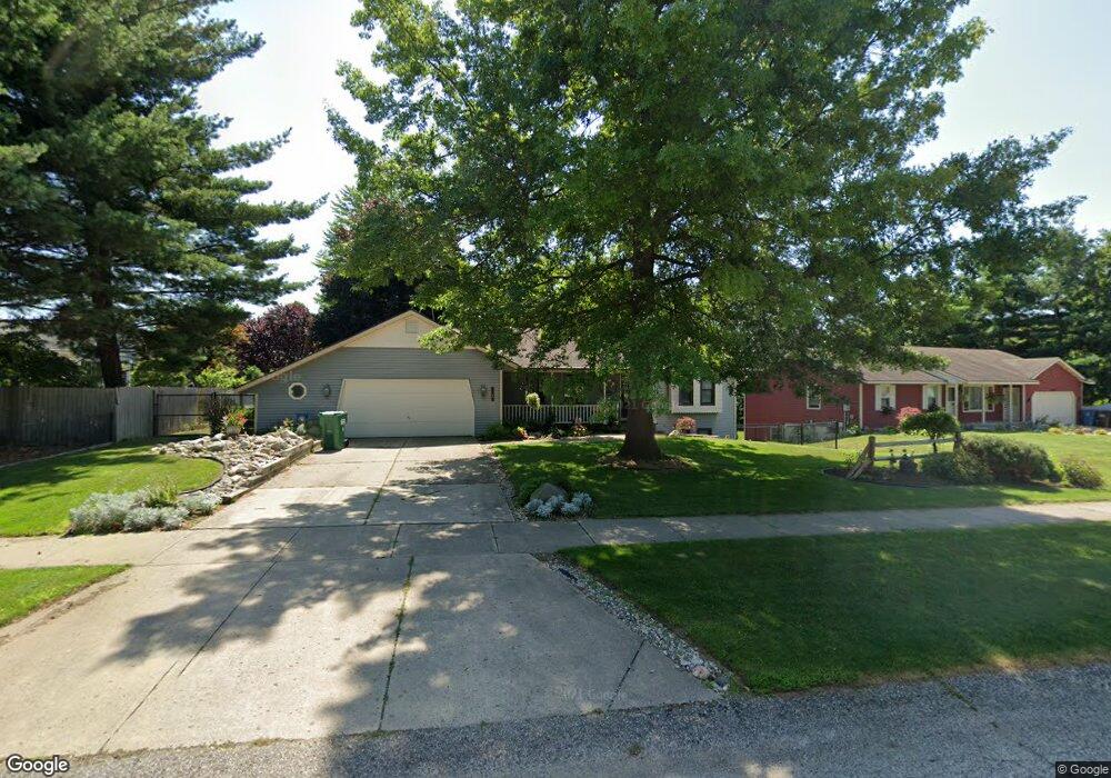
6610 Crownpointe Dr SW Byron Center, MI 49315
Estimated Value: $394,000 - $436,000
3
Beds
2
Baths
2,005
Sq Ft
$204/Sq Ft
Est. Value
About This Home
This home is located at 6610 Crownpointe Dr SW, Byron Center, MI 49315 and is currently estimated at $409,886, approximately $204 per square foot. 6610 Crownpointe Dr SW is a home located in Kent County with nearby schools including Marshall Elementary School, Robert L. Nickels Intermediate School, and Byron Center West Middle School.
Ownership History
Date
Name
Owned For
Owner Type
Purchase Details
Closed on
Apr 16, 2014
Sold by
Mack Janice L and Mack Janice D
Bought by
Mack Living Trust
Current Estimated Value
Purchase Details
Closed on
Dec 16, 2009
Sold by
The Carol M Riley Trust
Bought by
Mack Janice D
Purchase Details
Closed on
Sep 11, 2009
Sold by
The Carol M Riley Trust
Bought by
Mack Janice L
Purchase Details
Closed on
Aug 22, 2006
Sold by
Riley Richard M and Riley Janis M
Bought by
The Carol M Riley Trust
Create a Home Valuation Report for This Property
The Home Valuation Report is an in-depth analysis detailing your home's value as well as a comparison with similar homes in the area
Home Values in the Area
Average Home Value in this Area
Purchase History
| Date | Buyer | Sale Price | Title Company |
|---|---|---|---|
| Mack Living Trust | -- | None Available | |
| Mack Janice D | $119,900 | Trans | |
| Mack Janice L | -- | Transnation Title Agency Mi | |
| The Carol M Riley Trust | -- | None Available |
Source: Public Records
Tax History Compared to Growth
Tax History
| Year | Tax Paid | Tax Assessment Tax Assessment Total Assessment is a certain percentage of the fair market value that is determined by local assessors to be the total taxable value of land and additions on the property. | Land | Improvement |
|---|---|---|---|---|
| 2025 | $2,124 | $191,000 | $0 | $0 |
| 2024 | $2,124 | $172,400 | $0 | $0 |
| 2023 | $2,031 | $153,100 | $0 | $0 |
| 2022 | $2,831 | $134,600 | $0 | $0 |
| 2021 | $2,755 | $124,200 | $0 | $0 |
| 2020 | $1,870 | $112,800 | $0 | $0 |
| 2019 | $2,689 | $108,900 | $0 | $0 |
| 2018 | $2,633 | $103,800 | $18,800 | $85,000 |
| 2017 | $2,562 | $93,400 | $0 | $0 |
| 2016 | $2,471 | $88,700 | $0 | $0 |
| 2015 | $2,429 | $88,700 | $0 | $0 |
| 2013 | -- | $79,000 | $0 | $0 |
Source: Public Records
Map
Nearby Homes
- 6540 Kingtree Dr SW
- 6696 Highmeadow Dr SW
- 1171 Runway Place SW
- 1010 Bellview Meadow Dr SW Unit 68
- 1012 Bellview Meadow Dr SW
- 907 Amber View Dr SW
- 825 Amber Ridge Dr SW
- 6787 Sunfield Dr SW
- 6455 Silverton Dr
- 1058 Amberwood West Dr SW
- 924 Amberwood West Dr SW
- 6450 Estate Dr SW
- 6471 Estate Dr SW
- 6455 Estate Dr SW
- 323 Scabbard St SW
- 906 60th St SW
- 1493 Dexter Dr SW Unit 34
- 1501 Dexter St SW Unit 35
- 1531 Dexter Dr SW Unit 37
- 6745 Buchanan Ave SW
- 6626 Crownpointe Dr SW
- 874 E Crownpointe Ct SW
- 860 E Crownpointe Ct SW
- 909 Woodspointe Dr SW
- 850 E Crownpointe Ct SW
- 899 E Crownpointe Ct SW
- 895 Woodspointe Dr SW
- 6593 Crownpointe Dr SW
- 6615 Kingtree Dr SW
- 875 E Crownpointe Ct SW
- 836 E Crownpointe Ct SW
- 883 Woodspointe Dr SW
- 6585 Crownpointe Dr SW
- 6572 Kingtree Dr SW
- 935 Woodspointe Dr SW
- 861 E Crownpointe Ct SW
- 6577 Kingtree Dr SW
- 6579 Crownpointe Dr SW
- 871 Woodspointe Dr SW
- 849 E Crownpointe Ct SW