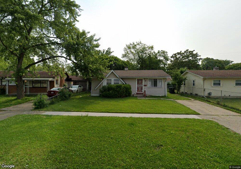
6610 Daryll Dr Flint, MI 48505
Brownell NeighborhoodEstimated Value: $45,000 - $67,000
3
Beds
2
Baths
942
Sq Ft
$60/Sq Ft
Est. Value
About This Home
This home is located at 6610 Daryll Dr, Flint, MI 48505 and is currently estimated at $56,065, approximately $59 per square foot. 6610 Daryll Dr is a home located in Genesee County with nearby schools including Brownell STEM Academy, The New Standard Academy, and Eagle's Nest Academy.
Ownership History
Date
Name
Owned For
Owner Type
Purchase Details
Closed on
Dec 8, 2016
Sold by
Kattola Jonathan M
Bought by
Home I Llc
Current Estimated Value
Purchase Details
Closed on
Aug 25, 2008
Sold by
Us Bank National Association
Bought by
Kattola Jonathan
Purchase Details
Closed on
Aug 3, 2007
Sold by
Fizer Harris
Bought by
Us Bank Na and Structured Asset Investment Loan Trust 2
Purchase Details
Closed on
Nov 4, 2005
Sold by
Russell Lula M and Estate Of Massie L Ollie
Bought by
Fizer Harris
Home Financials for this Owner
Home Financials are based on the most recent Mortgage that was taken out on this home.
Original Mortgage
$40,500
Interest Rate
8.42%
Mortgage Type
Fannie Mae Freddie Mac
Purchase Details
Closed on
May 1, 2004
Sold by
Dave & W Inc
Bought by
Ollie Massie L and Russell Lula M
Purchase Details
Closed on
Sep 4, 2002
Sold by
Uvalde Inc
Bought by
Dave & W Inc
Create a Home Valuation Report for This Property
The Home Valuation Report is an in-depth analysis detailing your home's value as well as a comparison with similar homes in the area
Home Values in the Area
Average Home Value in this Area
Purchase History
| Date | Buyer | Sale Price | Title Company |
|---|---|---|---|
| Home I Llc | -- | None Available | |
| Kattola Jonathan | $4,761 | None Available | |
| Us Bank Na | $13,500 | None Available | |
| Fizer Harris | $45,000 | None Available | |
| Ollie Massie L | $24,000 | Sargents Title Company | |
| Dave & W Inc | $16,200 | -- |
Source: Public Records
Mortgage History
| Date | Status | Borrower | Loan Amount |
|---|---|---|---|
| Previous Owner | Fizer Harris | $40,500 |
Source: Public Records
Tax History Compared to Growth
Tax History
| Year | Tax Paid | Tax Assessment Tax Assessment Total Assessment is a certain percentage of the fair market value that is determined by local assessors to be the total taxable value of land and additions on the property. | Land | Improvement |
|---|---|---|---|---|
| 2025 | $714 | $11,900 | $0 | $0 |
| 2024 | $671 | $9,000 | $0 | $0 |
| 2023 | $663 | $7,700 | $0 | $0 |
| 2022 | $0 | $5,700 | $0 | $0 |
| 2021 | $695 | $5,900 | $0 | $0 |
| 2020 | $713 | $6,800 | $0 | $0 |
| 2019 | $736 | $7,200 | $0 | $0 |
| 2018 | $759 | $7,700 | $0 | $0 |
| 2017 | $1,200 | $0 | $0 | $0 |
| 2016 | $784 | $0 | $0 | $0 |
| 2015 | -- | $0 | $0 | $0 |
| 2014 | -- | $0 | $0 | $0 |
| 2012 | -- | $11,400 | $0 | $0 |
Source: Public Records
Map
Nearby Homes
- 6702 Cranwood Dr
- 6610 Cranwood Dr
- 6914 Daryll Dr
- 6902 Sally Ct
- 614 W Holbrook Ave
- 613 W Foss Ave
- 1015 W Carpenter Rd
- 605 W Foss Ave
- 6814 Colonial Dr
- 618 W Austin Ave
- 6628 Orange Ln
- 610 W Austin Ave
- 525 W Bundy Ave
- 405 W Lorado Ave
- 405 W Bundy Ave
- 536 W Home Ave
- 1499 W Juliah Ave
- 1816 Russet Place
- 1605 Barbara Dr
- 5714 Suburban Ct
- 6606 Daryll Dr
- 6614 Daryll Dr
- 6609 Cranwood Dr
- 6602 Daryll Dr
- 6605 Cranwood Dr
- 6613 Cranwood Dr
- 6601 Cranwood Dr
- 6618 Daryll Dr
- 6611 Daryll Dr
- 6617 Cranwood Dr
- 6526 Daryll Dr
- 6626 Daryll Dr
- 6527 Cranwood Dr
- 6605 Daryll Dr
- 6621 Cranwood Dr
- 6622 Daryll Dr
- 6601 Daryll Dr
- 6522 Daryll Dr
- 6617 Daryll Dr
- 6523 Cranwood Dr